
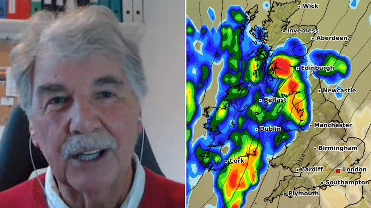


The exact day Hurricane Nigel will be “absorbed” by the British atmosphere has been outlined by meteorologist John Kettley.
The storm, which formed in the Atlantic late Saturday, follows Hurricane Lee which is currently lashing parts of Wales, the northwest of England and parts of Scotland.
According to Kettley, we will start to see the effects of Nigel in “the next four or five days”.
“At the moment, as you've mentioned already, there's plenty of rain around”, he said on GB News.
WATCH THE INTERVIEW BELOW
“There's some strong winds too, and that's to do with Lee and to do with Margo.
“So these are the previous ex-hurricanes which are now sitting over the UK.
LATEST DEVELOPMENTS
“Probably the weather today is as bad as it's going to be when Nigel suddenly gets in over the weekend, probably on the late Saturday into Sunday morning.”
Despite Hurricane Nigel being Category 1, it may not be as intimidating as it sounds and could produce scorching temperatures.
Speaking on GB News, fellow meteorologist John Hammond said the jet stream may “pivot” as a result of Nigel, producing “fine and warm weather” as a result.
Asked whether we can expect more flash floods in Britain, Hammond stated: “I don’t think so. I think it’s back to the sort of normal autumn to be honest.

John Kettley has discussed the exact date Storm Nigel will hit the UK
|GB NEWS
“So a fair bit of wind and rain, but I don’t think there’ll be anything too disruptive, too impactful let’s say, in the next two or three days.
“That said, we're going to get a fair buffeting from the combination of wind and rain.
“The storms, the floods which you referred to a moment ago, they were caused by a concoction of warm air at the surface.
“And many of us actually had a very hot start to the weekend, didn't we, particularly across some south-eastern areas.”
Despite signs of positivity on the weather front, these could be countered by another ex-hurricane blasting cross the Atlantic, Hurricane Lee.
“It’s weakening, but it will bring some very blustery weather through this week”, Hammond said.
“There will be some rain, but as I said at the start, I don’t think that rain will be so severe that it’s going to cause that sort of flash flooding that we saw during the last 24 hours.
“Lee will have some impacts on us in the form of some wind and rain, but it’s fairly normal autumn weather. There will be some weather warnings from combination of wind and rain, but I’m not expecting major impacts.”