


Eastern coasts face further threats from wind, rain and sea surges as Atlantic waters spawn yet another hurricane and a menacing cluster of tropical storms.
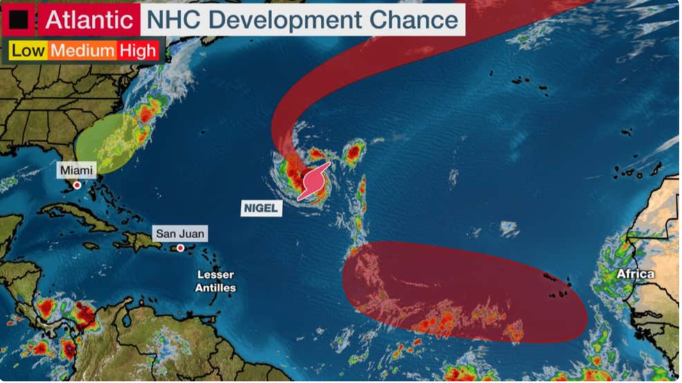
Newly formed Hurricane Nigel is expected to hit 100mph in the coming hours as meteorologists closely watch a separate tropical disturbance moving towards Florida.
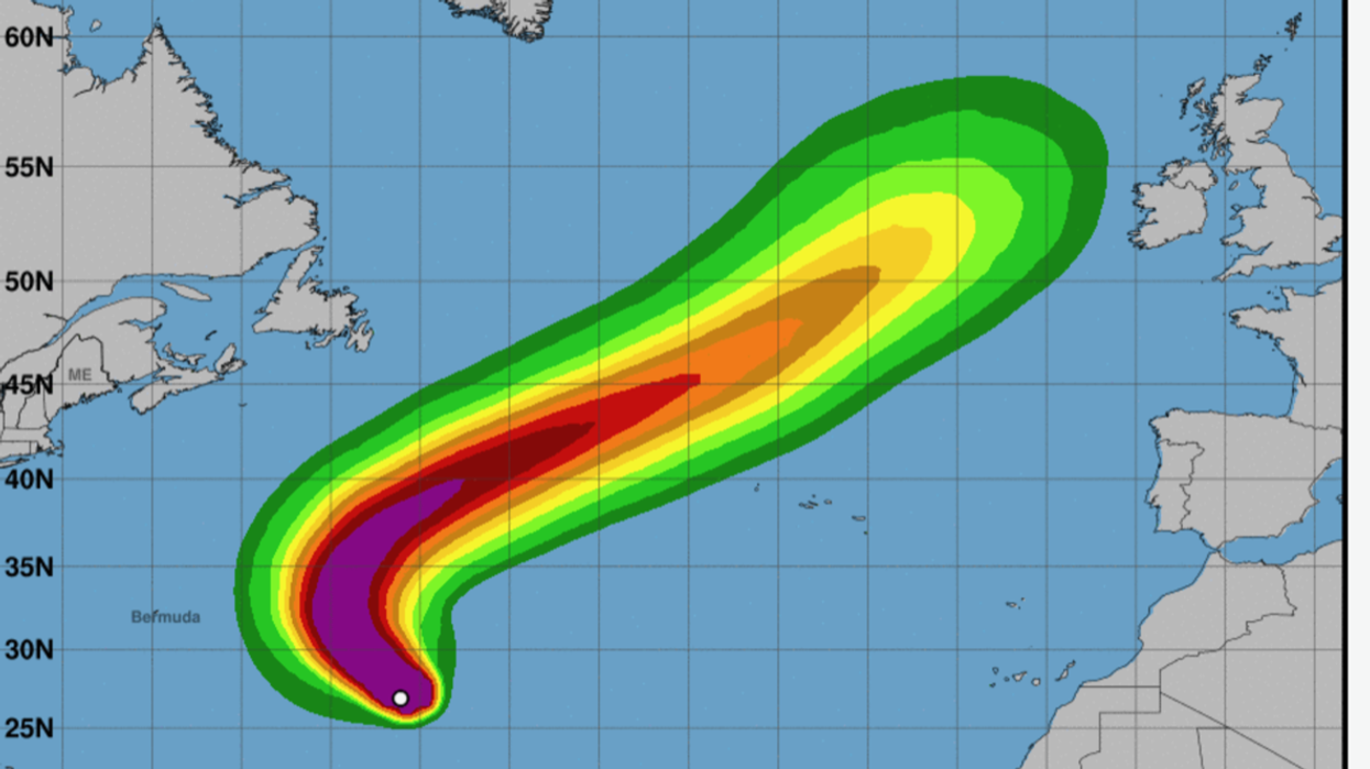
Nigel –the fourteenth hurricane of the season– is expected to veer north-eastwards into Atlantic waters missing landfall with the US.
However, the second tropical storm cluster building off the coast of Africa has meteorologists sounding early alarm bells for another bout of disruption.
UK WEATHER TO BE IMPACTED BY HURRICANES
The Weather Channel’s Dominica Davis said: “We continue to track the tropics and there are a few things going on.
“Nigel is not a threat to anyone. It is in the central Atlantic where it is going to safely stay away from people and land.
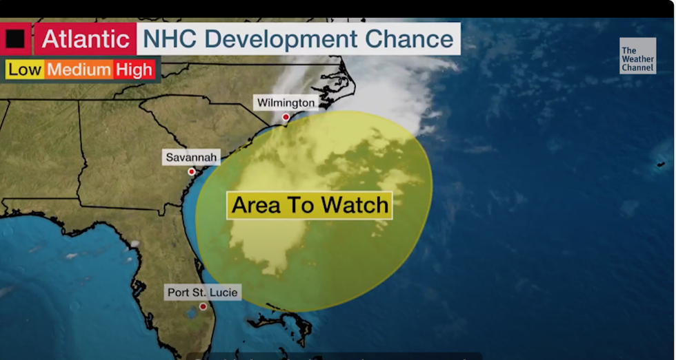
“Off the southeast coast is a designated area to watch. It is a cluster of storms right now but could this develop into something non-tropical or tropical, that’s what we’ll be watching through the week.”
The storm cluster will gather close to the coasts of the Carolinas and Georgia after its journey across the Atlantic ahead of the weekend, experts say.
The National Hurricane Centre is watching a tropical disturbance off the US coast
|The Weather Channel
It could muscle up into a tropical depression or another named storm, according to The US National Hurricane Centre (NOAA).
It marks the latest offering from a particularly active Atlantic hurricane season and follows Hurricane Lee which last week hit the country with high winds and sea surges.
While Nigel is currently expected not to make landfall, some experts warn it could switch track onto a similar path to Lee.
Jim Dale, US weather correspondent and meteorologist for British Weather Services, said: “Nigel could take a similar track to Lee, but it depends on how it rebounds off a high-pressure heat dome that is currently over a large area of the United States.
The National Hurricane Centre is watching for a tropical disturbance
|The Weather Channel
“Depending on how this develops it could deflect the storm, which will then move out into the Atlantic.
“This has been a particularly active season that has produced an abundance of cyclones.”
Clusters of thunderstorms forming off the coast of Africa often sow the seeds for hurricanes which then make a beeline for the United States.
The current disturbance could develop into a tropical depression which experts fear will strengthen off the east coast later this week.
A spokesman for The Weather Company (IBM) said: “The National Hurricane Centre also has its eyes on a tropical wave that will move off the African coast by Wednesday.
“A tropical depression is likely to form from this area of disturbed weather once it moves across the central and eastern Atlantic.
“It's too early to determine exactly where this system might track through the long-term future.
“The African tropical wave train generally becomes less active as we move into late September and October, and we'll need to begin looking closer to the Caribbean, Gulf of Mexico and western Atlantic for tropical development for the remainder of the season.”
Lee was the thirteenth hurricane of the season and brought strong winds and large waves to Canada and parts of New England.
It intensified rapidly from a category-1 to a category-5 storm to become one of the fastest-growing hurricanes of the past 40 years, according to experts.
Maximum wind speeds were measured at 160mph making it the first category-5 hurricane since Ian last year.
Nigel is forecast to grow to 115mph before weakening through the week to pose little threat to inhabited regions.
A NOAA spokesman said: “During the next day or so, the hurricane should remain in an environment that is quite conducive for strengthening.
“Nigel will turn northward in about 36 hours.
“Thereafter, the cyclone should accelerate in the flow to the southeast and south of a strong mid-latitude trough, and head into the higher latitudes of the Atlantic.”