


An Atlantic weather system could spark thunderstorms across parts of the United Kingdom this afternoon, with Britons warned to brace for flash flooding.
A "June Monsoon" his set to strike today, brining with it a dramatic change in weather conditions across the country.
After scorching heat of up to 32C in areas across the country, meteorologists are warning sudden downpours will soon do away with the balmy summer conditions.
The Met Office has two yellow weather warnings in force today for thunderstorms, with Britons told to prepare for "disruption and localised flooding".
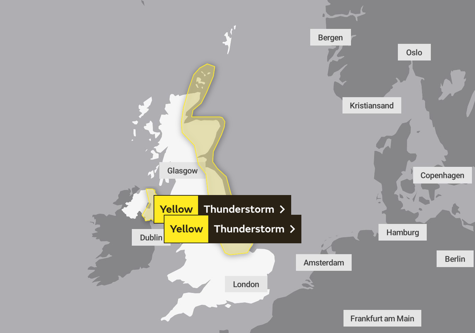
Two yellow weather warnings for thunderstorms are in place
|Met Office
"There is a slight chance that power cuts could occur and other services to some homes and businesses could be lost," it added.
"There is a small chance that homes and businesses could be flooded quickly, with damage to some buildings and temporary outdoor structures from floodwater, lightning strikes, large hail or strong winds."
The warnings cover Northern Ireland, the north-east of England, and Scotland.
Meanwhile, forecasters at NetWeather have put the UK on "severe thunderstorm watch" for the day.
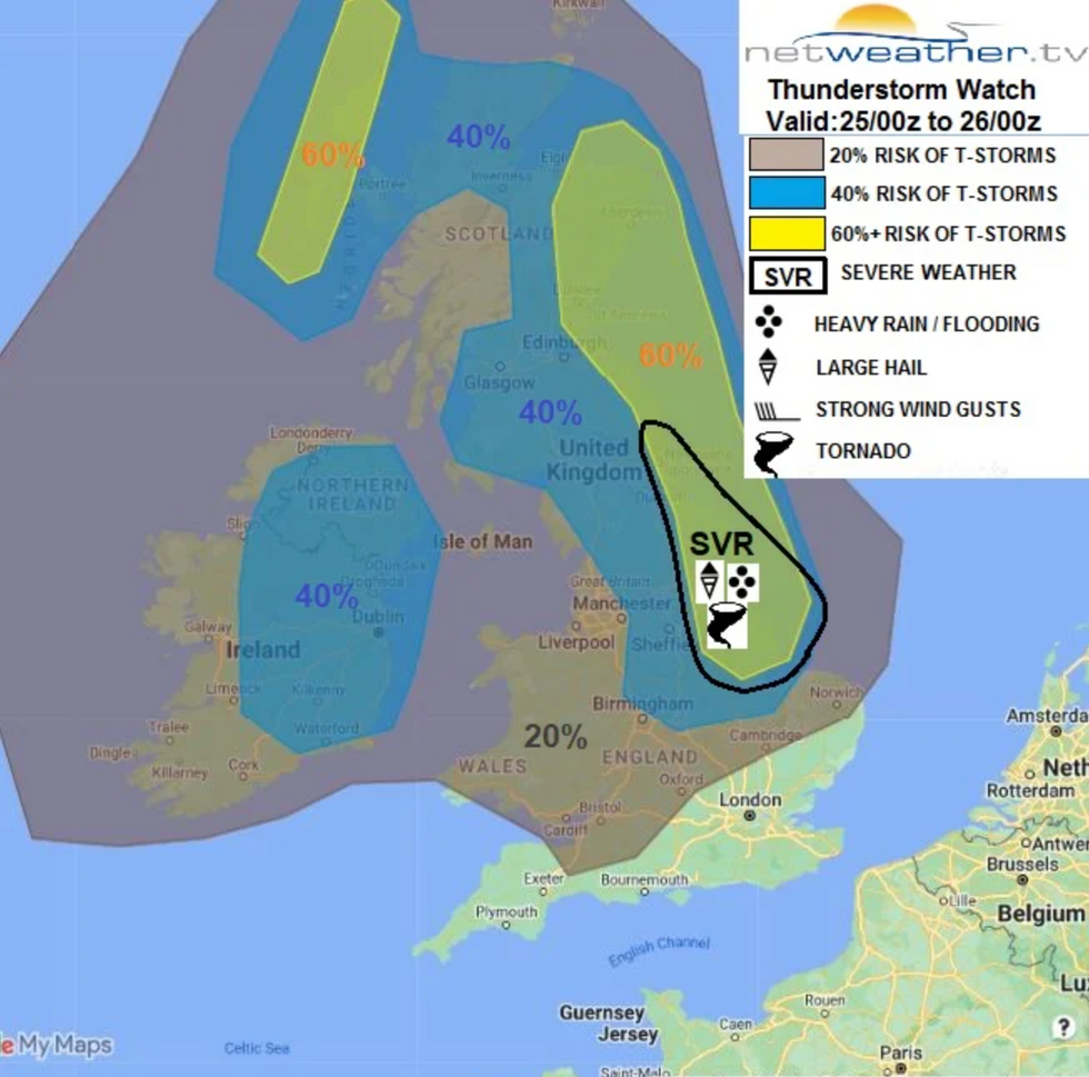
Britain has been put on 'severe thunderstorm watch'
|NetWeather
Terry Scholey said: "It'll be turning cooler and fresher in the West through the day today, as Atlantic systems move in.
"This change marks the beginning of the Westerly June monsoon, an important singularity, as these winds can often set the predominant weather pattern for much of the remainder of the summer."
He added: "It's been a 'muggy' night, with the thermometer not falling much below 20C in places. But most parts are starting fine with some sunshine, and apart from the odd shower over East Scotland, it's dry.
"It'll quickly become very warm or hot and 'sticky', with temperatures reaching a 'stifling' 30 to 32C across parts of East Anglia and the South East, and 26 to 29C more generally.
"The heat will 'trigger' a few showers through the afternoon, mostly East of the Pennines and across eastern Scotland. Some North of the Wash will be heavy, with a few thunderstorms giving hail and local torrential downpours that could cause 'flash' flooding. But rainfall amounts will vary, with much of the South and South East seeing little, if any, rain.
"Winds from the South or South East will be gusty near any storms, before 'veering' Westerly in the West that'll herald the arrival of cooler, fresher weather.
"A severe thunderstorm watch has been issued for today.
"Showers and storms across the East and North East clear away into the North Sea after dark, leaving clearer skies overnight."
The downpours are expected to leave Britain feeling "fresher" for the week ahead according to the Met Office, with a mix of sun and rain expected in the coming days.
The national weather agency added that there would be a "changeable period" of weather later this week with "spells of rain moving across the UK".