


BRITAIN’S near 70F Easter scorcher will collapse into a torrential deluge driven by 80mph gales triggering alarm bells for a ‘dangerous’ storm assault.
Bank-holiday sunshine will give way to a ‘venomous’ pressure cyclone hurtling across the Atlantic as forecasters warn all hell is about to break loose.
The unusually fierce weather feature, due to rip into the UK on Tuesday and Wednesday, could trigger the first named Storm of the season–Antoni.
Weather experts warn the powerful low-pressure system deepening in the Atlantic is on a collision course with the UK.
Jim Dale, meteorologist for British Weather Services, said: “This is the calm before the storm, because after the weekend there looks to be a very meaty feature coming in off the west coast.
“This could develop into a major storm through the middle of next week and currently looks significant enough to warrant the first name of the season, which would be Antoni.“
This is going to present a particular danger because it will arrive at a time when people will be travelling and returning after Easter.“
It has also got a fair amount of rain with it and will take people by surprise.”
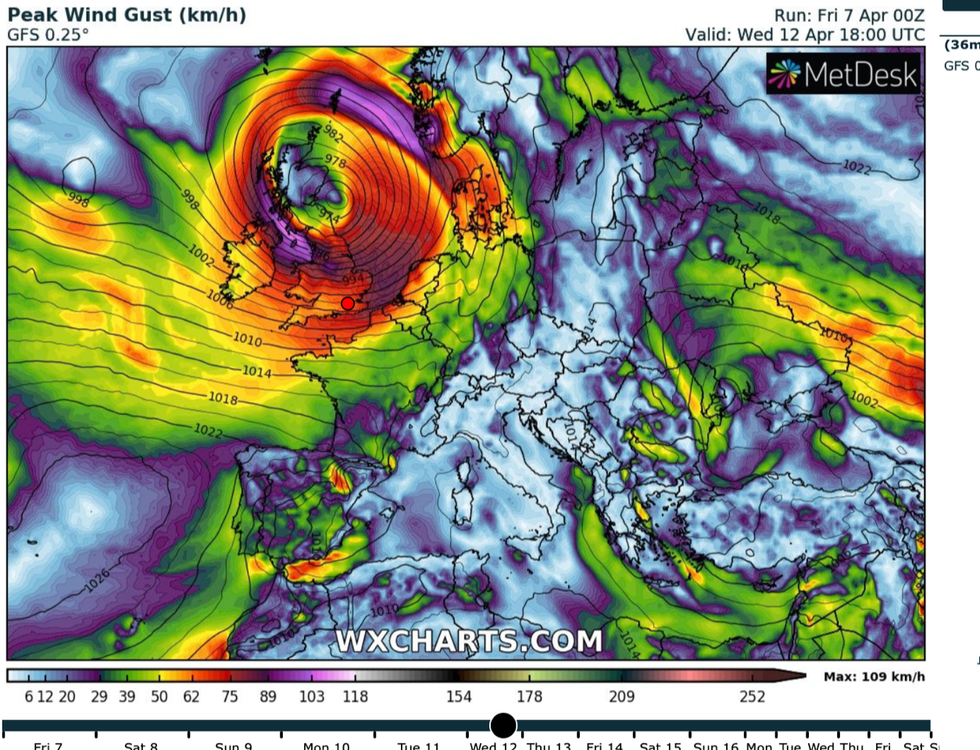
The fierce storm system will batter the UK on Wednesday, forecasters have warned
|WX Charts
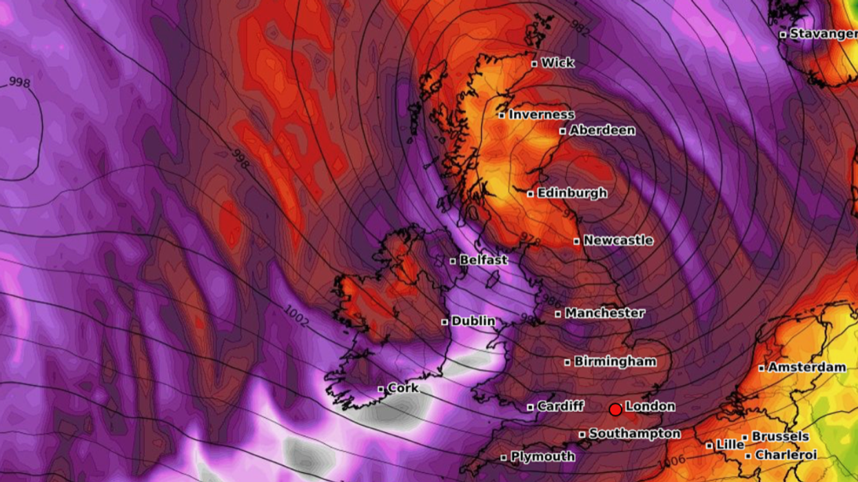
The storm will tear in from the west coast on Tuesday evening with much of the UK feeling the clout through Wednesday.
Gusts could hit 80mph in exposed regions, with 50mph to 60mph gales possible more widely, dropping to 40mph across southern Britain.
“This storm has got some venom,” Mr Dale warned.
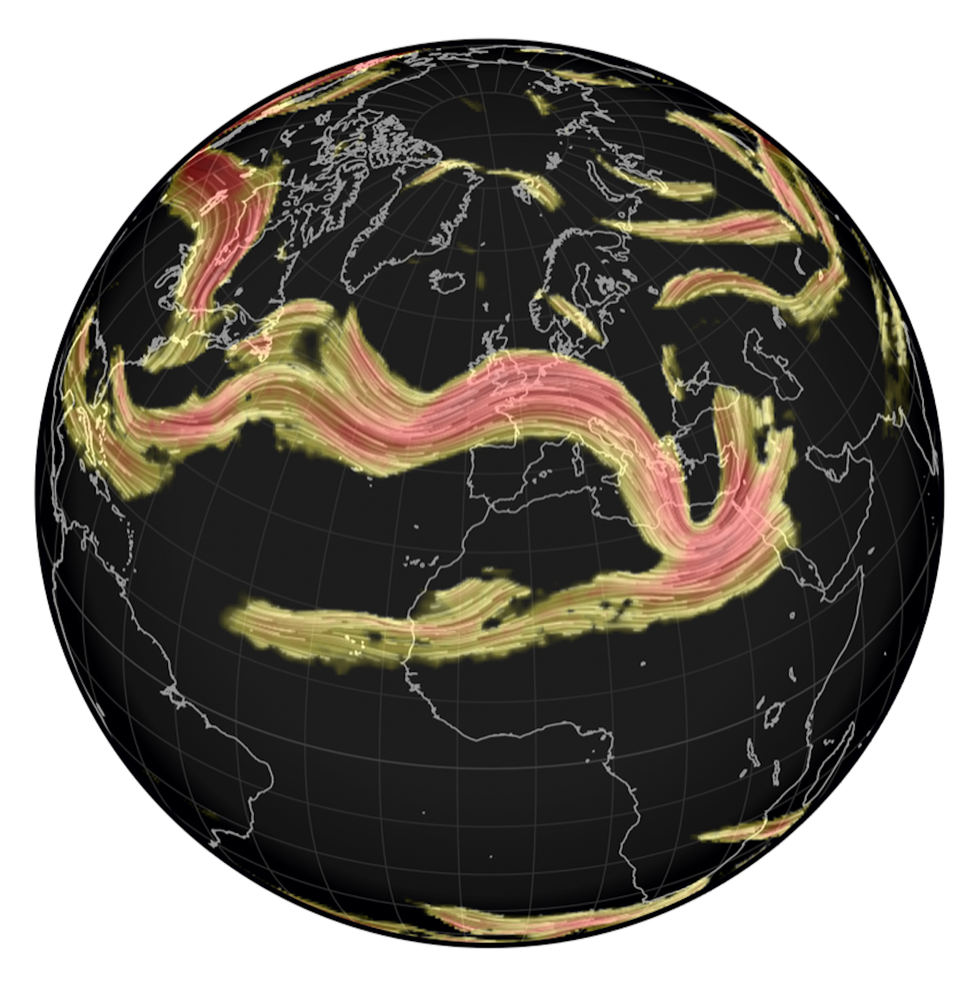
UK weather alert: A 200mph jetstream is ripping the brutal storm towards the UK
|UK Met Office
He added: “It comes in late on Tuesday and will first affect northern Ireland and western Wales.“
Then it will move further south and affect the rest of the country through Wednesday.“
This is long overdue because we are at the end of the storm season and out of winter, and it is unusual to get storms as we go into summer.”
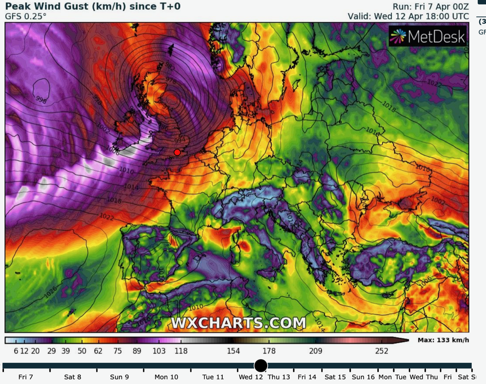
The latest weather maps show the vicious storm slamming into the UK on Wednesday
|WX Charts
The 2022/23 season has been unusually calm with the UK Met Office still to name a storm from the annual list released before autumn.
Bouts of wet and windy weather spawning from the Continent over winter have prompted European meteorological services to issue a name.
Wednesday's tempest, however, if it earns a title will be the first ‘home-grown’ storm of the season.
The warning comes as Britain gears up for Easter sunshine with temperatures expected to nudge 20C by Sunday.
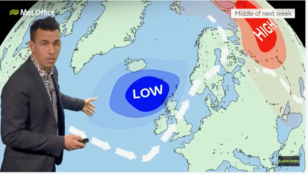
The Met Office has warned of the Atlantic system barrelling in on the jet stream
|Met Office
Much of the country will enjoy blue skies and warm rays through the next couple of days before wind and rain moves in on Monday.
Hopes of a scorcher have prompted bookmakers Coral to slash the odds from 4-1 to 2-1 on the hottest Easter Sunday on record.
Spokesman John Hill said: “There is a real danger of Easter eggs melting on Easter Sunday as temperatures look set to climb into the high teens.“
As a result of the latest forecast, we have slashed the odds in half on it ending as a record-hot Easter Sunday this year.”
The Met Office has not yet issued a storm name or warnings for unsettled conditions next week, but remains on high alert.
Government forecasters say the calm weather is about to give way to a ‘lively’ Atlantic system barrelling in on the jet stream.
Met Office meteorologist Aidan McGivern said: “The jet stream is quite a powerful feature picking up a low-pressure system later Tuesday into Wednesday.
“Some computer models produce quite a lively system with the risk of disruption from wind and, or, rain, so we are keeping a close eye on that.”