


A cold front stretching to Eastern Europe will split Britain in two as the nation braces for tropical humidity, powerful winds and thunderstorms.
The UK weather will this week take another U-turn as warmth and humidity build to the south while the north braces for wind and rain.
In charge is a stretched-out cold front, snaking across the country, keeping weather experts eagle-eyed over where the skies might go bang.
Met Office meteorologist Aidan McGivern said: “The dividing line between the more humid air to the south and the cooler, more changeable weather to the north is a cold front, and this sets the scene for the week.
“High humidity could lead to the development of thunderstorms across northern France, drifting towards southeast England on Wednesday evening and into the early hours of Thursday.
“But that is open to doubt at the moment because there is every chance they will hit southeast England and bring some impacts, but if they go in a slightly more of an east direction, they will miss southeast England entirely.”
Britain’s weather this week will be nudged by an aggressive jet stream charging out of the United States.
While southern and southeastern regions will keep a pocket of warmth, strong winds will batter the west coast.
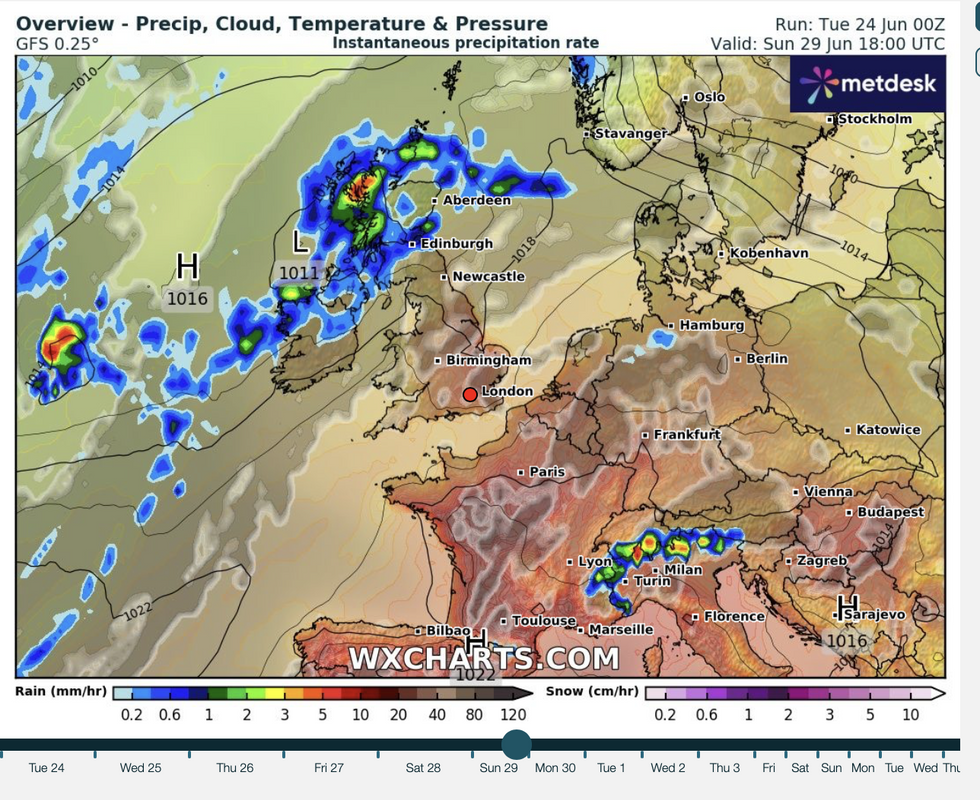
Wet and windy to the north, drier to the south
|WX CHARTS
As the jet stream shifts, high pressure, heat and humidity will build again ahead of the weekend, McGivern warned.
He said: “On the other side of the Atlantic, over North America, we have a developing jet stream really picking up strength, and how this develops will impact our weather for the rest of the week.
“It looks likely that an unseasonably strong jet stream will develop across the Atlantic and head towards the UK for the end of the week, and that is going to bring a strengthening of the wind on Thursday and into Friday, we keep the keen wind to the west.
“It is warming up as we go into the weekend across many southern parts of the UK at least.”
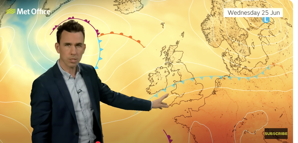
Met Office’s Aidan McGivern describes how cold front will split the UK’s weather
|MET OFFICE
Weather models show thermometers in parts of the country at the weekend rocketing back into the 30Cs.
Next week could see Britain bake in the hottest spell of summer so far as temperature records teeter.
Jim Dale, meteorologist for British Weather Services and social commentator, said: “As we come to the end of the month and the start of July, there is every chance that we will see temperatures back into the 30Cs.
“With the foundations laid so far this spring and summer, we are also looking at an increased chance of seeing temperature records fall.
“Going into the start of July, there is a good chance temperatures in parts of the country will come close to the monthly record.”
Jason Nicholls, lead international forecaster for AccuWeather, added: “The south will turn drier and brighter by the weekend, while the north may see additional showers through the end of the week.
“Some showers during the middle of the week may be thunder as a front passes across the UK.”