


The US hurricane season will be dragged out by freakishly hot sea temperatures driving ‘weird’ storms to spawn off the eastern coasts.
Ocean waters near Florida ‘a quarter the temperature of a boiling kettle’ are fueling a spate of unusual tropical disturbances–with another on the way within days.
Hurricanes and tropical storms usually seed off the West African coast before sweeping westwards on the prevailing trade winds towards America.
But abnormal oceanic conditions are causing them to pop up on the US doorstep, threatening another month of strange storm activity.
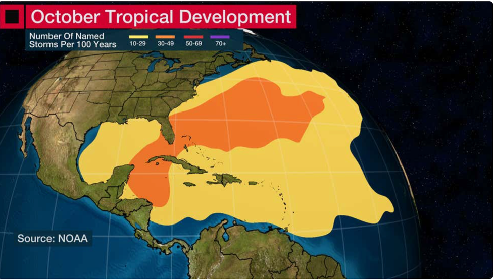
Frequency of tropical storms in October
|NOAA
Jim Dale, US weather correspondent and meteorologist for British Weather Services, said: “This is exactly what happens when you turn the heat up on the stove and the milk boils over.
“Temperatures around some of the US coasts are still above normal, and to put it into context, about a quarter of the temperature of a boiling kettle.
“So, around the Caribbean and Florida we are seeing tropical storms spawn off the coast rather than coming in from Africa, Ophelia was an example.
“I would expect to see this trend continue through until the end of October.”
A cluster of thunderstorms germinating in Caribbean waters could bring a repeat of Ophelia within the next week, he said.
Warming of the atmosphere due to climate change is helping to drive the strange phenomenon, he added.
He said: “There is some thunderstorm activity in the Caribbean at the moment which they are watching, and if the circulations are right and big enough, we could see another Ophelia.
“There is also going to be the threat of hurricane activity and cyclone activity, with threat very much present because of the high sea temperatures.
“This is unusual in that it seems to be a fairly new situation.”
Eastern states close to tropical waters are most at risk, including the Carolinas, Georgia, and Florida.
Temperatures are around three or four degrees higher than average in parts, according to the National Oceanic and Atmospheric Administration (NOAA).
Florida waters are currently simmering at 87.8F compared to the monthly average of 80.8F.
Off the coast of Georgia, temperatures have risen to 80.6F, around four degrees higher than the 77F monthly average.
The warnings come towards the end of the traditional hurricane season which runs from early summer to October.
Hurricane activity in November is unusual, although meteorologists say a warmer climate could prolong the season.
Chris Dolce, senior meteorologist for The Weather Channel, said: “October marks the start of the final leg of Atlantic hurricane season, and although activity begins to slowly wind down, recent years have shown us impactful hurricanes can still strike the US.
“Hurricane season usually quiets down even more as we head into November, especially for the US.
“Recent years have shown the impacts hurricanes can still bring to the US late in the season, and since 2016, Hurricanes Matthew, Nate, Michael, Delta, Zeta and Nicole have all made a US landfall in October or November.”
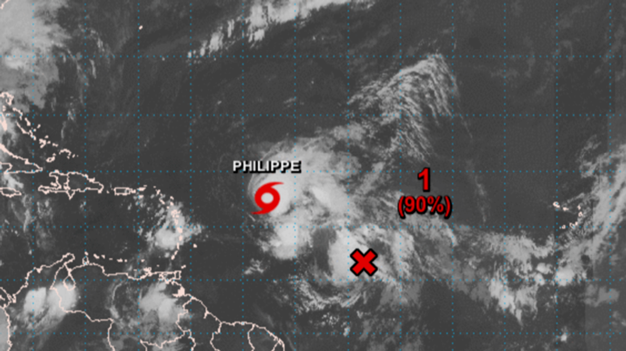
The NOAA is currently watching the progress of Philippe which could arrive to the Leeward Islands as a fully fledged tropical storm after the weekend.
A NOAA spokesman said: “There remains uncertainty in the intensity forecast and it is possible Philippe maintains its tropical cyclone status as it reaches the northern Leeward Islands.”