UK weather forecast: Britain set for WASHOUT with record rainfall to get even WORSE as 'low pressure from North Sea' sweeps in

Rain expected to hit the country over the weekend will supplement a record 18 months of downpour - which climate scientists have blamed on 'our warming world'
Don't Miss
Most Read
Spring officially sprung yesterday as the sun's passage across the equator marked the vernal equinox in the Northern Hemisphere - but meteorologists have warned of a surge in rainfall which will only add to a record year-and-a-half of wet weather.
Despite the change in season, much of the UK saw a good deal of cloud cover this morning with bursts of rain and drizzle peppering the country.
And, while Ireland can expect downpours throughout the day, Met Office data predicts that any rain today is largely set to subside by the afternoon as a wet front currently dampening north-east England peters out.
And Britons can look forward to pleasant temperatures as the week continues - some areas in southern England can expect thermometers to reach 18C.
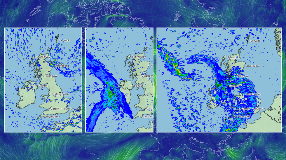
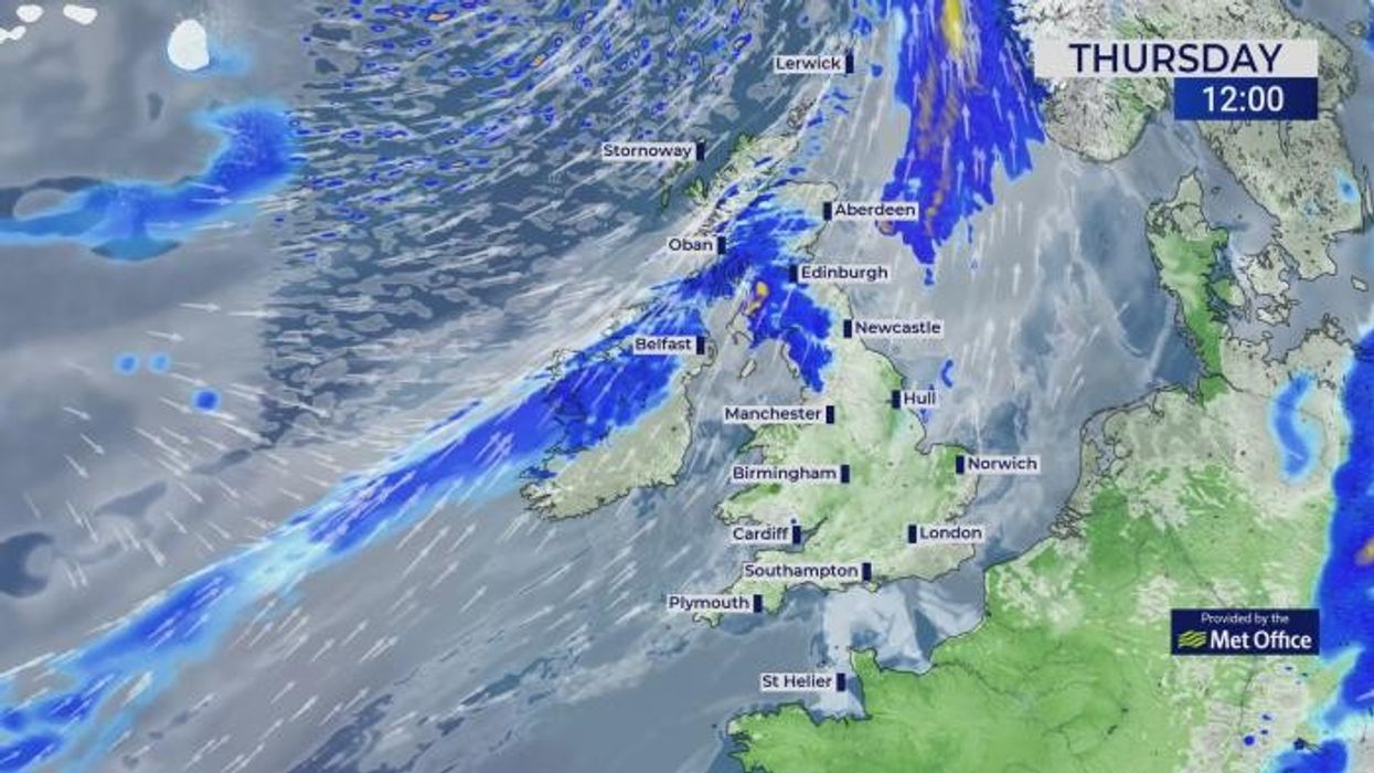
Met Office imagery shows the band of rain heading across from the Atlantic to cover the UK and Ireland
|Met Office/Earth Nullschool
Moving through Friday and Saturday, the UK can expect a smattering of light westerly showers across the day - with Scotland and the north west set to bear the brunt of any rain, while a "shallow area of low pressure is set to track through the North Sea on Sunday bringing further risk of showers", meteorologist George Pacey said.
And dramatic images from the Met Office show a band of rain is making its way across the north Atlantic - and it's set to make land early on Sunday morning.
By Sunday night, this band of rain will reach western Wales and Cornwall, where it's set to cover the whole of the UK and Ireland until at least Tuesday, according to the Met Office.
The rain will only add to what has been a record 18 months for the country - with England experiencing its highest levels of rainfall since records began in 1836.
LATEST DEVELOPMENTS:
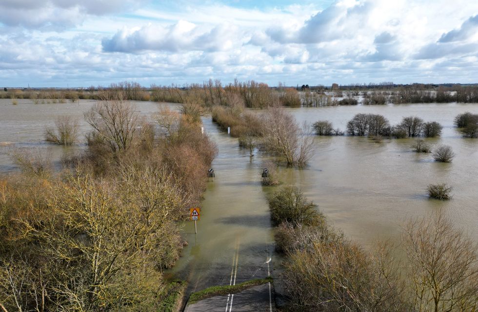
The 18 months have seen farming and transport badly affected by flooding and rainfall
|PA
The groundbreaking wet weather has seen farmers unable to plant crops in water-stricken fields, as well as transport networks crippled by floods, leaving climate scientists worried.
Alongside the rain, last year was the hottest on record around the world, and the second-hottest in the UK, in what scientists say is a direct result of climate change.
Ed Hawkins, a climate scientist at the University of Reading, noted the UK has always experienced "very variable amounts of rain", but said there had been a "large increase in the amount of rain that falls on the island, particularly in the wintertime, but also in the autumn and spring".
Hawkins said it was "a consequence of our warming world", and told the FT Britons should only expect more downpours "as the world continues to warm in the future".
Data from the Met Office marks the 'meteorological winter' - between December 2023 and February 2024 - as one of the wettest ever recorded, even when factoring in January's below-average rainfall.
A senior scientist at the Met Office, Mike Kendon, said: "The UK’s observations clearly show winters are getting warmer, and they are also getting wetter since as the atmosphere heats up, it has an increased capacity to hold moisture."
While the Agriculture and Horticulture Development Board, a trade body for farmers, warned that the UK may need to import more crops as a result of wet weather-induced low planting levels and losses caused by severe winter conditions.
A senior analyst at the body, Helen Plant, said: "Farmers still have the chance to plant crops such as spring barley and oats - but if heavy rain continues, crops will be planted at a point where they may become economically unviable."


