


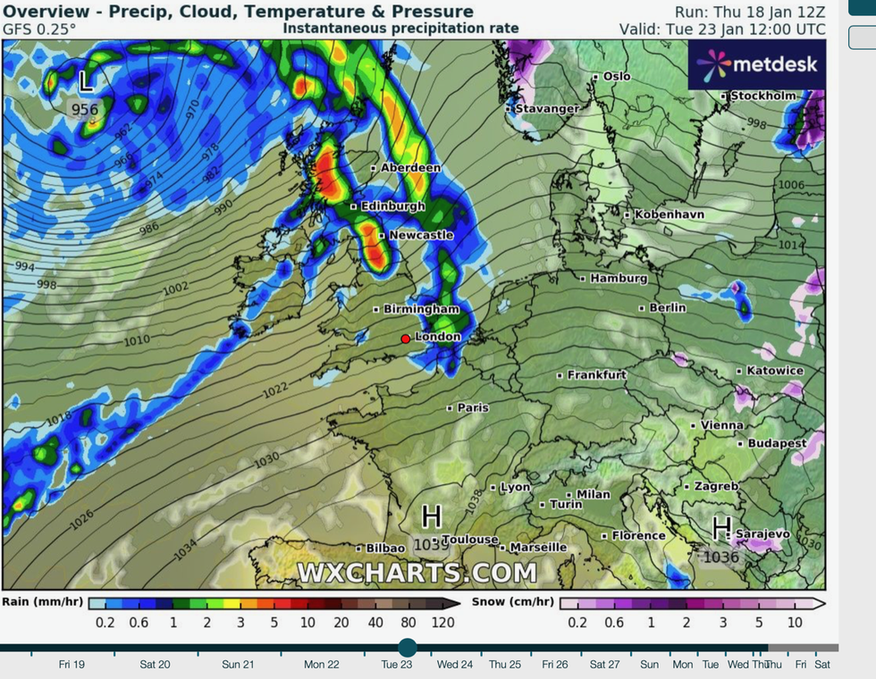
Snow-hit Britain is now facing a storm deluge driven by jet stream winds that will send temperatures rocketing to unusual highs.
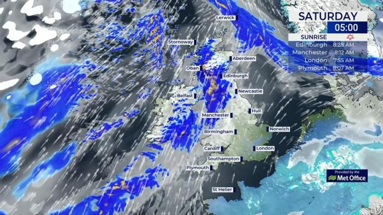
Sub-zero temperatures, snow and ice will be blown away this weekend by gales and torrential rain as the weather makes a dramatic U-turn.
Southerly gusts will rocket temperatures into double figures next week – well above average for mid-winter, according to the Met Office.
Meanwhile, government forecasters have swapped snow and ice warnings for a near-nationwide raft of wind and rain alerts.
Britain is set to see gales and torrential rain
|WXCharts
Met Office meteorologist Alex Burkill said: “The jet stream is going to drive a deep area of low pressure towards the UK as we go through the weekend, particularly on Sunday.
“To understand what happens after this week, it is worth having a look at what is happening on the other side of the Atlantic, and we have a huge temperature contrast with very cold weather across northern parts of the US.
“And this huge temperature contrast is making a very strong jet stream and that is going to push its way across the Atlantic as we go through the end of the week and then it is going to drive a deep area of low pressure towards the UK.”
Gusts of 80mph will blast northern Britain while heavy rain threatens to plunge swaths of the country back into flood misery.
Weather models show the jet stream pulling low-pressure storms systems towards Britain until the end of the month.
Exacta Weather forecaster James Madden said: “From this weekend, we are going into a period of milder but more unsettled weather, and I would expect further warnings for stormy conditions including heavy rain and strong winds.
LATEST DEVELOPMENTS:
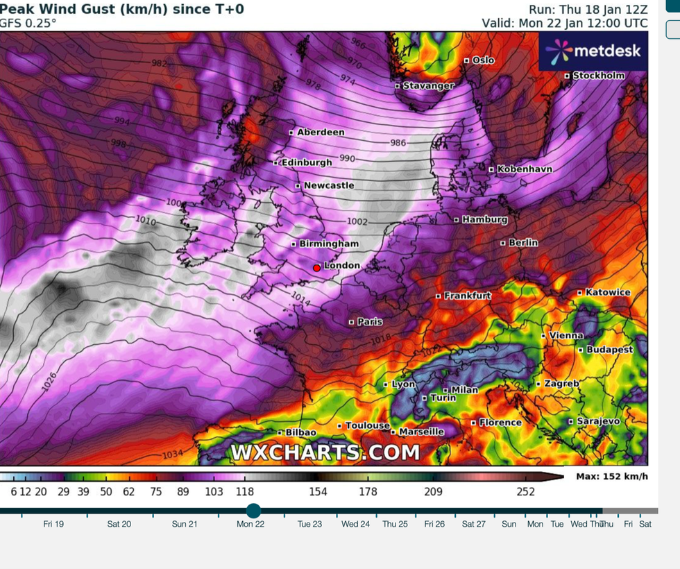
Wind gusts could hit up to 60mph
|WXCharts
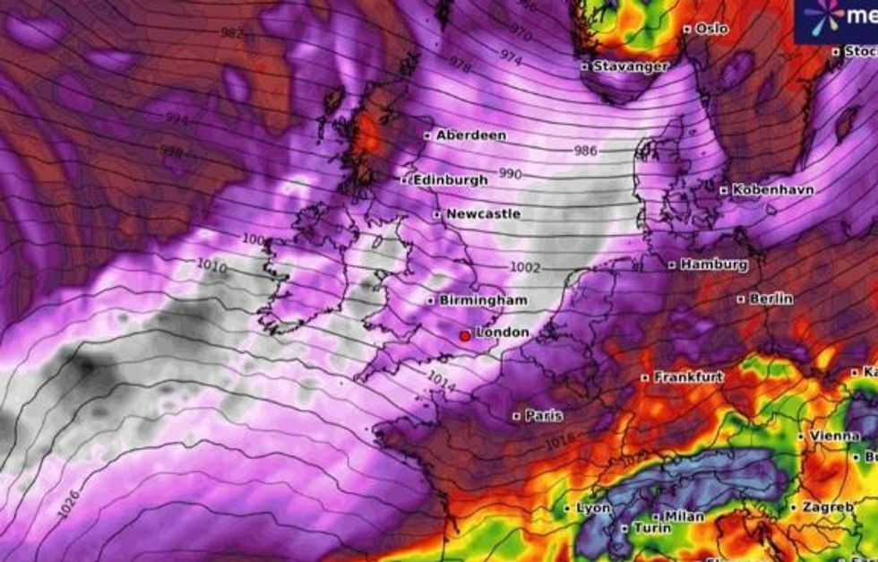
Storm Isha hitting the UK
|WX Charts
“After the weekend, we will be stepping away from the snow risk for around seven to 10 days during which more unsettled conditions will prevail.
“However, it will feel mild through this period.”
Storms clashing with cold air still in place over the UK threaten to trigger further snowy downpours.
Scotland and northern England will be in the firing line through the end of the weekend and into next week.
Mr Madden said: “Another temporary snow event is likely across the northern half of the country during Sunday and into the early hours of Monday, and there could be some more snow or sleet even to central and southern England.
“During the end of the month, there could be some further moderate snow events in the far north.”
The Met Office has issued warnings for up to four inches of rain on Sunday and Monday across parts of Wales and Scotland.
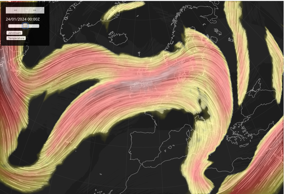
Jet streams firing over the UK over the next few days
|Netweather
A separate warning for wind is in force across Scotland, and most of England and Wales with just the southeast dodging the brunt of the assault.
Met Office deputy chief meteorologist David Hayter said: The Atlantic influence will introduce some wet and windy weather, with a deep area of low pressure approaching from the west on Sunday.
“While detail is still being worked out, we expect windy weather for many and some heavy rain in the west and so we’ve issued warnings for Sunday for wind and rain.”
The switch from an Arctic to Atlantic weather pattern will be driven by a change in shape of the jet stream.
The jet is about to straighten, forming a ‘zonal’ conveyor belt across the Atlantic for storm systems to batter Britain.
Jim Dale, social commentator and meteorologist for British Weather Services, said: “The jet stream is firing back up again and taking on a straighter, zonal, pattern which means the risk of more unsettled conditions.
“Britain will once again be at risk of strong wind and rain, and that could bring flooding to parts of the country.”
However, temperatures will rise from the lows of the past week to ‘quite mild’ in parts, he added.