


A hurricane-like storm growing in unusually warm waters off the coast of Florida threatens to unleash a torrential deluge marking a ‘washout’ start to autumn.
The ‘tropical disturbance’ will strengthen in the run up to the weekend before whipping up potent gales, high tides and torrential downpours.
National Football League (NFL) NFL and College Football fixtures are again at risk this weekend as the astronomical autumn kicks off to a turbulent start.
Meteorologists are avidly watching an area of developing storms which through the next 48 hours is expected to develop into a low-pressure cyclone.
US weather: Coastal sea temperatures
|NOAA
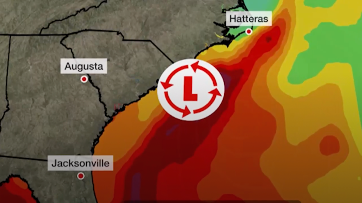
Eastern states, particularly North Carolina, particularly the village of Hatteras, Florida and even New York are at risk, experts say.
Domenica Davis, meteorologist for The Weather Channel, said: “We are watching this area off the southeast coast for potential development, and what we are watching is for this to dampen the first weekend of fall.
“We are looking at the potential for this area of disturbed weather to form into a low and start to move to the north by late week and into the weekend.
“What it is likely to do is bring rain to the southeast coast up through the mid-Atlantic this weekend and even parts of the northeast.
“So, we could be talking not only downpours but gusty winds and high surf.
This could be a washout in Hatteras, and you could see two to three inches with this thing.”
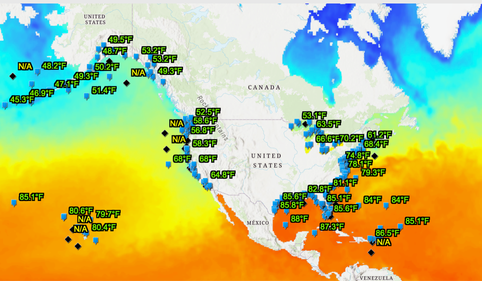
America’s hurricane season is being driven by unusually warm ocean waters brought to simmer point after the hot summer.
Sea temperatures hit 38C off the coast of Florida in July drawing comparisons to a hot tub.
Southern Florida endured some of the highest temperatures on record this summer, according to the National Oceanic and Atmospheric Administration (NOAA).
This could nurture the tropical disturbance off the east coast into a sub-tropical storm, experts warn.
Ms Davis said: “Water temperatures are still pretty warm, and this thing could take on some sub-tropical characteristics.
“Regardless, what it is likely to do is bring rain to the southeast coast up through the mid-Atlantic this weekend and even parts of the northeast.
“So, we could be talking not only downpours but gusty winds and high surf.
“This could be a washout in Hatteras and you could see two to three inches with this thing.”
The burgeoning storm is being helped to fatten in a loop of an energetic jet stream as it swoops southward over Florida.
While coastal regions hunker down for a possible tropical onslaught, colliding air masses across the states threaten more widespread thunderstorms.
Hot air flooding up from Mexico will collide with cold air from the north to drive deeply unstable atmospheric conditions.
Miserable weather could washout play during the start of the NFL and College Football seasons.
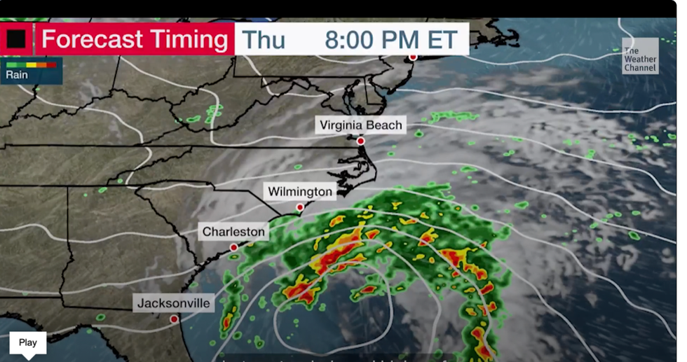
Wind and rain circle around Florida and the east coast
|WEather CHannel
Jim Dale, US weather correspondent and senior meteorologist for British Weather Services, said: “We are looking at some very heavy rain and gusty winds from this weekend.
“This could affect Maine, Washington DC, Florida and even New York, and threatens to hamper proceedings at the NFL and College games.
“This disturbance off the coast of Florida is one to watch.
“It has created its own little universe and could end up being quite an event.
“It could end up behaving like a hurricane and is going to be one to watch over the coming days.”