


BRITAIN’S September heatwave could erupt into a tropical ‘Armageddon’ deluge driven by the remains of a brutal category-5 hurricane.
Meteorologists are watching Hurricane Lee on its path through the Caribbean and towards the North Atlantic.
The now category-5 storm – the most powerful designation – could eventually unleash a deluge of torrential rain and thunderstorms as its remnants nudge the UK later this month.
Initially, it could build a swathe of high pressure similar to the driver of the current heatwave plunging the nation into another steam bath before it jolts the jet stream to open the heavens.
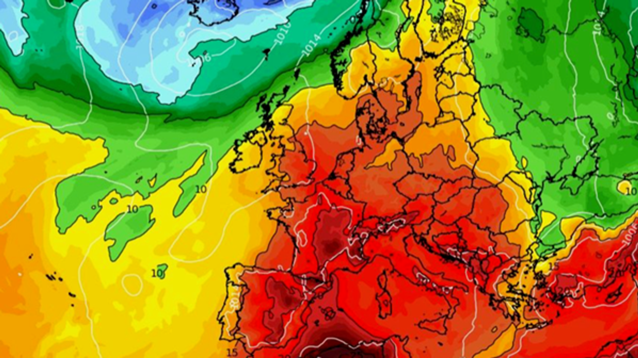
Hot weather continues through September
|WX Charts
Jim Dale, meteorologist for British Weather Services, said: “The remnants of Lee could get mixed into another low-pressure forming close to the UK and this could affect our weather in a couple of ways.
“We could first get another build of high pressure leading to the same sort of heatwave conditions as we are seeing now, although I do not expect to see the same temperatures.
“Then we are looking at what could be Armageddon-type rain and thunder later in the month, again driven in part by the remnants of Lee.
“I think that we are looking at a mixture of both, but when the rain comes it could be very heavy.”
The warning comes as Britain bakes in an unprecedented spell of early autumn heat with roasting conditions forecast through the weekend.
Extreme temperatures will build atmospheric instability triggering violent thunderstorms on Saturday, according to the Met Office.
Government forecasters also say an unusually high level of tropical storm activity in the Atlantic basin could affect Britain’s weather through this month.
Two tropical cyclones could give the UK weather a shake during the second half of the month, according to the Met Office.
Met Office meteorologist Alex Burkill said: “Looking further ahead, and we have Lee which is in the southern Atlantic, and there is another tropical cyclone.
“Those are likely to interfere with our weather as we go into the third week of September.
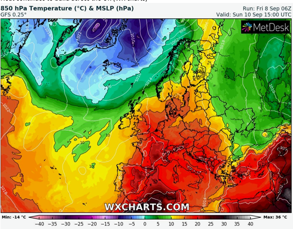
UK weather forecast: Low pressure circles UK later this month
|WX Charts
“The track of Lee heads westwards towards the US, but then it will go northwards and then eventually eastwards, and the other tropical cyclone is also likely to head towards our shores albeit heavily changed and altered by the time it reaches us into the third week in September.”
Independent forecasters agree hot weather could largely continue through the rest of the month with thunderstorms an ever-present risk.
James Madden, forecaster for Exacta Weather, said: “A hot September is now well and truly underway and the coming days should see temperatures in excess of 30C with the potential maximum temperature record for September breached.
“A Thundery breakdown is likely during next week as the jet-steam begins to veer southwards once again.
“However, confidence is high for another area of high pressure and rising temperatures to return around mid-month which could be similar to the current heatwave in terms of maximum temperatures and duration.”
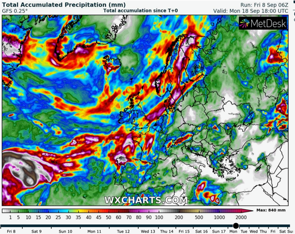
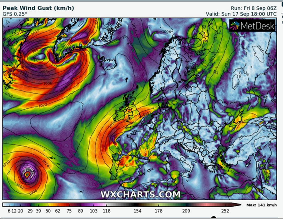
Heavy rain storms are expected through September
|WX Charts
Hurricanes and tropical storms frequently affect the UK weather when their remains are carried by the jet stream into the northern Atlantic.
The current hot weather has been blamed in part to the remains of Hurricane Franklin which has helped to drive high pressure close to the UK.