
US weather: America's North West coast facing rain and snow onslaught THIS WEEK
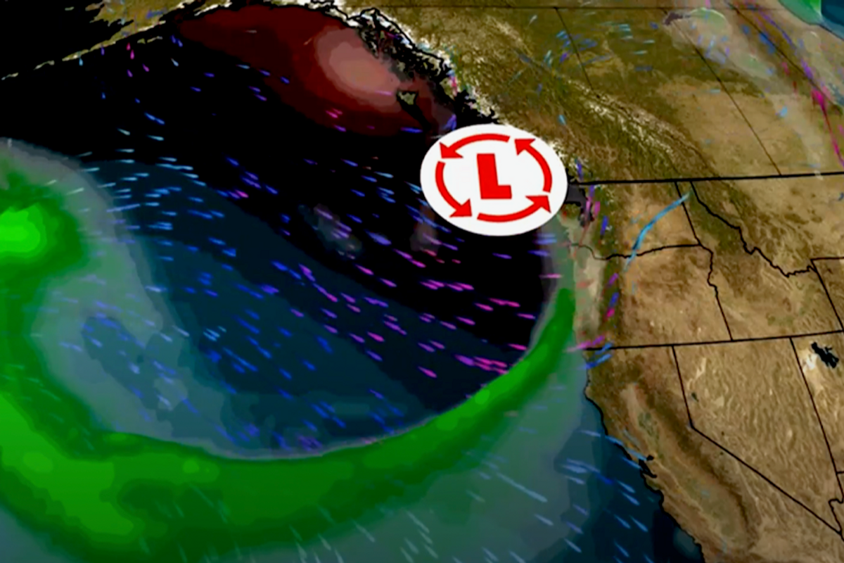
Atmospheric river crashes into the west coast of US
The Weather Channel

America's north-west states will bear the brunt of the latest weather onslaught as an ‘atmospheric river’ unleashing torrents of rain and snow.
The phenomenon, driven by warming Pacific waters during El Nino years, can dump the water equivalent of 27 Mississippi Rivers, according to Fox Weather.
It results from a powerful low-pressure cyclone sweeping weather fronts from the ocean into the west coast where they condense into torrents of rainfall.
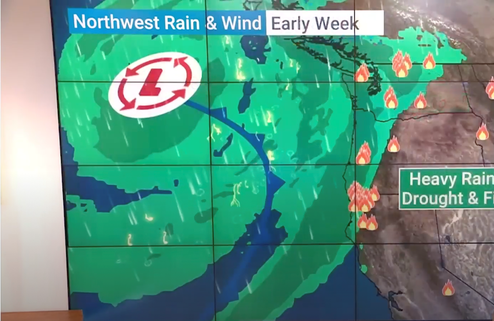
The first atmospheric river of the season is expected to crash into the coast this week with Oregon, Washington and North California first in the firing line.
Low pressure associated with the atmospheric river
The Weather Channel
However, for regions hit by drought after the long, hot summer, the deluge will come as a relief.
Orelon Sidney, a meteorologist for The Weather Channel, said: “The first atmospheric river of the season is on deck in the Pacific northwest, and it is much needed it has been quite dry across parts of Washington and Oregon.
“Three to five inches is possible in those heaviest areas and Seattle could pick up one to two inches.
“The Dakotas back across the Idaho panhandle into northern California where we have either a moderate extreme severe drought will hopefully get a very good drink because it is much needed”
Mountainous regions of Canada and the Olympic Peninsular between Washington and Seattle could see snow, she said.
She added: “High elevations across British Columbia could see some snow, and I wouldn't be surprised in some of the extreme northern cascades to see a little bit of snow fall there.
“The Olympic peninsula mainly looks like rain for you right now, but I wouldn't be surprised overnight to see a little bit of a mix.”
The term atmospheric river describes a trailing front laden with vast quantities of water carried by a low-pressure system.
They are fuelled by warm eastern Pacific ocean waters and are particularly frequent during El Nino years.
El Nino was confirmed late this summer after sea temperatures began to rise off the coast of South America.
Meaning 'Little Boy’, it sees prevailing winds slow causing eastern sea temperatures to rise and can have an impact on global weather patterns.
The atmospheric river could erupt into a barrage of thunderstorms later this week, according to Jim Dale, US weather correspondent and senior meteorologist for British Weather Services.
He said: “This is caused by an area of low pressure banging up against the west coast of the US.
“It is going to produce some thunderstorms later in the week, and as it is a large low, Oregon, Washington and Canada will get some heavy and persistent rain.
“This area of low pressure will wallow around over the next couple of days as it pushes across these states after coming in off the Pacific, and there could be some notable rain totals as a result.”
A spokesperson for The Weather Channel said: “That atmospheric river will last a few days.
“Towards coastal Oregon, there will be wind coming on shore with this particular system.”
Meanwhile, Tropical Storm Philippe continues to hurtle towards eastern US coasts as the Atlantic hurricane season continues apace.
It follows Lee, Nigel and Margot earlier this month, although thanks to a potent wind shear high is not expected to strengthen as rapidly, according to the NOAA.


