


Britain is facing Christmas storm hell with a barrage of cyclonic assaults threatening to maul the festive season.
Gales and heavy rain will set in this weekend whipped up by deep low-pressure systems, sparking warnings to check forecasts before going out.
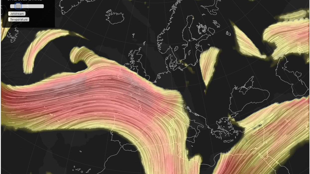
The recent bitter cold and snow is melting into a pattern of volatile storms flung at the UK by a supercharged jet stream.
Britons hoping for festive snow are warned ‘storms are more likely’ with heavy rain and floods threatening yuletide celebrations.
Jim Dale, social commentator and senior meteorologist for British Weather Services, said: “It is now going to be the wet weather that is the focus as low-pressure systems come in during a period of Atlantic-dominated weather.
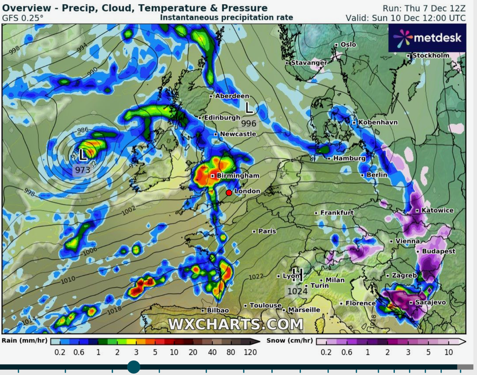
Loew pressure coming into the UK
|WX Charts
“It does not look favourable for a white Christmas, and what is more likely is an unsettled picture with heavy rain and the risk of storms.
“We will have to watch for developing storms in the run up to Christmas, and flooding will be the more likely problem, and this is likely to be the pattern for the next couple of weeks.”
Low-pressure cyclones from the west will keep temperatures above-average, particularly in the south, he said.
Northern regions will catch the chilly lick of the Arctic over the coming days, he added.
He said: “There is nothing currently in the forecasts that suggests a repeat of the recent cold snap.
“It is now going to turn milder, particularly in the south although to the far north, the cold will hang on.”
Weather models currently show the chance of a drier spell later next week, although long-range forecasts differ.
The Met Office predicts a changing pattern between unsettled weather driven by low pressure, and high-pressure dominated periods of calm.
However, government forecasters agree this weekend will be blighted by relentless bouts of wind and rain.
Met Office meteorologist Alex Deakin said: “When we’re talking wet and windy, we’re talking low-pressure systems and we have a number of them lined up in the Atlantic.
“Another one arrives on Friday night and into Saturday, and then we’re keeping a close eye on a developing area of low pressure likely to bring another spell of wet and potentially very windy weather on Sunday, and there is even another one perhaps following on behind that.”
Volatile weather will be driven, once again, by an active jet stream surging at 150mph across the Atlantic.
Irish Sea coasts are in the firing line at the start of the weekend before the rest of the UK gets a bashing on Sunday.
Mr Deakin said: “There’s a really active and strong jet stream at the moment and it’s south shifted and it’s powering these areas of low pressure and intensifying them and spreading them across the UK.
“An area of low pressure has the potential to bring some very wet and windy weather initially into Northern Ireland on Sunday morning, but then this spell of rain will swing across through Wales, parts of England and southern Scotland once more.
Particularly gusty winds around this area of low pressure, and it does have the potential for some very lively gusts, which could be shifted a little further north or south depending on how that low interacts with the jet stream.
“Keep an eye on the forecasts particularly if you’ve got plans for Sunday.”