
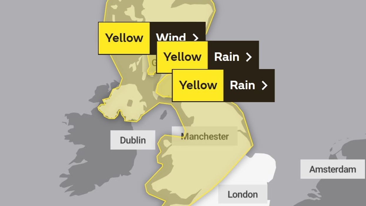


The Met Office has issued a major update over the upcoming Storm Agnes.
In an update issued by the Met Office, the storm is expected to hit earlier than expected, however, the update also suggests the warning will end sooner too.
Two warnings have been issued, one for wind, lasting from midday on Wednesday to 7am Thursday and another for rain which was brought forward in the most recent update.
According to the weather agency, the warning for rain will last from 3pm to midnight on Wednesday.
Prior to the update, the Met Office's rain warning stretched from 9pm on Wednesday and 6am on Thursday.
However, they said the rain would ease by the early hours of Thursday morning.
WEATHER LATEST:
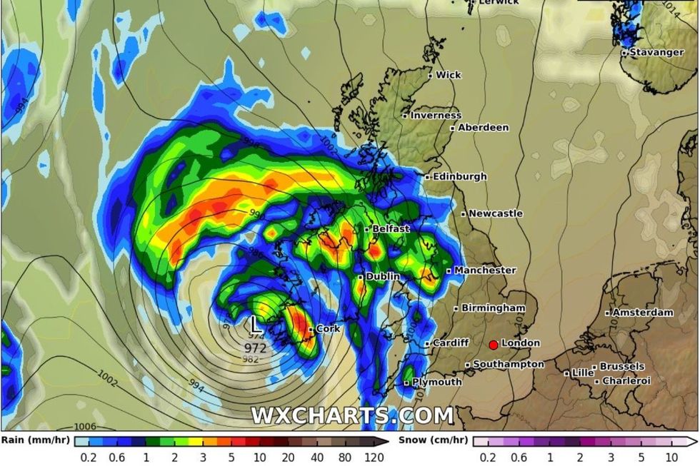
Storm Agnes forecast on Wednesday
|WX Charts
Met Office Chief Meteorologist Steve Ramsdale said: “While the precise track and depth of Storm Agnes is still being determined, there’s a high likelihood of wind gusts around 50 to 60mph for some inland areas.
“Exposed coastal areas could see gusts of 65-75mph with a small chance of a few places seeing around 80mph.
“As well as some very strong winds for many, Storm Agnes will also bring some heavy rain, with the highest totals more likely in Scotland, northern England, Wales and Northern Ireland.
“Around 60mm of rain is possible in a few places over high ground in Scotland.”
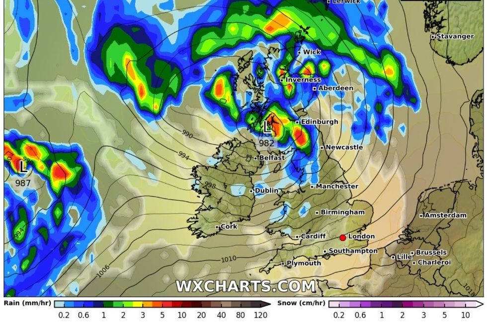
Storm Agnes will bring 80mph winds - map showing Wednesday night
|WX Charts
Airports across the UK are also bracing for blustery conditions and have issued advice to travellers ahead of the storm.
A spokesperson for the airport told BirminghamLive: “We are prepared for these weather conditions and will be operating in line with our usual extreme weather procedures.”
Following the storm on Thursday, the Met Office has predicted temperatures could reach as high as 24C as Storm Agnes subsides.
British Weather Services' senior meteorological consultant Jim Dale told the Mirror: “A taste of an Indian summer is currently on the cards in the aftermath of the 'offspring’ of the ex-hurricane Nigel [Storm Agnes], and will last from Saturday to the following Tuesday.
“It'll mainly cover South-East England, with 23 or 24C possible at the upper limits.
“Prior to that warmth, the Atlantic storm is forming and will move in from the Southwest, crossing northern parts of the UK on Wednesday.
“I first saw this potential development last week, and warned it may turn into a potent force.
“Expect 60 to 70mph gusts in the North-West, and 40 to 50mph gusts elsewhere.
“There will be sizeable rain too, mainly in the same areas as the highest winds, with more than 25mm expected in places. As ever we watch and wait!”