


The Met Office has shared the exact moment an 800-mile storm shift will bring 80mph winds to British shores.
Forecasters even fear adverse conditions could bring the “real possibility” of the country’s first storm of the season.
Storm Agnes’ potential arrival would come just days after Hurricane Nigel brought torrential downpours to the UK.
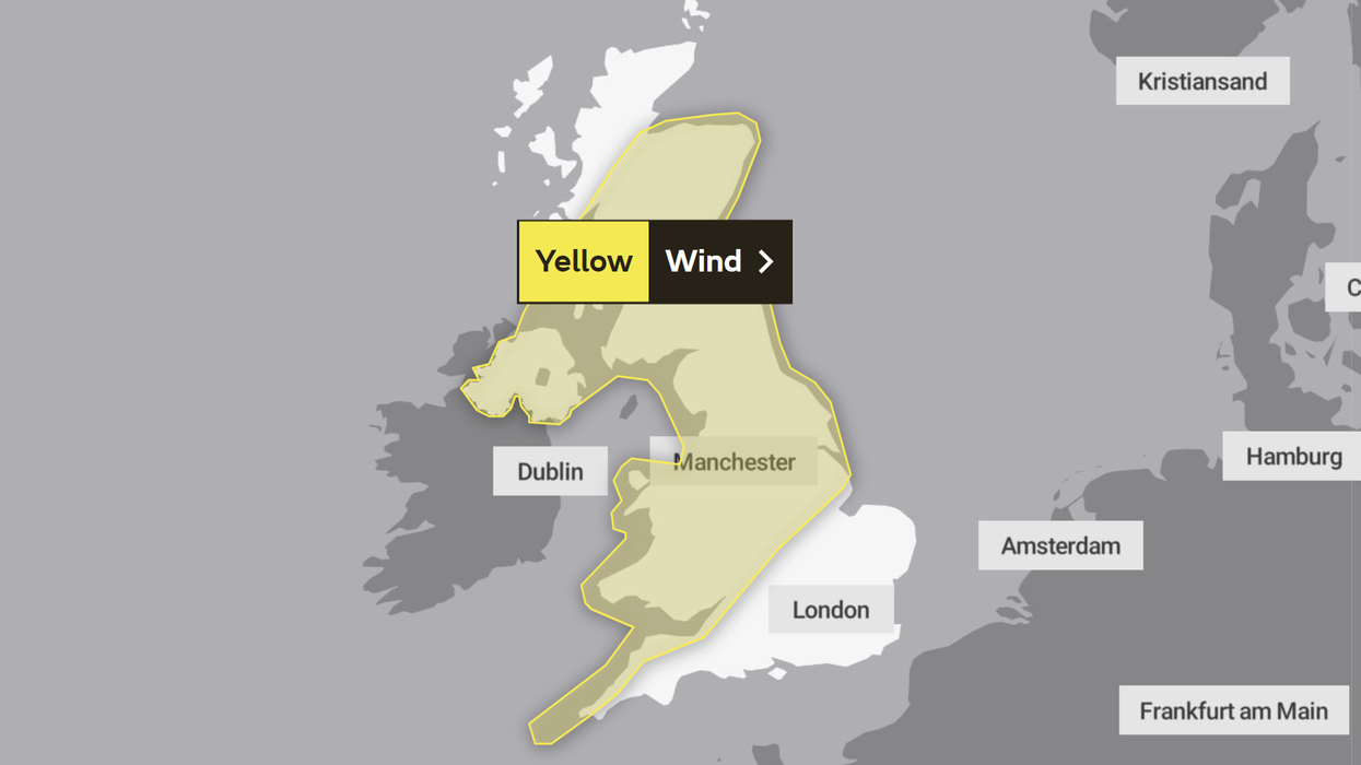
The Met Office issued a yellow weather warning to last from 10am on Wednesday to 7am on Thursday.
WATCH NOW: Meteorologist John Hammond gives his weather update
Large swathes of the UK are facing the yellow wind warning, including: Central, Tayside & Fife, East Midlands, Grampian, Highlands & Eilean Siar, North East England, North West England, Northern Ireland, SW Scotland, Lothian Borders, South West England, Strathclyde, Wales, West Midlands and Yorkshire & Humber.
The forecast spell of strong winds will bring a small chance of significant disruption.
It could also see a small chance of injuries and danger to life from flying debris and large waves, there is a slight chance of damage to buildings, power cuts could occur in places and journey times face potential cancellations.
“A deep area of low pressure is expected to approach southwest Ireland early on Wednesday, and track across northern parts of the UK before clearing early Thursday,” the Met Office said.
LATEST DEVELOPMENTS: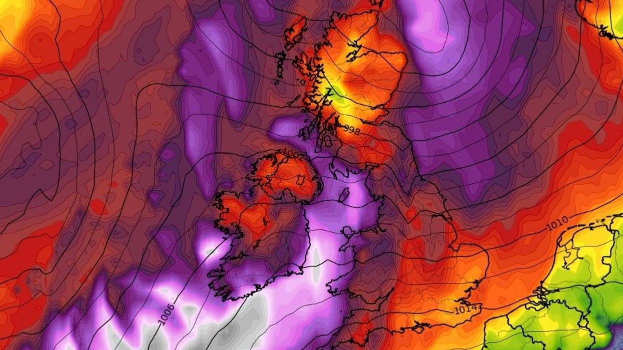
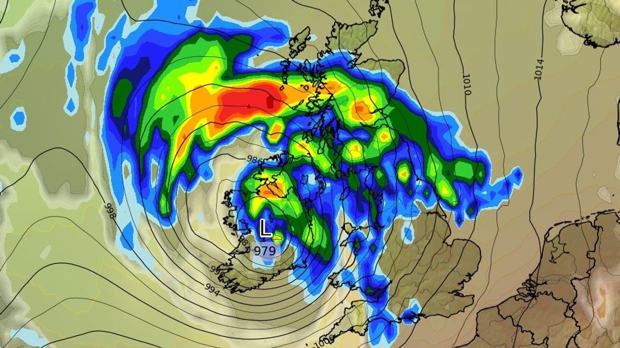
WXCHARTS summary of maximum wind gusts on Thursday
|WXCHARTS
“There is some uncertainty on the precise track and depth of the low, however the most likely outcome at present is for a wide swathe of 50 to 60 miles per hour gusts to affect inland areas, perhaps locally stronger over and to the lee of hills in the north.
“Some Irish Sea coasts could see gusts of 65 to 75 miles per hour, with a small chance of 80 miles per hour gusts on the most exposed coasts and headlands.”
Met Office meteorologist Craig Snell added: “We are keeping a very close eye on things.
“We've got a very jet across the Atlantic and that's the breeding ground for some potentially deep areas of low pressure.
The UK will also see heavy downpours on Wednesday, WXCHARTS has suggested
|WXCHARTS
“It's one we are keeping a very close eye on is this area as it moves towards the UK onto Wednesday, potentially quite a deep feature as it moves towards our neck of the woods.
“We could potentially see some very heavy rain and also some very strong winds.
“Some uncertainty on this at this stage, so we are keeping a very close eye on it.
“The main advice at the moment is to keep a very close eye on the forecast.”