


The United Kingdom looks set to roast in an Indian summer after a brutal week of stormy weather, a senior meteorologist has claimed.
Warmer temperatures are expected to return to Britain from next Saturday (September 30) and will last until the following Tuesday (October 3).
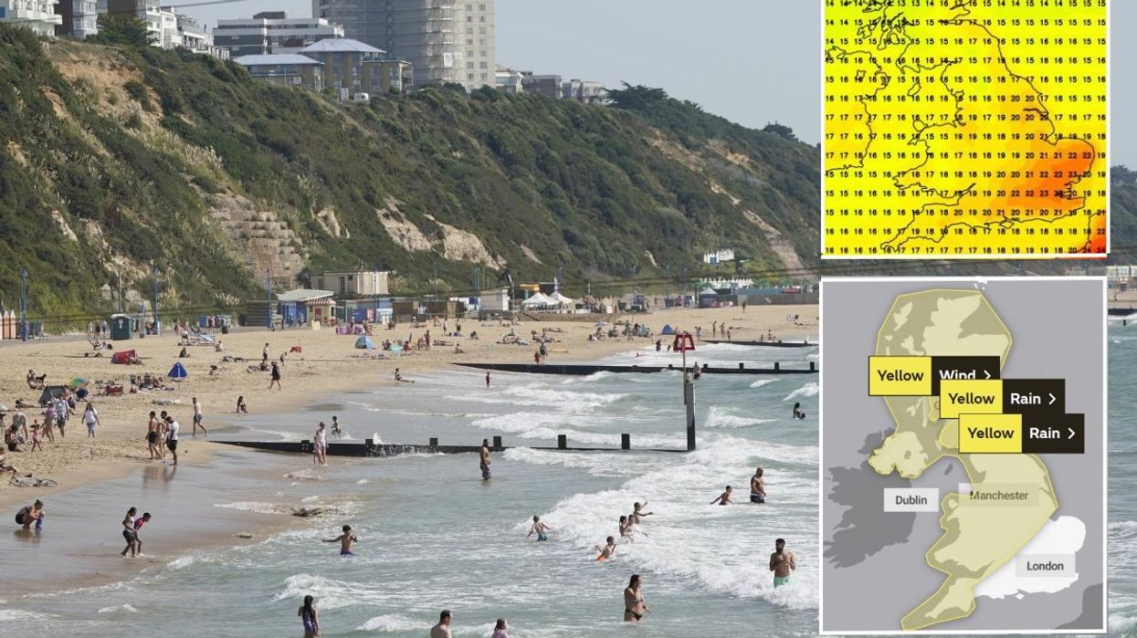
The south east of England is poised to experience mercury reaching its highest over that period, with 24C forecast in places.
British Weather Services' senior meteorological consultant Jim Dale told the Mirror: "A taste of an Indian summer is currently on the cards in the aftermath of the 'offspring’ of the ex-hurricane Nigel [Storm Agnes], and will last from Saturday to the following Tuesday.
WATCH NOW: Jim Dale talks with Nigel Farage about the importance of weather
"It'll mainly cover South-East England, with 23 or 24C possible at the upper limits.
"Prior to that warmth, the Atlantic storm is forming and will move in from the Southwest, crossing northern parts of the UK on Wednesday.
"I first saw this potential development last week, and warned it may turn into a potent force.
"Expect 60 to 70mph gusts in the North-West, and 40 to 50mph gusts elsewhere.
LATEST DEVELOPMENTS: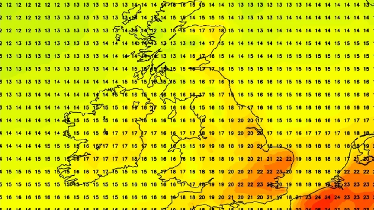
An image of temperatures ticking up later this month
|NETWEATHER
"There will be sizeable rain too, mainly in the same areas as the highest winds, with more than 25mm expected in places. As ever we watch and wait!"
The two rain warnings have been put out to last from 9pm tomorrow to 6am on Thursday.
The wind warning is in place from midday on Wednesday to 7am the following morning.
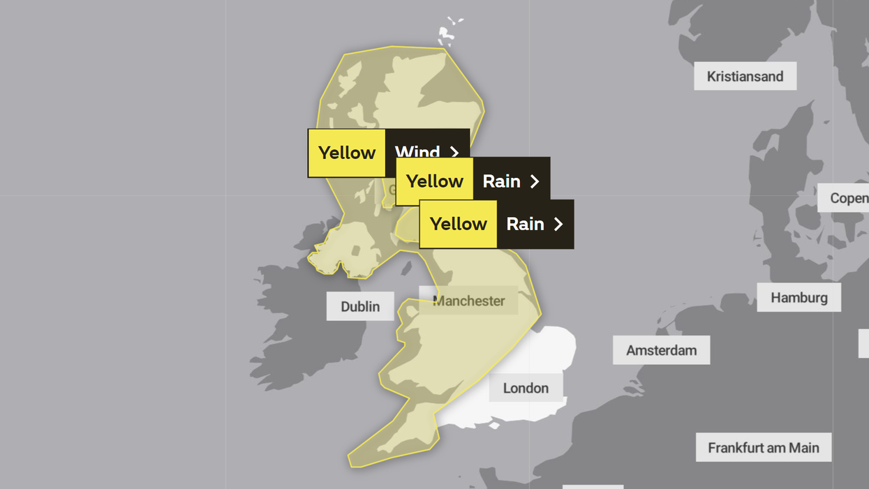
The Met Office has issued three weather warnings which will cover much of the UK
|MET OFFICE
A majority of the UK is going to witness Storm Agnes over the coming days, with London and the South East of England the only places not covered by the triple warning.
Met Office chief meteorologist Steve Ramsdale said: "While the precise track and depth of Storm Agnes is still being determined, there's a high likelihood of wind gusts around 50 to 60mph for some inland areas.
"Exposed coastal areas could see gusts of 65-75mph with a small chance of a few places seeing around 80mph.
"As well as some very strong winds for many, Storm Agnes will also bring some heavy rain, with the highest totals more likely in Scotland, northern England, Wales and Northern Ireland.
"Around 60mm of rain is possible in a few places over high ground in Scotland."