
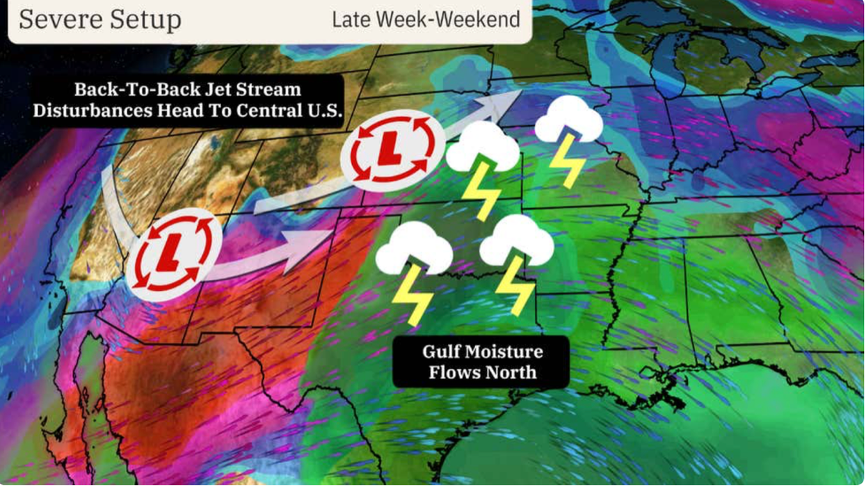


Back-to-back ‘jet-stream disturbances’ fuelled by battling hot and cold air masses threaten a weekend of ‘tornadic storms’.
Swaths of the United States are on alert for torrential rain, churning whirlwinds and downpours of giant hail.
Severe weather could persist into mid-May as cold air from the north clashes with tropical southerlies.
Kinks in the jet stream will drive the growth of low-pressure storms systems putting the nation in line for a weekend deluge.
Storms strike
|The Weather Channel
Weather Channel meteorologist Chris Dolce said: “The jet stream will eject multiple storm systems into the central United States this weekend.
“There will be a strong risk of tornadoes, large hail and damaging winds before the threat pushes east and expands to the north.
“A pair of back-to-back jet-stream disturbances will track from the Rockies into the Plains from Thursday through Sunday, and both of those energy impulses will spark daily bouts of severe weather.”
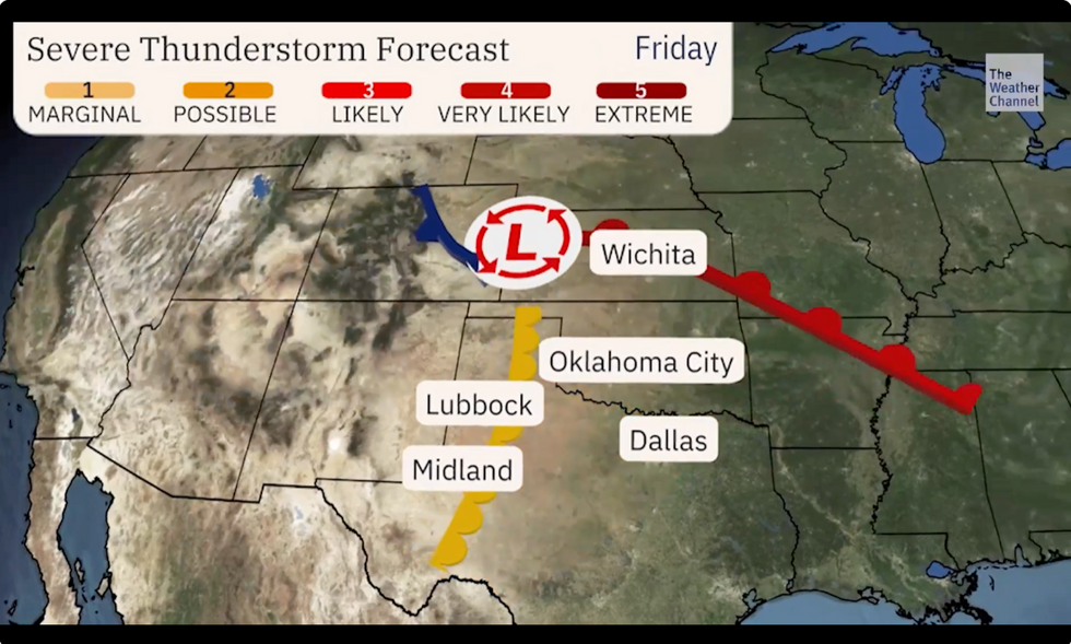
The first round of storms ahead of the weekend will be isolated to the worst-hit regions of west-central Texas, Oklahoma, Kansas, Nebraska and Colorado.
Severe ‘supercell’ thunderstorms fuelled by volatile atmospheric conditions will spawn giant tornadoes.
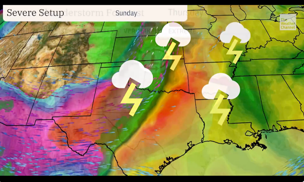
The storm threat will widen into the weekend, spreading eastwards to the Plains and the Midwest.
Mr Dolce said: “On Saturday, the second of the two jet-stream disturbances will budge into the Plains, and this could push severe thunderstorms from north Texas northward into Oklahoma, southern and eastern Kansas, northwest Arkansas and western and northern Missouria and the Mississippi Valley.
LATEST DEVELOPMENTS:
Thunderstorm risk
|The Weather Channel
“In a corridor from north-central Texas into central and eastern Oklahoma and south-central and southeast Kansas, there will be an increased risk of tornadic storms, however it is still too early to be sure of that potential.”
America’s national weather service (NOAA) warned the recent ‘benign’ weather will this weekend come to a crashing end.
A ‘severe spring set up’ will drive a barrage of damaging storms through swaths of the country, it warned.
A spokesman said: “The Storm Prediction Centre has issued an Enhanced
Risk for severe weather; very large hail, severe wind gusts, and a couple strong tornadoes will all be possible.
“Unsettled weather and severe thunderstorm chances gradually expand across much of the central United States over the next several days.”
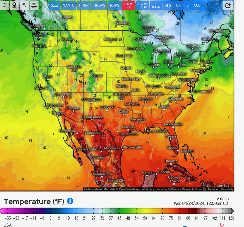
Temperature contrast across the US
|Weather.us
Volatile weather is being driven by the jet stream, in turn powered by vast temperature differences across the US.
Parts of the northeast, including New York and the Great Lakes are currently shivering in a late winter blast that has pushed the mercury below freezing.
Further south, a blast of tropical air from the Gulf of Mexico is pushing temperatures into the 80Fs.
Where the two air masses meet, the jet stream is firing up and injecting storm systems with energy.
Unsettled weather could hold out for another two weeks as the battle ensues, according to experts.
Jim Dale, meteorologist for British Weather Services and co-author of ‘Surviving Extreme Weather’, said: “This set up is going to continue and will bring the risk of severe storms into the start of May.”