


A late polar blast plunging temperatures 20 degrees below average will dust parts of the country with a flurry of snow.
Arctic air sweeping through Canada will hit northeastern states ahead of the weekend bringing harsh frosts and wintry showers.
In line are the Great Lakes and surrounding areas, although winter could return as far south as Illinois, Michigan and New York.
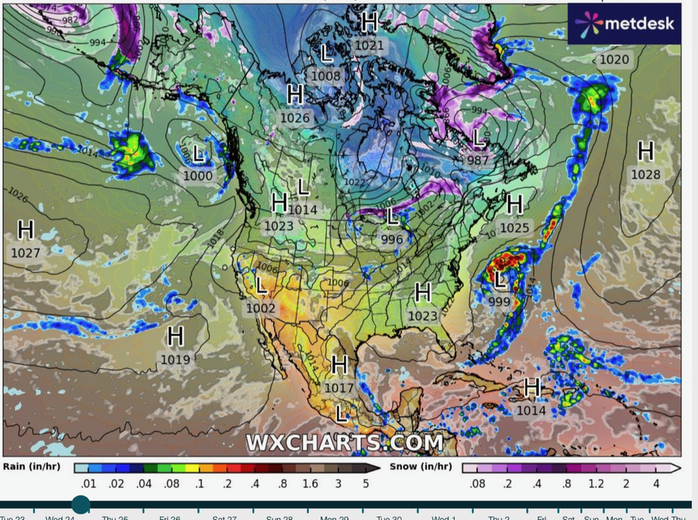
A cold front will be driven across the United States by atmospheric air currents sweeping bitter air in from the north.
A cold plunge is coming in from the north
|WX Charts
A spokesman for The Weather Channel said: “Winter will return for a quick cameo this week as an upper-level flow funnels cold air in from Canada.
“This system will initially bring rain, but there could be some snowflakes mixed in behind the cold front.
“And where the front moves through, temperatures will plummet, so people should keep their coats handy.”
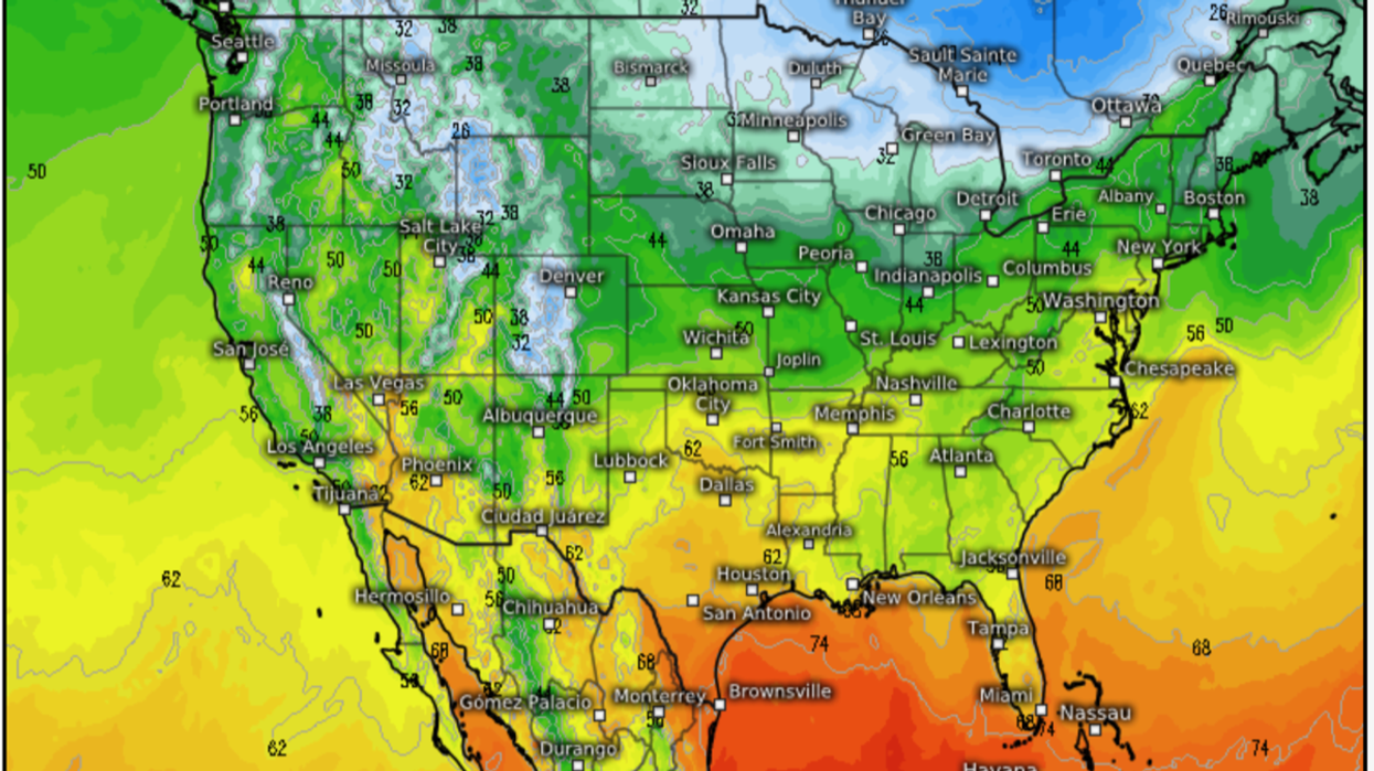
Temperatures could fall below freezing around the Great Lakes, the Appalachians and southern New England.
Cold air hitting warmer air to the south will revive the threat of storms, with torrential rain and gales forecast later in the week.
Freezing weather will hold out into the weekend before tropical gusts from the Gulf of Mexico begin to push further north.
LATEST DEVELOPMENTS:
Jim Dale, meteorologist for British Weather Services and US correspondent, said: “The Polar front is sinking south and bringing cold air out of Canada and into the United States.
“The first to be in the firing line is the Midwest, although the cold will then move to the northeast into the weekend.
“In addition, with warmer air coming up from the Gulf of Mexico, there will be a risk of storms as the atmosphere turns unstable.”
The National Weather Service (NOAA) said temperatures across the northeast will plunge much lower than average for the time of year.
Thunderstorms will hit the Great Basin and the Pacific northwest through the end of the week, it added.
A spokesman said: “Unsettled weather is forecast throughout parts of the Great Basin and the Pacific Northwest by Thursday as initial upper ridging and well above average temperatures gradually erode.
“Cooler weather is in store for the Great Lakes and much of the eastern United States.
“This will allow for midweek temperatures to drop to around 10 to 20 degrees below average for the Great Lakes and Northeast.”
A spokesman for The Weather Channel added: “The ingredients are coming together for a series of severe storm disturbances this week.
“Multiple systems fuelled by Gulf moisture will ride the jet stream into the weekend, and these could bring large hail, wind damage and a few tornadoes.”
AccuWeather long-range forecaster Paul Pastelok added: “A cold front will move across the Midwest, Ohio Valley, and the Northeast.
“This front will stall across the south-central Plains and the northern Gulf States on Thursday and Friday, and showers and thunderstorms may develop along this front in the central Plains.”