


A ‘volatile’ festive week will see a 200mph jet stream dish up a frenzied cocktail of torrential rain, 70mph gales, snow and freakishly high temperatures.
Scotland was alone in a White Christmas yesterday while the rest of the UK saw the mercury nudge double figures for one of the warmest Christmas Days on record.
The highest temperature was 13.6C making it the hottest December 25 since 2016, and the average minimum temperature record toppled as the mercury failed to fall below 12.4C in East Malling, Kent, and Exeter Airport.
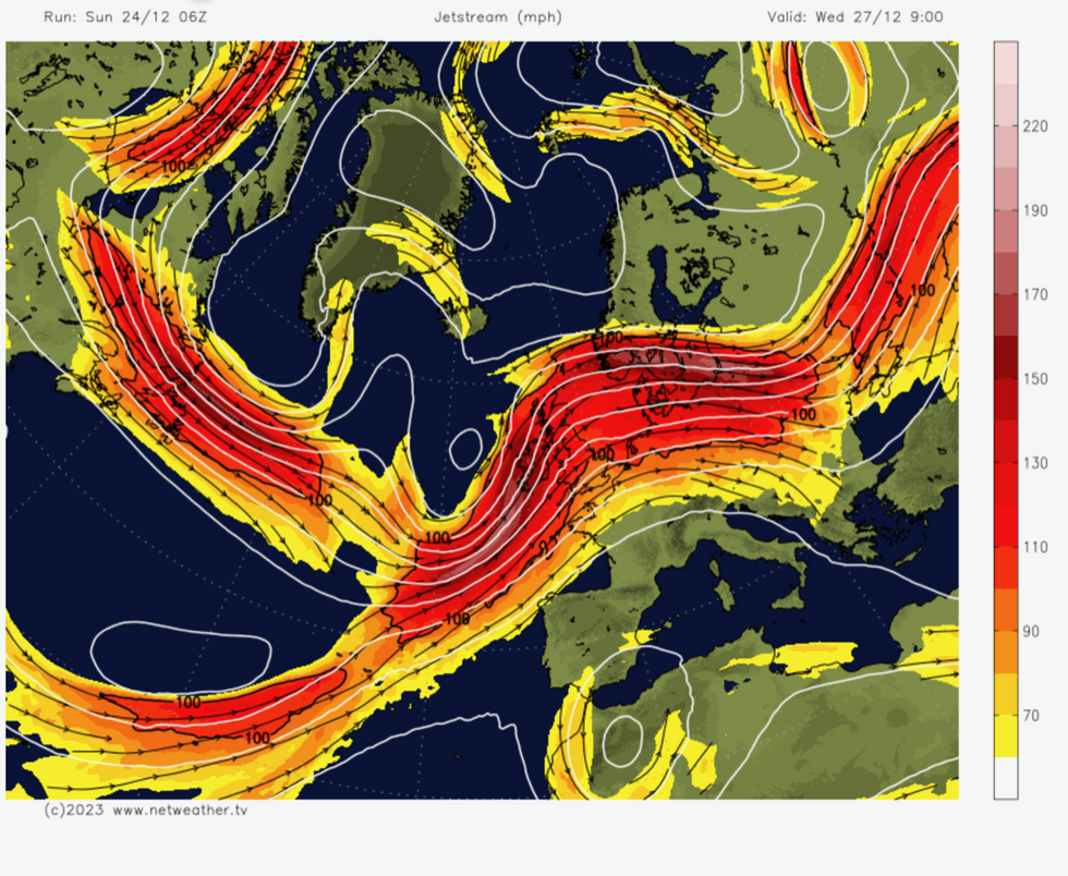
jet stream map
|NetWeather
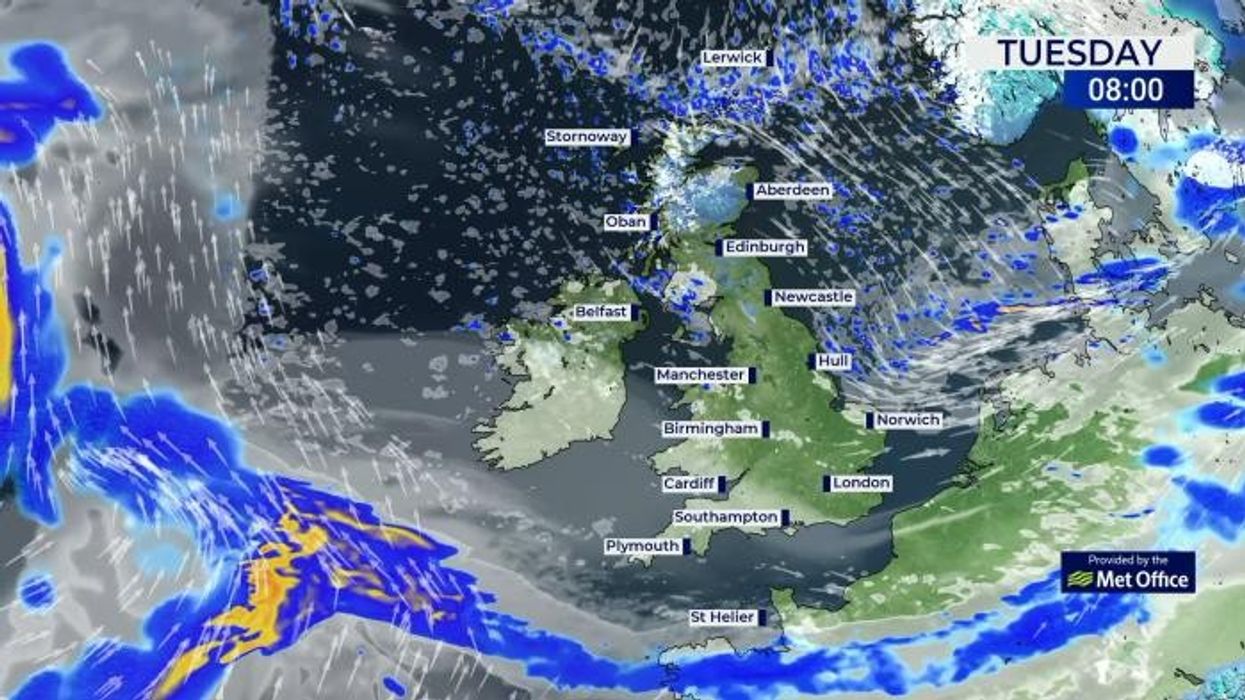
Met Office alerts for rain and up to six inches of snow are in force in Scotland, with further advisories for rain along the west coast and northern England, and wind in the south.
Foul weather will be driven by a ‘zonal’ jet stream, firing across the UK with a core speed of 200mph, according to experts.
Jim Dale, social commentator and meteorologist for British Weather Services, said: “We are looking at a very volatile period of weather, with a period of wet and windy weather on the way after Christmas as a low-pressure system comes in off the Atlantic.
“It is going to stay generally unsettled through the period and during the run-up to New Year.
LATEST DEVELOPMENTS: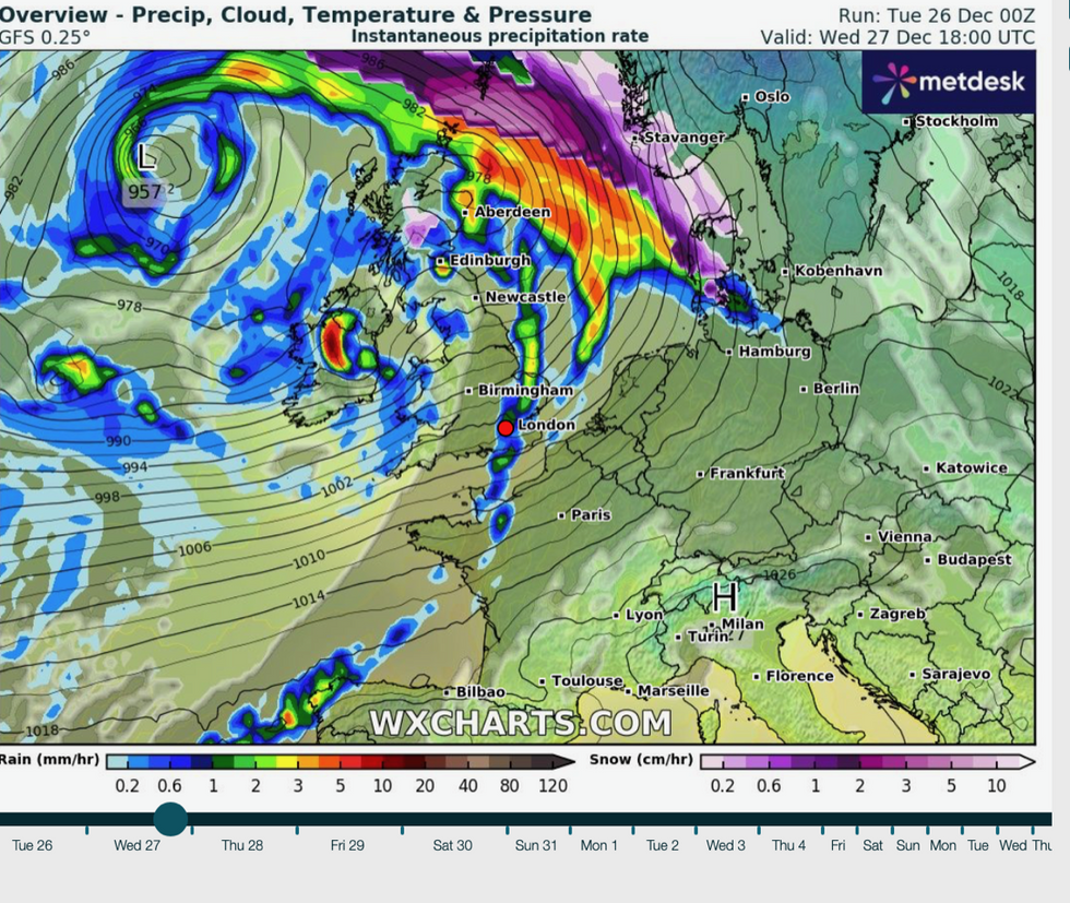
Storm roars in on Wednesday
|WX charts
“This is due largely to the jet stream taking on a more zonal configuration, and this will steer lows in from the west, compared to when it is wavier in shape which brings colder and more settled weather.”
Those hoping for a White Christmas yesterday would have been largely disappointed with only northern Britain seeing a flake.
Elsewhere, temperatures stayed well above average for the time of year with further oddly warm weather likely through the end of the year.
Mr Dale said: “Scotland is most likely to stay in the freezer, with northern Britain in the fridge, and the rest of the UK looking in from the kitchen.
“We will be watching the jet stream and the movement of the Polar front for any colder weather moving south, and the possibility of snow, but it looks like a more Atlantic influence will bring milder but more unsettled weather to much of the UK through the rest of the year.”
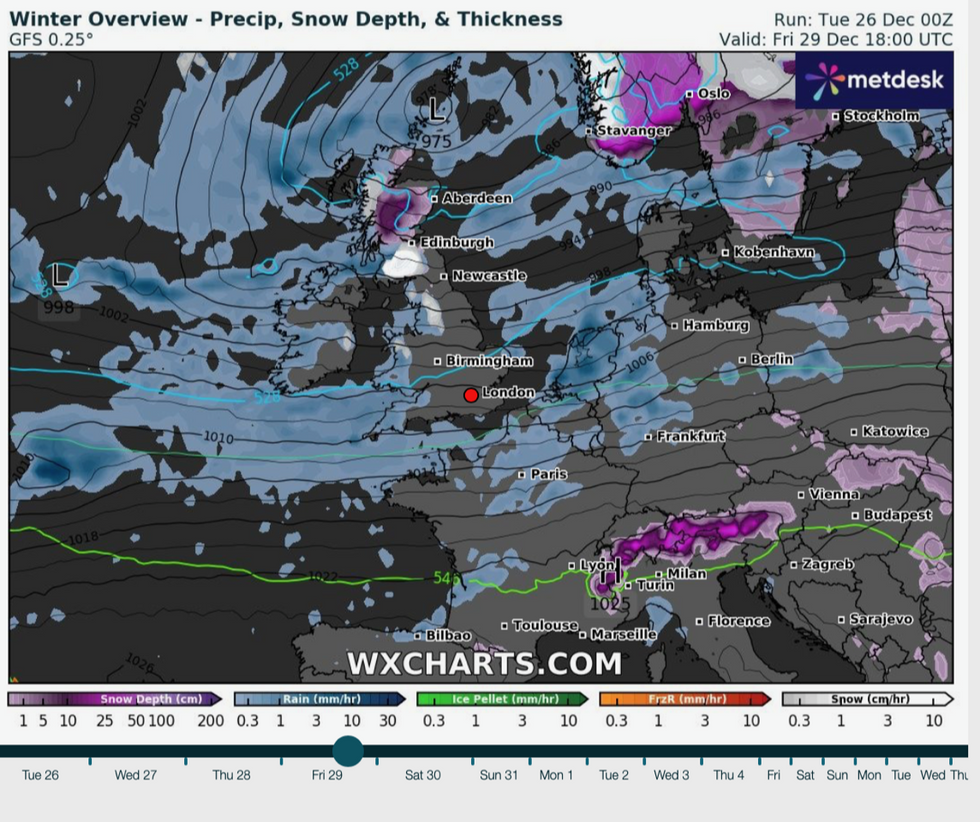
Rain and snow smother the UK
|WX charts
Wet and windy weather will move in from the west towards the end of Boxing Day, according to the Met Office.
Temperatures will be lower compared to Monday, although still above average for the time of year.
Met Office meteorologist Alex Burkill said: “Low pressure is generally going to be in charge, so there is more unsettled and more changeable weather to come.
“There will be some strong winds at times and some longer spells of rain.
“It is mostly going to mild for most of us, but there is the chance of something a little bit colder towards the north of the UK, and so the cold air will never be far away, and this cold air could push its way a little bit further southwards.”
Weather models show a furious jet stream surging over the UK with a core ‘jet streak’ speed of 200mph.
The normal speed of the jet stream is around 110mph, though faster at the core, and is driven by temperature and pressure contrasts in the upper atmosphere.