


A ‘ninety-degree switch’ of the jet stream will sweep in a -15C wind chill this weekend as hopes mount for festive snow.
A winter deluge could hit in the run up to Christmas as Polar air blasts in from Scandinavia, currently in the grip of a big freeze.
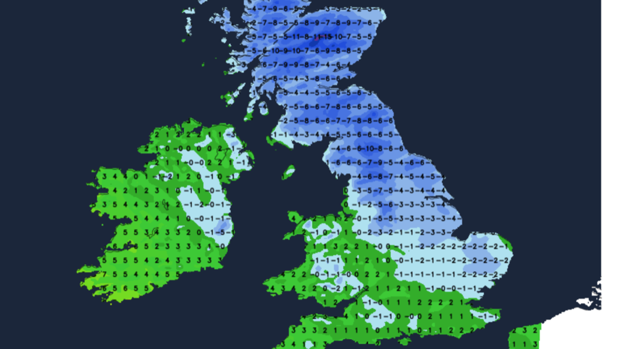
The first snow flurries are expected over Scotland and high ground of northern England where bitter winds on Saturday and Sunday will make it feel close to -15C.
Although drier weather is forecast across southern regions after the weekend, long-range experts are growing hopeful for a White Christmas.
Jim Dale, social commentator and meteorologist for British Weather Services, said: “The east of the UK is now on the periphery of a cold snap that is coming all the way down from Scandinavia, and across Europe, so here it is going to start feeling cold with the risk of frost and ice.
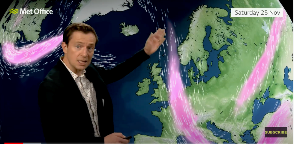
Met Office forecast shows jet stream diving at 90degrees
|Met Office
“As things stand, all it would take would be for a low-pressure system to develop and pull some of this in, and then we would see snow hitting the UK.
“It is currently more likely that we will see a White Christmas than we would usually expect at this stage of autumn going into the start of winter.”
Thermometers will plumet after the weekend with sub-zero temperatures forecast across the country.
High pressure will keep rain and widespread snow at bay for the time being, although a snowy shock to the system could herald the start of December.
James Madden, forecaster for Exacta Weather, said: “Another wintry blast looks possible during the start of December, possibly during the first week or thereabouts.
“This will bring a much greater risk of more widespread snow which could reach beyond the mountains and hills to lower regions of the country.”
Meanwhile, a sharp swerve of the jet stream threatens to keep Britain shivering through the next week.
Cold air plunges over the UK
|Netweather
The jet has ‘split into two’ over the Atlantic and will join forces with a storm system spinning to the south of the UK to drive the cold.
Met Office meteorologist Alex Deakin said: “By the time we get to the weekend the jet stream is sitting to the east and that will have an impact on the winds and will allow things to turn colder.
“It’s what happens during the second half of the weekend that is open to doubt and that is due to an area of low pressure that…is likely to drift south during Sunday.
“The jet stream out in the Atlantic is almost splitting in two, with one arm going to the north and a cut-off low pressure developing.
“We are going to see a switch-around of 90 degrees over the next four or five days, and you will notice that colder air.”
High pressure will dominate the weather after the weekend which, during winter, brings colder weather to the UK.
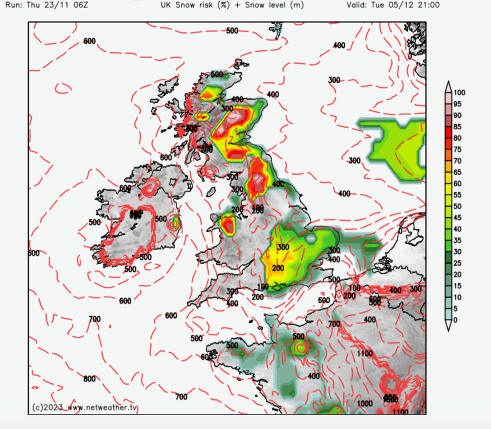
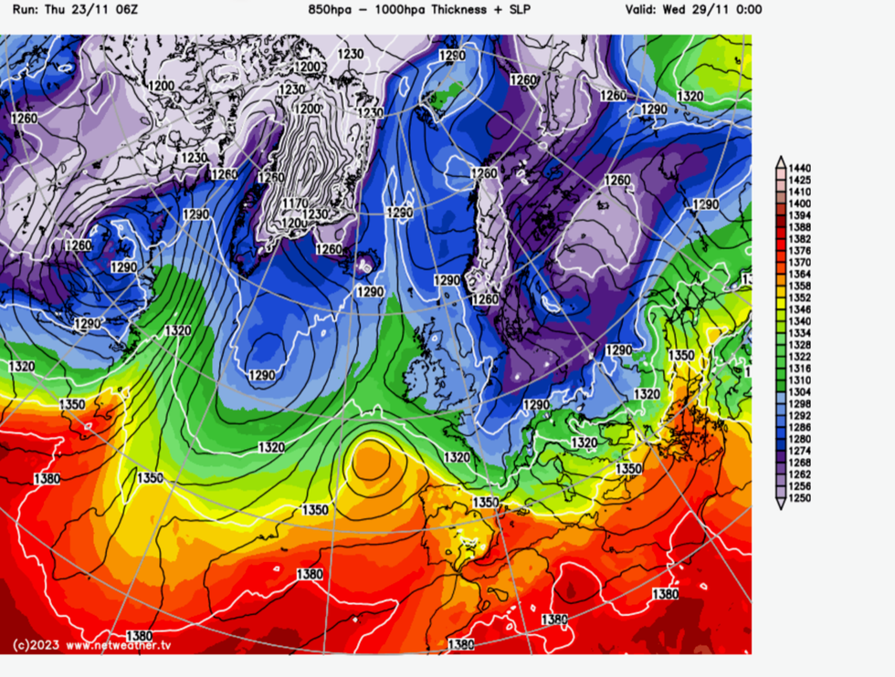
Snow risk spreads through the start of December
|Netweather
Mr Deakin added: “There is quite a strong signal that we are going to have high pressure to the west of the UK.
“That would bring the winds in from the northeast, or the northwest or straight in from the north.”