


Heavy snow is set to fall across the UK in the coming week, with new weather charts show a deep blanket of snow could remain in some areas for as long as ten days.
An inbound Arctic blast will send temperatures plunging from overnight tonight, with the mercury barely reaching above zero in the days to follow.
Scotland will be the first to be hit with the Met Office having imposed a yellow weather warning for snow and ice throughout today and into tomorrow.
Weather maps from WX Charts indicate that parts of northern Scotland could see around 10cm of snow over the next two days.
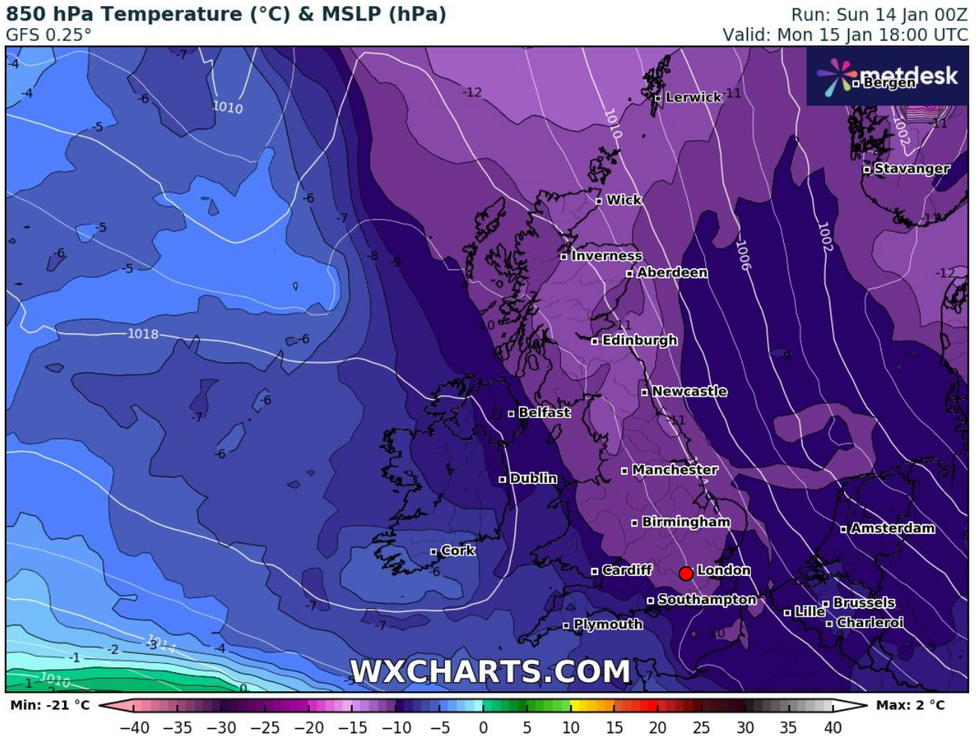 An inbound Arctic blast will send temperatures plunging from overnight tonight | WX CHARTS
Meanwhile Northern Ireland could also see up to 5cm of snow on higher ground on Monday, with a yellow warning in place from 3am until the end of the day.
By Tuesday snow is set to have also settled on areas in northern England, with anywhere north of Manchester at risk.
Come Wednesday the latest weather charts indicate it will be the south's turn to be hit with a deluge of snow.
Up to 11cm of snow an hour will fall in parts of Cornwall and Devon. And even after the snowfall stops, the ground will be covered in up to 12cm of white for days to come.
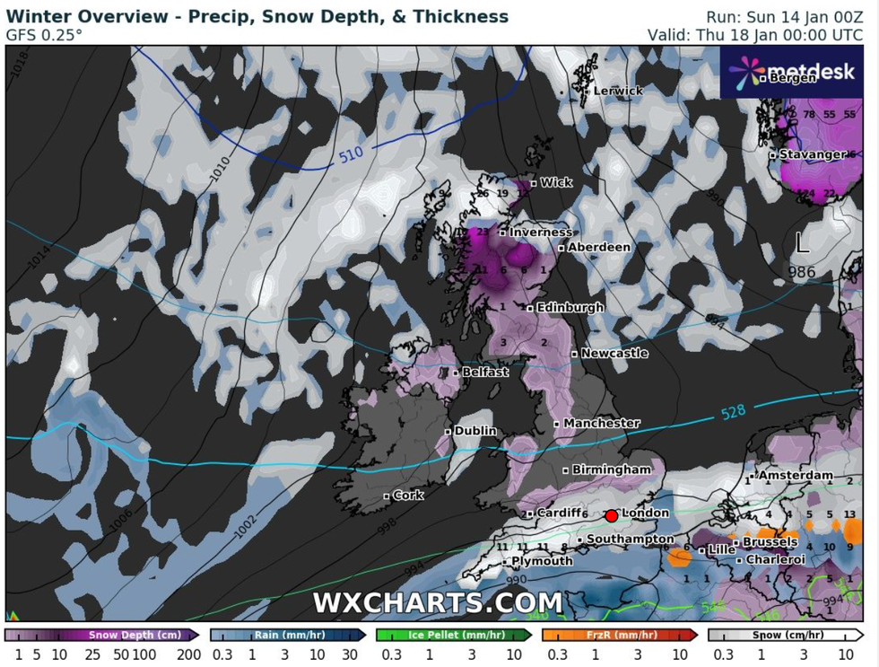
Wednesday will see the south hit with snow, while a heavy coating remains in the north
|WX CHARTS
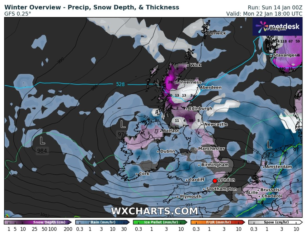
The deep-lying snow will stick around until heavy rain washes it all away
|WX CHARTS
WX Charts suggest it won't be until heavy rain fall in ten days time that the last of the snow is wiped away.
Giving the forecast for the week ahead, Met Office meteorologist Conor Criswick said: “It is going to be feeling pretty chilly in the north of Scotland.
“Throughout the week we are going to see more and more snow showers and warnings, towards the end of the week we will probably see an accumulation.
“The warning is of 2cm to 5cm of snow, throughout the week there is the possibility we will see a build up of snow.
“The top temperature for Aberdeen is 2C on Sunday but it will probably feel cooler.
“Snow showers will be moving inland throughout the course of the day.
“It continues all day Sunday into Monday and we are likely to see an accumulation of snow and further warnings.
“We are going to see showers feeding across Scotland, Northern Ireland, and mainly the east coast of England. It should be dry and bright inland.
“On Tuesday, we are going to see more rain turning to snow moving east across the country, with more prolonged snow and more accumulations at low levels in the north of Scotland and northern England.
“That’s where we could see 5cm or 10cm of snow in low-lying areas.
“There’s a very low chance the south might see a bit of it.”