


A three-pronged summer deluge will kick-half term with a barrage of gale-swept electric downpours.
Britain’s weather is about to tumble downhill, starting gently before gathering pace to an assault of torrential downpours.
Scotland and northwestern regions are first in the firing line for showers before a ‘huge shift’ dumps inches of rain.
Jim Dale, meteorologist for British Weather Services, said: “The weather is going to change in three stages, starting in the northwest with showers before a brief respite and a huge shift in the weather as we get to the weekend.
“Heavy rain is on the cards for the weekend in a more typical pattern of changeable conditions, and we could see more than an inch and a half of rain in parts of the country.
“With heavy rain, there will also be a risk of thunder in parts of the country, although by the nature of these, it is difficult to predict exactly where they will happen.”
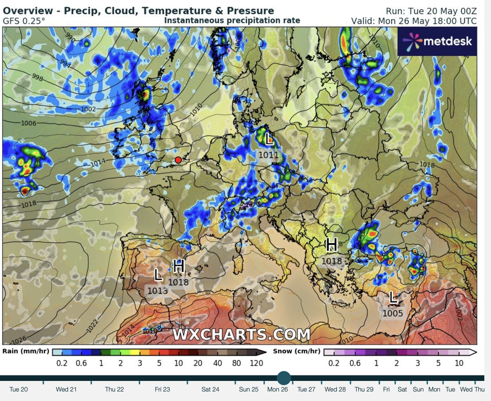
WX Charts map shows rain moving in over Bank Holiday Monday
|WX charts
The dramatic U-turn is the result of high pressure behind the largely dry weather giving way to low pressure.
Stormy lows from the Atlantic will nudge out the ‘blocking high’ that has dominated Britain’s weather for weeks.
With the rain will come cooler temperatures, with highs in the mid-20Cs to sink into the teens.
Met Office deputy chief Meteorologist Mark Sidaway said: “The high pressure that has been around for the last few weeks will slowly lose its grip on the UK, bringing a change to more unsettled conditions with many areas seeing rain or showers, ending the prolonged dry spell.
“The change this weekend will start with weather systems moving in from the Atlantic, arriving from the west probably later on Friday and through Saturday.
“They will bring with them spells of rain, which may be heavy at times, with a risk of strong winds in places.”
LATEST DEVELOPMENTS:Much of the country will be in the grip of rainfall by the Bank Holiday, although bursts of sunshine will rescue a total washout, he said.
He added: “These conditions will gradually spread across the UK on Saturday, with Sunday and Bank Holiday Monday likely seeing sunshine and showers.
“So, while the bank holiday won't be a complete washout, with some sunshine expected, this weekend represents a notable shift from the fine and settled weather pattern that has dominated so far this month.”
Wednesday is likely to be the last day of full sunshine before the Atlantic rolls in to end the week.
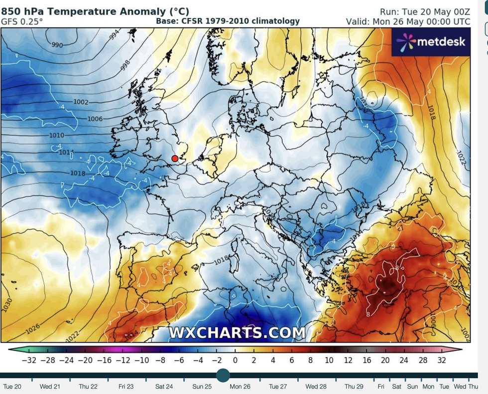
WX Charts map also shows temperatures dropping over same period
|WX Charts
Sun-lovers can enjoy one more day of 20C temperatures and golden rays before the brollies go up.
Jason Nicholls, lead international forecaster for AccuWeather, said: “On Wednesday, it will be dry, warm and sunny for many.
“However, a weather front is expected to spread across the country through the end of the week, and this will bring spells of rain, some of which will be thundery.
“Further rain is expected through the weekend, and again, there will be a risk of an isolated thunderstorm.”