


The United Kingdom is going to be blanketed by heavy snowfall in just a few days time, weather charts have suggested.
Large swathes of England, Scotland and Wales will see snow fall over next week in the build-up to the Christmas period.
The wintery conditions will likely last for a fortnight, with Scotland facing the brunt of it.
WX Charts has identified where snow will specifically fall, when it will hit Britain and how long the UK will be blanketed for.
WATCH NOW: The Met Office's weather forecast
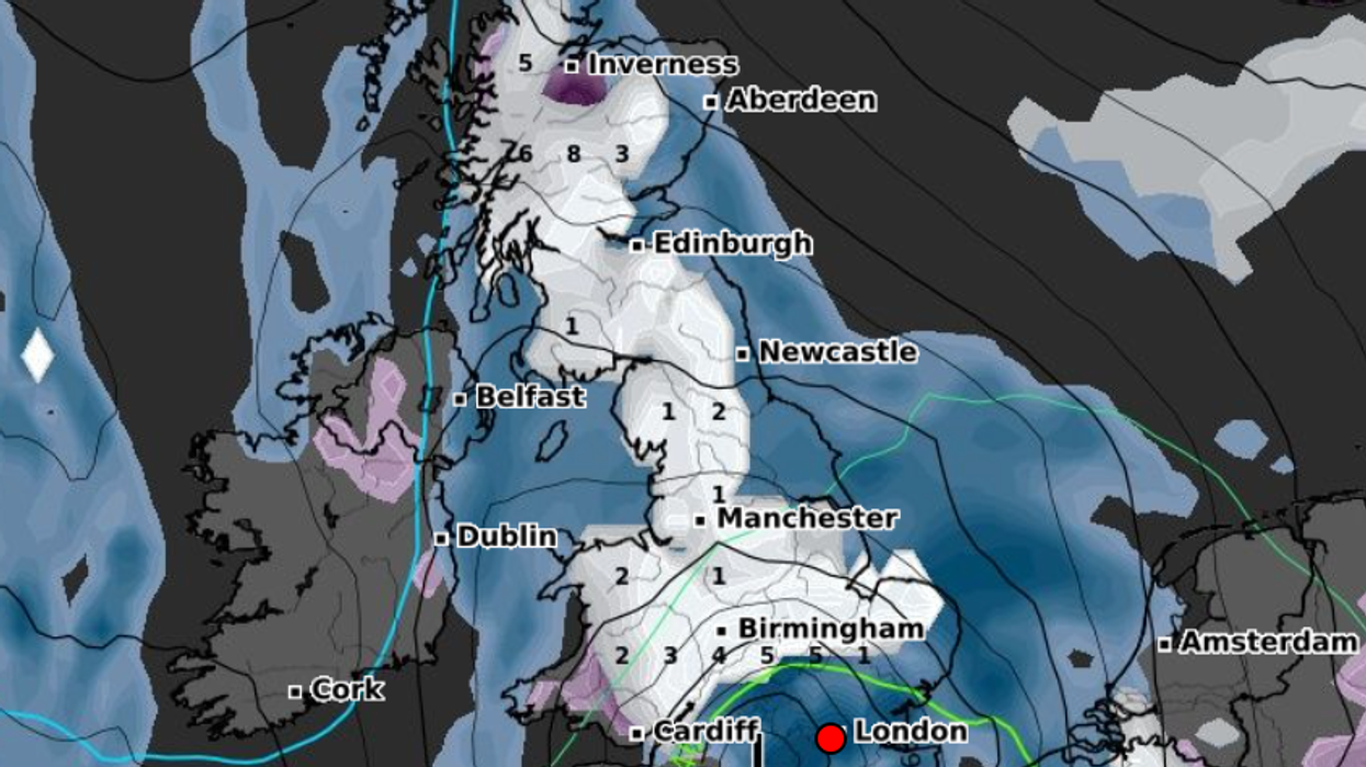
The weather mapping website indicated snow will first hit north west Scotland today.
It will spread across Great Britain next Friday, stretching from Wick to just outside London.
Snow will blanket much of the south of England on December 8.
The weather maps suggest the snow will remain in place until the end of its current long-range forecast on December 10.
LATEST DEVELOPMENTS: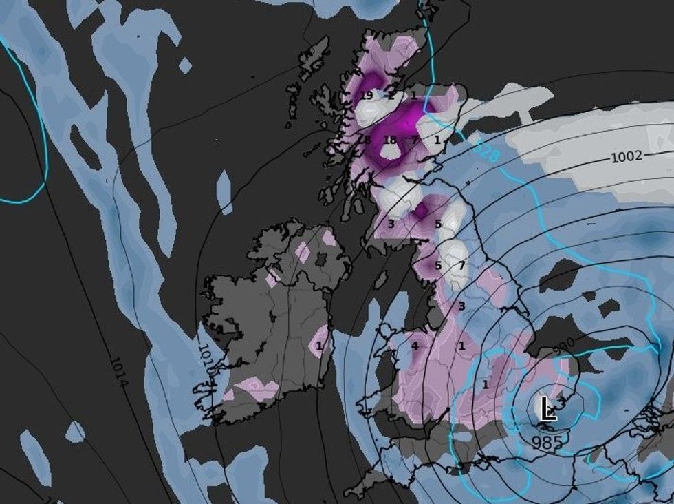 The United Kingdom is likely to see snow in the coming days | WXCHARTS
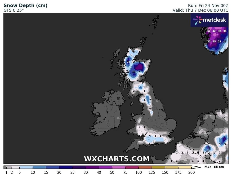
Snow depth could exceed 30 centimetres in Scotland
|WXCHARTS
Mercury will continue to plummet as snow comes to the UK ahead of Christmas.
Temperatures of -11C will hit central Scotland on December 7.
Mercury will dip below freezing across the UK, with -5C in Wales and -7C in North West England.
However, the Met Office appears less concerned about snow falling in the coming days.
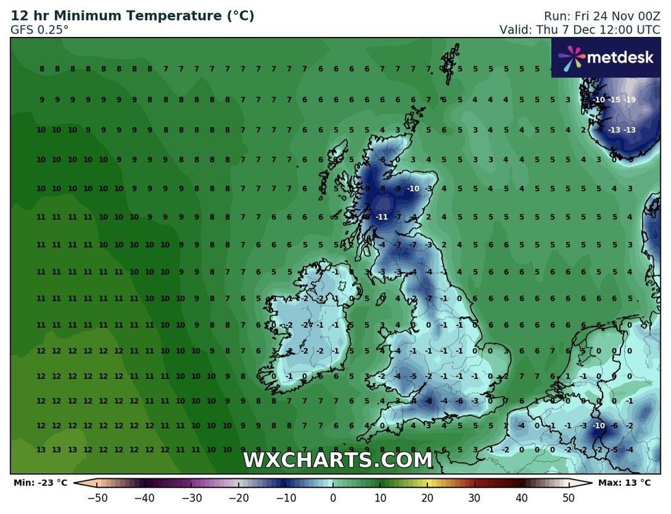
Temperatures could drop to as low as -11C
|WXCHARTS
In its November 28 to December 7 weather forecast, the UK’s national weather service said: “Colder than average conditions are most likely overall, as chances of some wintry showers, or even more general snow towards the turn of the month, are increasing.
“Cloud and rain is likely to be clearing southeastern England early on, followed by a period of widely colder, drier and brighter weather and the return of overnight frosts.
“Scattered showers along with an overnight ice risk may affect some coastal areas of northern and eastern Scotland, and eastern England at times, which could turn increasingly wintry over hills in the north.
“These conditions could then persist, particularly in the north, but there is an increasing chance of areas of cloud, rain and/or snow, perhaps with strong winds too, spreading north across at least southern areas from later next week.”