


An "Omega block" drawing chilly winds and fog from the North Sea threatens to cloak parts of Britain in a ghostly shroud of "haar and fret".
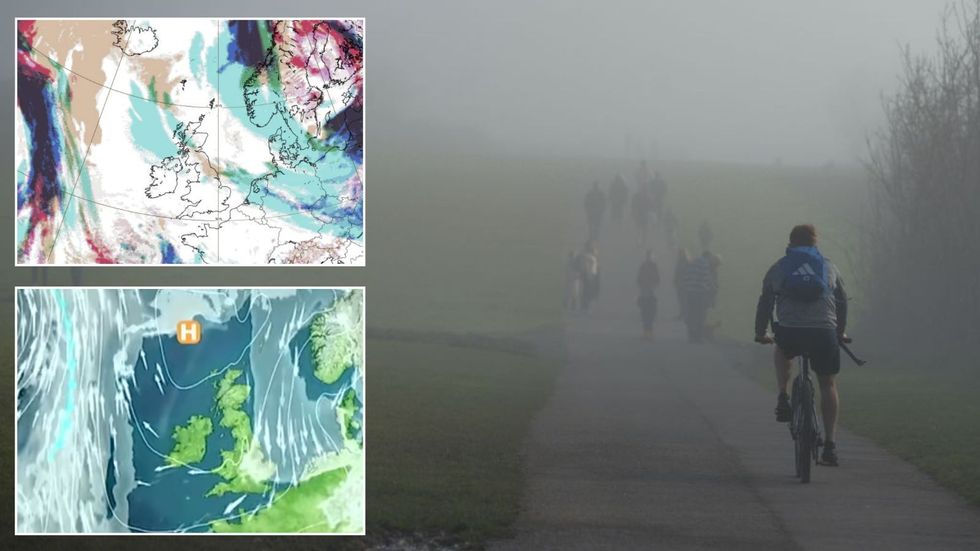
As temperatures rise, meteorologists are keeping close eyes on a "fickle" cloud of sea fog poised to smother the east coast.
High pressure responsible for the warm weather will shift to the north, pulling down winds from the Polar regions.
Laden with nautical moisture, Arctic gusts will sweep eastern regions with a swathe of low cloud, mist and fog.
An 'Omega block' drawing chilly winds and fog from the North Sea threatens to cloak parts of Britain in a ghostly shroud of 'haar and fret'
|Met Office/ Getty/ ECMWF charts
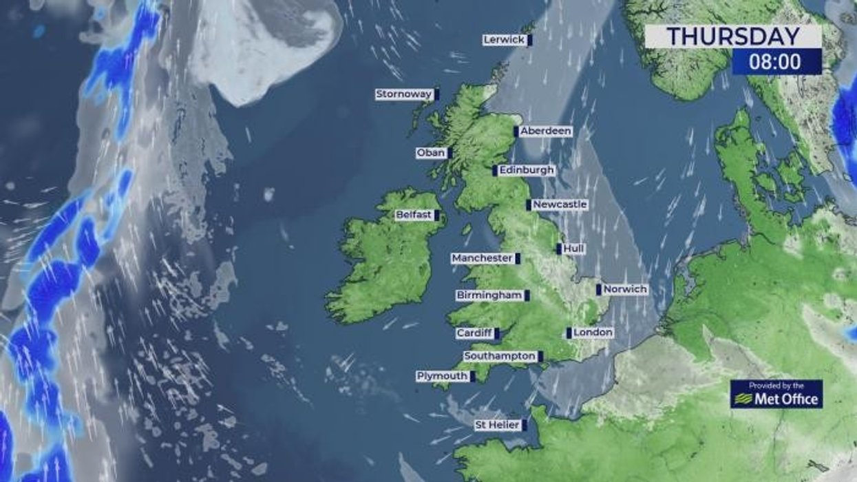
Met Office meteorologist Alex Deakin said: “On Thursday, high pressure is meandering to the north of the UK, and it means that winds are coming in around the high pressure, and this is going to draw in cooler air and moisture from the north sea.
“We are going to see those eastern areas plagued by mist and low cloud, and this ‘haar and fret’ is a fickle mistress, hard to pin down and one of the hardest things for meteorologists to forecast.
“It is one of the things that we will be keeping our eye on for how much this haar and fret affects the coast over the next few days, and eastern areas are going to be susceptible to that.”
Elsewhere, temperatures ahead of the weekend could top the mid-or even the high-20Cs.
LATEST DEVELOPMENTS:
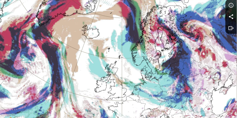
An ‘Omega block’ of high and low pressure straddling the UK will push the mercury above average for the time of year, particularly away from eastern coasts.
Deakin said: “We have a classic omega block, with a loop in the jet stream with low pressure flanking high pressure, and it is called an omega block because it looks like a Greek capital letter Omega.
“This omega block is sticking around, and it is really hard to shift this blocking pattern.
“There is a chunky area of high pressure sitting over the UK and this is likely to continue over the next few days.”
Britain’s up-and-down weather has shifted from extreme heat at the start of May, to thunderstorms and now back to heat.
As temperatures rise, meteorologists are keeping close eyes on a 'fickle' cloud of sea fog poised to smother the east coast
|ECMWF charts
Warm air coming in from the Bay of Biscay triggered a spate of eruptions after the weekend, although experts predict a calmer picture ahead.
However, the lack of rain after weeks of largely cloudless skies will push parts of the country towards drought.
Jim Dale, meteorologist for British Weather Services, and co-author of ‘Surviving Extreme Weather’, said: “After storms at the start of the week, we expect high pressure to bring a largely dry, settled and warm period through to the weekend.
“Temperatures could rise into the high-20Cs, and there is a chance that we could see the highest temperature of the year so far.
“This is the outlook for the next few days with high pressure in charge, although we are looking at a possible change again at the end of the month.”
Jason Nicholls, lead international forecaster for AccuWeather, said: “High pressure will stay in charge through the rest of the week, and this will lead to more sunshine and warm weather across the UK.”