


Heavy snowfall is expected to hit Britain ahead of Christmas as cold Artic winds hit the north of the country, the latest weather map suggests.
Forecasts show a period of "unsettled" conditions next week with northerly winds bringing some snowfall and ice.
Snow is expected to fall across northern England and Scotland from December 22 until Christmas eve.
Met Office forecasters suggest "a period of strong, potentially disruptive, winds" could push the wintry conditions up the country.
Met Office forecasters suggest 'a period of strong, potentially disruptive, winds' could push the wintry conditions up the country
WXCHARTS
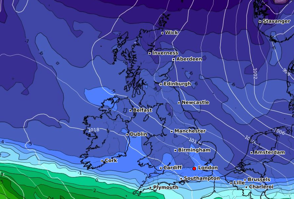
The colder interlude could be "very short-lived" and may not reach the far south.
A Met Office spokesperson said: "At the start of this period, a milder and more mobile Atlantic pattern is expected to quickly become established, bringing rainfall, especially for the north and northwest.
"In addition, a period of strong, potentially disruptive, winds is likely for at least central and northern parts of the country.
"Into the Christmas period, there is an increased chance of a colder interlude with northerly winds bringing some snowfall and ice, especially for the north."
LATEST DEVELOPMENTS:
- UK weather forecast: Britain braces for 'transition' as high pressure regime replaced by dominant unsettled wind storm
- UK cold weather: Britain could be set for White Christmas snowfall amid -10C Nordic winter blast
- Met Office issues 'danger to life' amber weather warning as heavy rainfall sparks landslides and flood risk
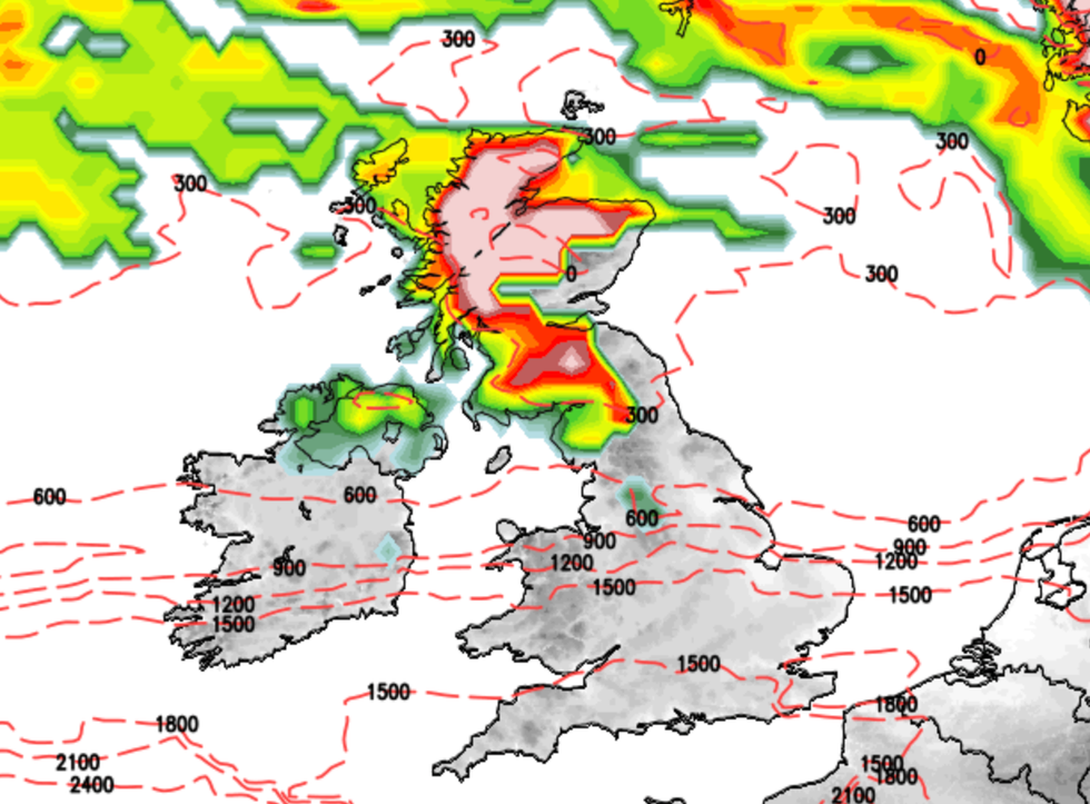
Weather maps show that up to 25cm of snow could fall in Scotland on December 24.
While the likeliness of a colder spell with snow and ice increases later in December and into the New Year, overall conditions are expected to remain mostly mild and wet.
The Met Office spokesperson added: "A mobile Atlantic pattern becomes more probable towards New Year's Eve, with the majority of cloud and rain likely across the west, and drier and brighter conditions more probable in the east."
It has snowed on Christmas Day in the UK 38 times since 1969, with the most recent sighting in 2010.
The colder interlude could be 'very short-lived' and may not reach the far south
Net weather
Temperatures could reach 10C during the night in some areas of central England, compared with an average night-time temperature of 1.4C in December in the UK.
Met Office chief forecaster Paul Gundersen said: "Later next week and the days running up to Christmas there are some suggestions that the jet stream will drift further south, allowing conditions to turn more widely unsettled.
"There is also a chance of winds switching to more of a northwesterly direction, allowing conditions to become a little colder, with a risk of some wintry showers developing in the north.
"At this stage, there is very little sign of any widespread or severe cold and wintry weather."
