


A -10C blast of Nordic winter from Lapland could bring the first widespread White Christmas for more than a decade.
Thermometers will start to fall over the weekend with predictions for one or two ‘notable wintry blasts’ in the run-up to the big day.
UK cold weather: Britain could be set for White Christmas snowfall amid -10C Nordic winter blast
|Netweather
While forecasts could change in the coming days, Christmas Day promises a ‘high prospect’ for snow.
Exacta Weather forecaster James Madden said: “There is now a very high probability that from the early to middle part of next week, the UK will start to see snow, although the finer details in terms of when and how far south the snow will reach will change between now and then.
“However, there are likely to be one or two notable wintry blasts from the start of Christmas week, and that means there is a higher prospect for snow on Christmas Day.
“Weather models currently show the northern half of the country in line for the heaviest snowfall, and while the chance of a true White Christmas will be greater in these regions, some subtle changes between now and then could deliver widespread snow on Christmas Day.”
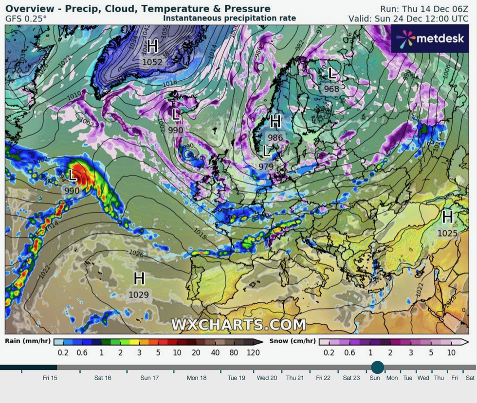
Weather models show a blast of winter sweeping across northern Scandinavia and Finland towards the UK in the run-up to Christmas.
LATEST DEVELOPMENTS: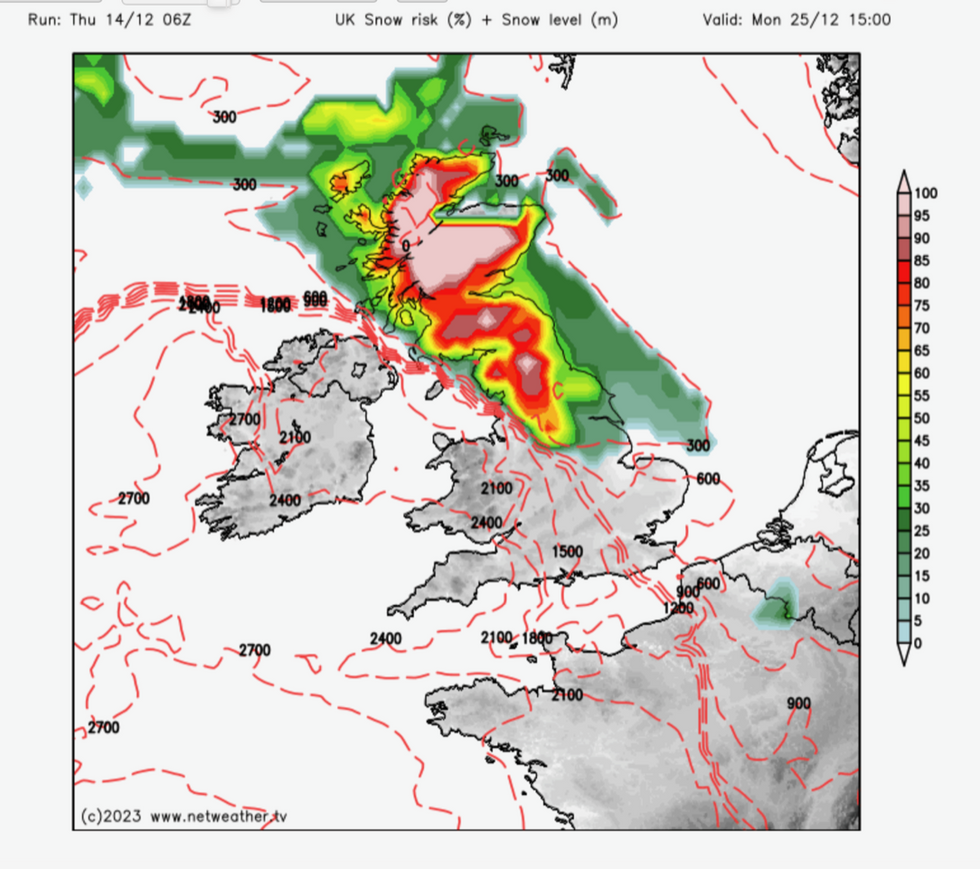
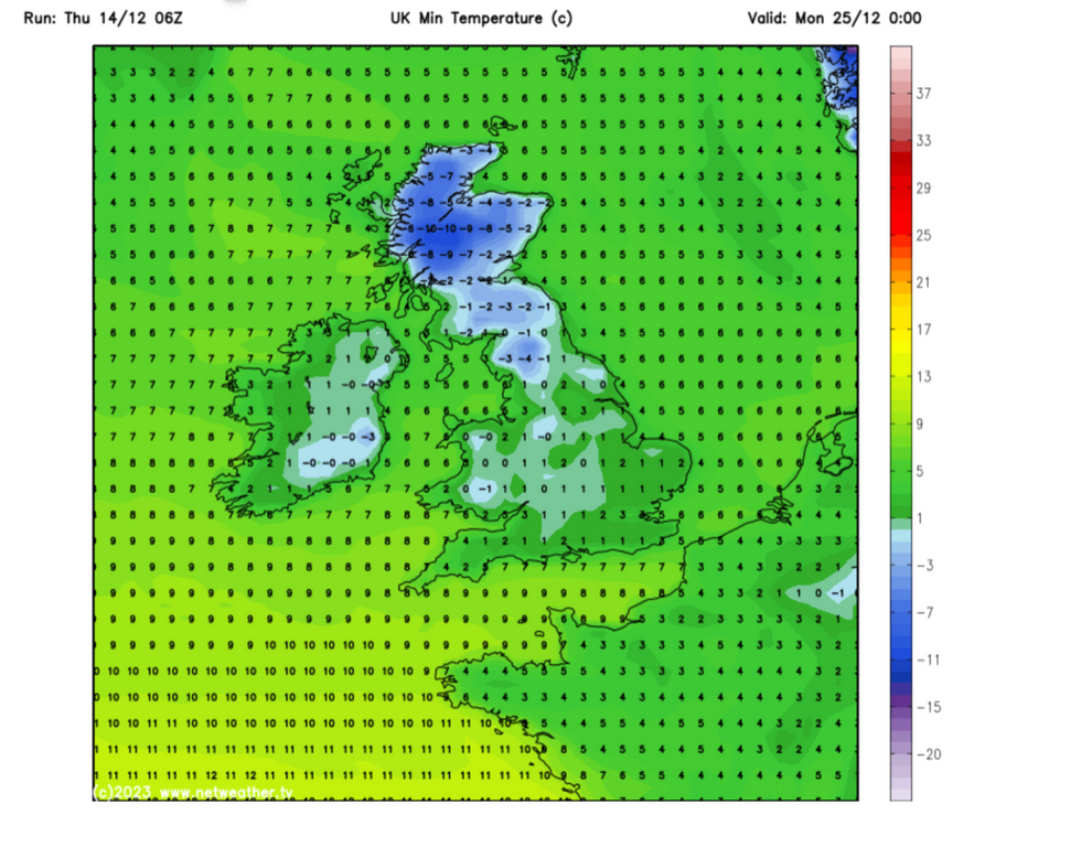
Snow predictions for Christmas Day
|Netweather
Low pressure close to Lapland will feed into high pressure to the north of Europe and a separate low close to Britain, driving the cold blast.
Temperatures could dip to -10C in Scotland and northern England while the mercury will hover close to zero elsewhere.
Snow charts show the highest risk to be above northern Britain, although flurries could reach further south through the festive period.
Widespread snowfall on December 25 would bring the first proper White Christmas since 2010, according to Government forecasters.
Last year was officially a White Christmas with snow recorded by the Met Office at nine per cent of stations across the UK.
However, Britain’s unpredictable weather could yet throw a spanner in the works, bringing Christmas rain instead of snow.
Nordic cold arrives
|Netweather
Jim Dale, social commentator and meteorologist for British Weather Services, said: “There now looks to be an Arctic flow heading towards the UK during the Christmas period.
“However, there could be a pushback before Christmas day leaving Scotland with the snow, so it still remains on a knife edge.
“If we get something in from the Atlantic, this would bring rain, but all it takes to make a White Christmas is one flake, so it is still all to play for.”
In the meantime, warmer air from the south this week will take the sting out of winter’s tail.
Winds falling over the Scottish mountains– the so-called Foehn effect–will further rocket temperatures, according to the Met Office.
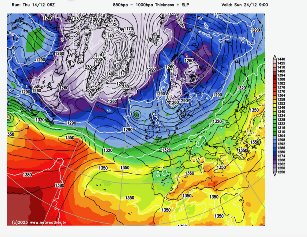
Low pressure feeds cold down from Lapland
|WC charts
Chief forecaster Paul Gundersen said: “High pressure will draw up warmer air from the southwest, and as we go into the weekend, we will see milder conditions by both day and by night for all.
“The Foehn effect could result in particularly mild conditions for areas such as east Scotland.
“Later next week and the days running up to Christmas there are some suggestions that the jet stream will drift further south, allowing conditions to turn more widely unsettled.
“There is also a chance of winds switching to more of a north-westerly direction, allowing conditions to become a little colder, with a risk of some wintry showers developing in the north.”