


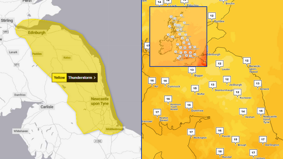
The Met Office has issued a yellow weather warning for thunderstorms across swathes of the country as a period of record-breaking hot weather finally comes to an end.
An area of Britain stretching from Edinburgh to Middlesbrough has been told to brace for storms from 11am on Wednesday, with travel disruption and flooding predicted to follow.
"Heavy showers and some thunderstorms are expected to develop across parts of southeast Scotland and northeast England on Wednesday, clearing east into the North Sea later in the afternoon," the Met Office says.
"Whilst some places may see relatively small amounts of rainfall, a few locations could see 15-20mm of rain in an hour or less leading to some impacts from surface water flooding."
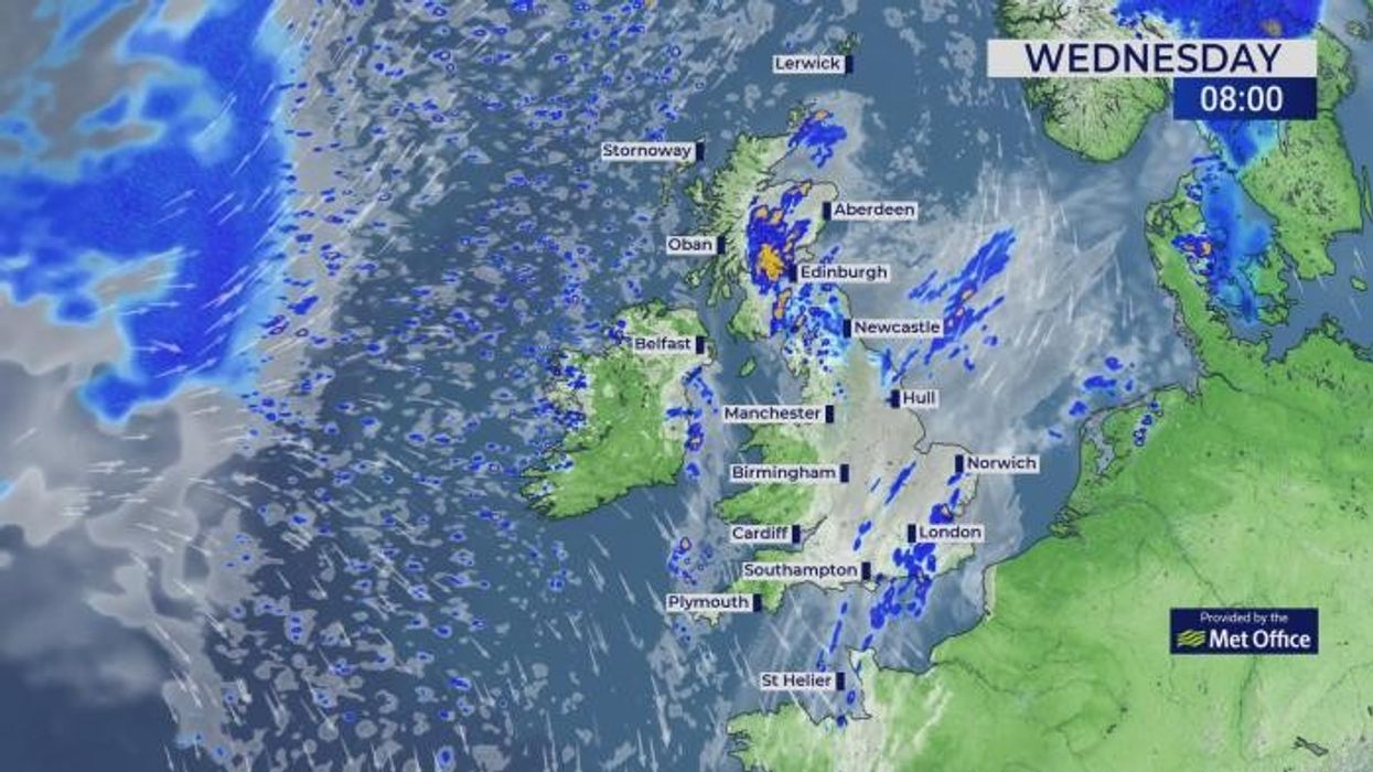
PICTURED: Scotland and the North East at 4pm on Wednesday. Temperatures are set to fall to 12C as thunderstorms are poised to sweep across into the North Sea
|MET OFFICE
The alert is slated to end at 6pm - but before then, meteorologists say that powercuts and public transports delays may be likely.
The full list of areas affected under the warning is:
Central, Tayside & Fife
- Falkirk;
- Fife.
North East England
- Darlington;
- Durham;
- Gateshead;
- Hartlepool;
- Middlesbrough;
- Newcastle upon Tyne;
- North Tyneside;
- Northumberland;
- Redcar and Cleveland;
- South Tyneside;
- Stockton-on-Tees;
- Sunderland.
Southwest Scotland, Lothian Borders
- East Lothian;
- Edinburgh;
- Midlothian;
- Scottish Borders;
- West Lothian.
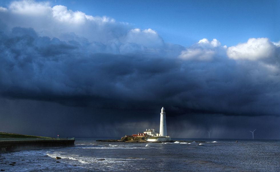
PICTURED: Dramatic clouds and rain over St Mary's lighthouse at Whitley Bay, Tyne and Wear
|PA
After the thunderstorms clear, the Met Office says that strong winds may develop on the western flank of the affected area, with gusts of around 40 mph possible for a short period of time.
The warning follows England's warmest June on record, while the UK as a whole has sweltered through its second-warmest since 1884.
The first month of summer saw two heatwaves, the first of which coming in during the third week of June.
The second then swept across southern and eastern England towards the end of the month.
LATEST WEATHER UPDATES FROM GB NEWS:
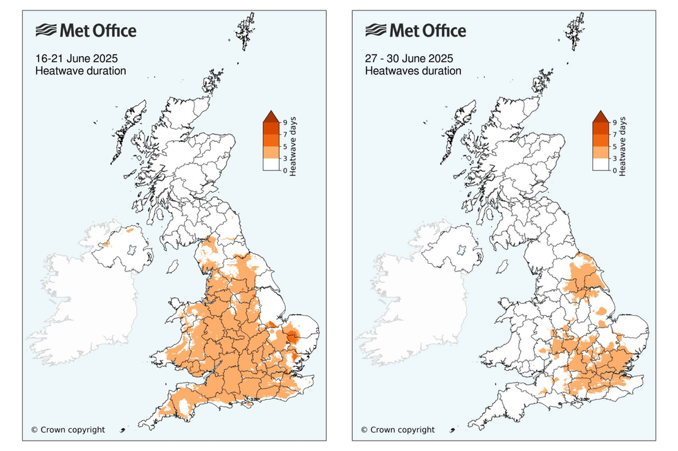
The Met Office has shared maps of both of June's heatwaves as forecasters look back on a record-breaking month
|MET OFFICE
Met Office Climate Scientist, Dr Amy Doherty, said: "While we've not conducted formal climate attribution studies into June 2025's two heatwaves, past studies have shown it is virtually certain that human influence has increased the occurrence and intensity of extreme heat events such as this.
"Numerous climate attribution studies have shown that human influence increased the chance that specific extreme heat events would occur, such as the summer of 2018 and July 2022.
"Our Met Office climate projections indicate that hot spells will become more frequent in our future climate, particularly over the southeast of the UK.
"Temperatures are projected to rise in all seasons, but the heat would be most intense in summer."