


Arctic winds and snow threaten a -10C Valentine’s Day Freeze as the mercury divebombs for the most romantic night of the year.
A bitter twist to Britain’s winter weather misery will trigger snow and widespread sub-zero temperatures.
A brief mild spell to the south mid-week will shiver into oblivion as the nation is swept by bitter Polar winds.
Britons will be wrapping up from Thursday, experts warn, with the Arctic assault to last into the weekend.
TRENDING
Stories
Videos
Your Say
Jim Dale, meteorologist for British Weather Services, said: “We are about to go into a cold period, from around Thursday or Friday and then through the weekend.
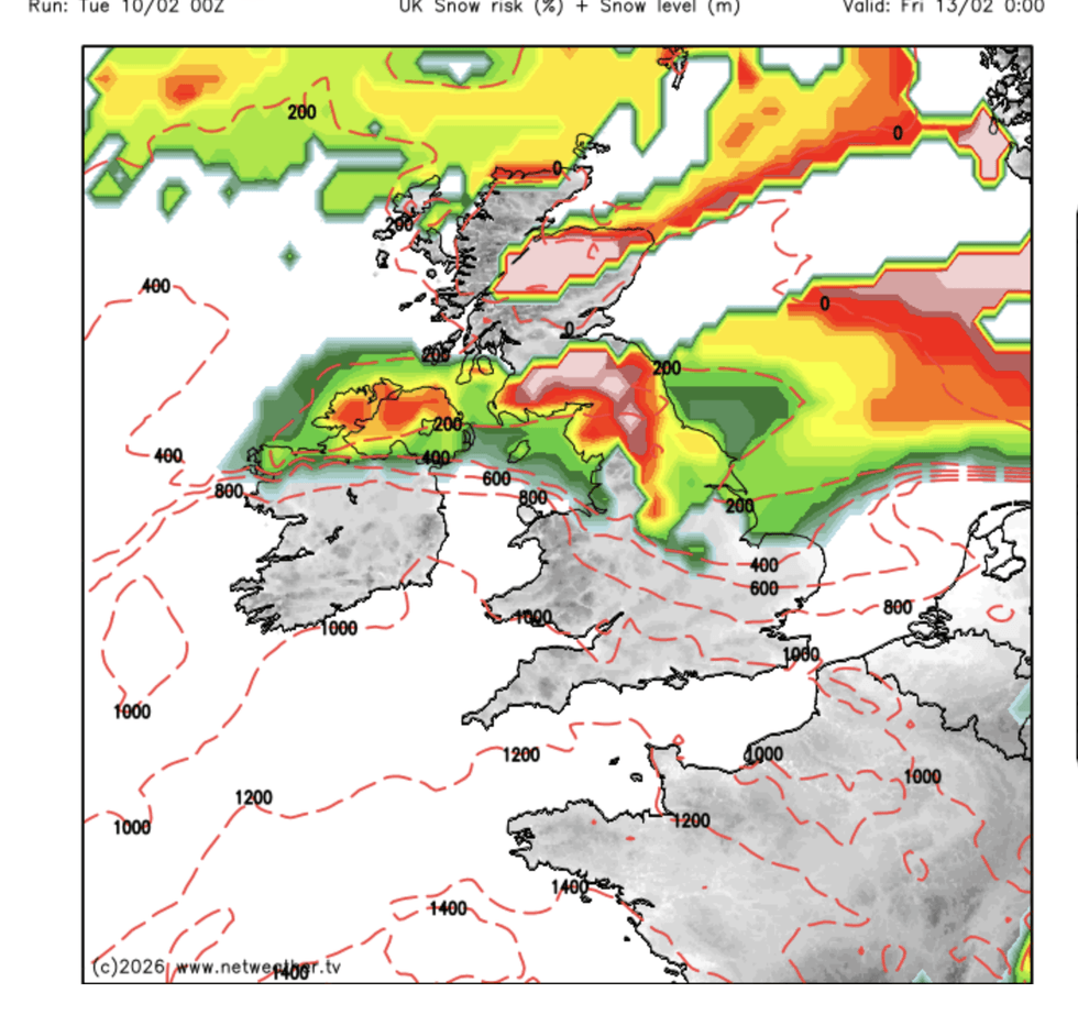
“With a significant windchill, it is going to feel very cold in parts and while the risk of snow will be greatest to the north, there will be a risk of something across the whole country.
“We are looking at temperatures of minus 10C in parts and feeling colder in the northerly winds.”
Arctic winds will cross Scotland and northern England over the next 24 hours, before the far south hits the freezer.
Britain will experience a -10C chill
|NETWEATHER
Heavy rain will turn to snow, with much of the country facing issues from ice and frost, Mr Dale warned.
He said: “There will be a demarcation in terms of the snow and extreme temperatures, with the north most at risk in terms of snow and drifting snow.
“All eyes are going to be on where and when the snow hits from Friday and then through the start of the weekend.
“It is going to feel quite miserable in the cold and with the wind.”
LATEST DEVELOPMENTS
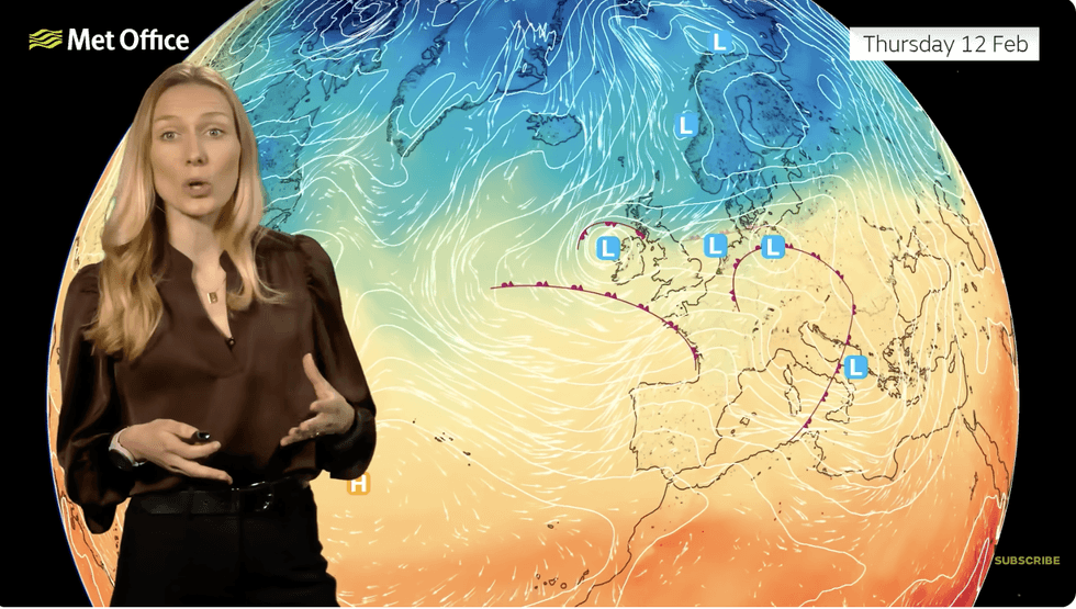
Annie Shuttleworth warns colder air will sink across the UK
|MET OFFICE
Persistent rain will meanwhile pelt parts of the country plagued with floods through the start of the year.
Eastern Scotland and parts of western England will stay in the crosshairs of Atlantic storms.
Met Office meteorologist Annie Shuttleworth said: “We will see rainfall totals build up this week as weather fronts move in, and eastern areas of Scotland will see the highest totals through this week, and with the ground saturated, we have warnings in force.
“We will see the pattern start to change through this week, and by the time we get to the end of the week we will start to see more northerly winds start to move in bringing colder air.
“And we will see some snow as it turns colder by the end of the week.”
A ‘blocking pattern’ of high pressure to the east stalling systems of low pressure arriving from the Atlantic will weaken ahead of the weekend, she said.
This will draw northerly winds into the country and allow lows to cross the UK instead of stall at the coast, she added.
She said: “Across the north on Wednesday, we are starting pull in colder air from parts of Scandinavia, and into Thursday, we will see that colder air sink further south.
“That is because the blocked pattern is starting to shift and low-pressure systems are moving further eastwards, something they have not been able to do for many months now.
“It means that a lot of the rain over the highest ground of Scotland will fall as snow, and we could see some snow to lower levels, with temperatures below average across the country.”