


A nationwide split threatens sub-zero temperatures and snow for parts, while temperatures elsewhere hit double figures.
Warring weather systems straddling Britain will keep Scotland and northern England in the freezer while the south gets a taste of spring.
Highs of 11C are possible in parts of the country after the weekend, although mild winds with carry the sting of heavy rain.
In a similar theme this winter, tussling meteorological models struggle to agree on the play out between high and low pressure dominating the weather.
TRENDING
Stories
Videos
Your Say
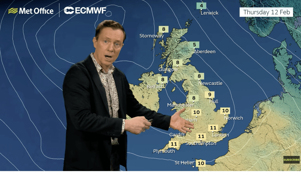
Met Office meteorologist Alex Deakin said: “High pressure is building further north, and that could draw in some colder air, but not all models agree, and if the low stays further west, it will keep things relatively mild.
“The Met Office model shows examples where the colder air wins, but there are more examples that keep the milder air to the south and colder air to the north and keep that battle going.
“We are likely to have further issues in the areas where the showers are most frequent.”
Britain’s weather is being kept in a state of confusion by the jet stream, plunging south at a hurtling superspeed.
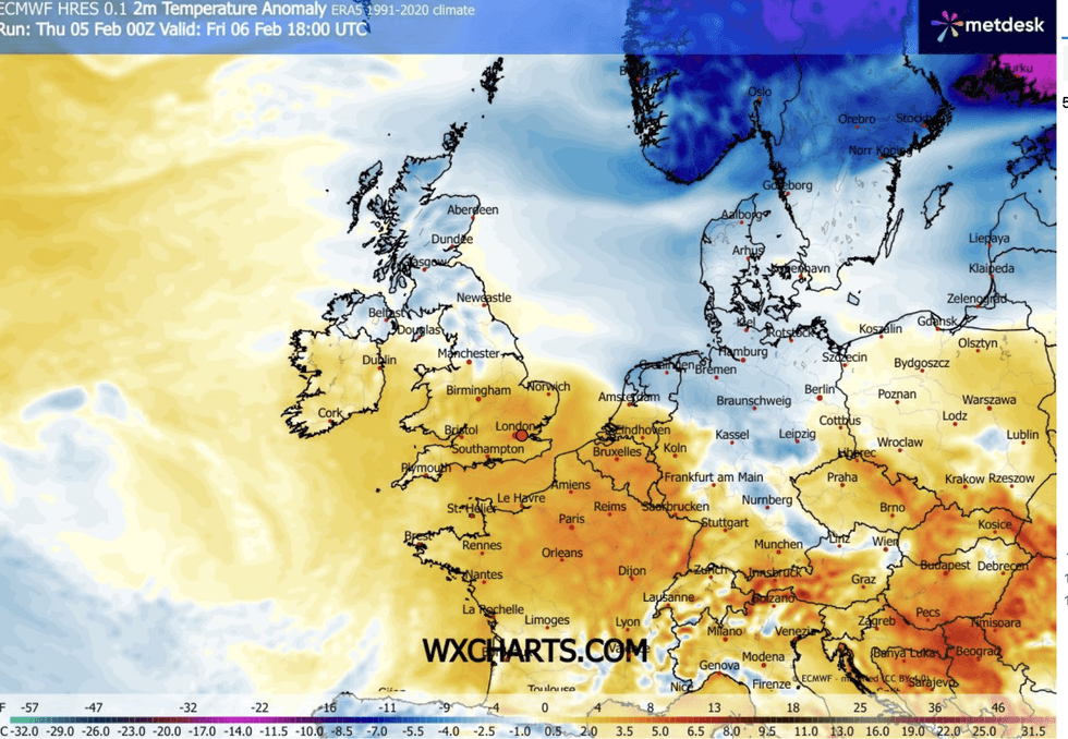
WX Charts shows a north-south split across the country
|WX CHARTS
Low pressure steered on 200mph jet winds is crashing into high pressure stalled to the north of Britain.
Southern and western regions will remain under a milder shower of downpours while chilly easterly winds hit the north.
Deakin said: “The jet stream is well to the south and very active, and that means that we’re on the colder side of the jet with low pressure systems continuing to feed us.
“Next week, the jet is still south shifted, but showing signs of changing a little bit of its orientation.
LATEST DEVELOPMENTS:
Alex Deakin describes north-south split
|MET OFFICE
“With more rain tracking northwards hitting the colder air, we will see snow over the hills of northern England and eastern Scotland.
“The next couple of days see further rain for most of us with a brisk easterly, southeasterly wind, with milder conditions in the south and a bit colder further north and rain falling as snow over the hills.”
Long-range forecasters warn the first taste of an easterly could harbour something with sharper teeth.
Changes in winds high above the Polar stratosphere, leading to a Sudden Stratospheric Warming (SSW), threaten a late February freeze.
An SSW was behind notable winter chills, including the notorious 2018 Beast from the East.
While nothing is expected on the scale of that February whiteout, Britain could be about to catch a late winter cold.
Jim Dale, meteorologist for British Weather Services and co-author of ‘Surviving Extreme Weather’, said: “There is little change in the current pattern of wet weather through the next week, although there could be something colder coming to parts after this weekend.
“But around mid-month, we are looking at a more significant event, and this would bring colder weather and the threat of more widespread snow.
“This is something we are keeping our eyes on.”
SSW events can affect the UK’s weather by pushing the polar airmass south into the northern hemisphere and disrupting the jet stream.
A Met Office spokesperson said: “The stratospheric sudden warming can sometimes cause the jet stream to ‘snake’ more, and this tends to create a large area of blocking high pressure.
“Typically, this will form over the North Atlantic and Scandinavia.
“This means that northern Europe, including the UK is likely to get a long spell of dry, cold weather, whereas southern Europe will tend to be more mild, wet and windy.”