


A storm stalled off Britain’s west coast threatens a turbulent weekend of gale-driven downpours and snow.
The deep cyclonic low nudging in on the jet stream will hit swathes of the country with more rain while wintry showers blanket the north.
Temperatures across the south will nudge briefly, although to the north, bitter winds will bring harsh morning frosts.
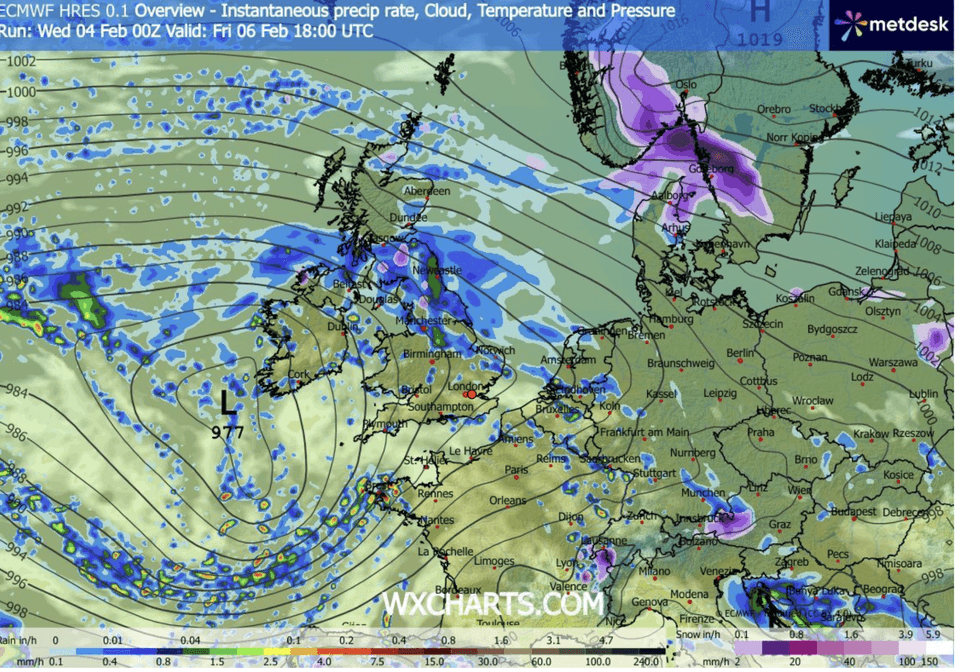
Jim Dale, meteorologist for British Weather Services, said: “Ahead of the weekend, there is a low-pressure system coming in from the west, and this is going to bring another bout of wet and potentially windy weather, particularly across regions that have already seen a lot of rain so far this month.
TRENDING
Stories
Videos
Your Say
“This will keep the flood risk high in these areas, which are very wet, with any further accumulating rain likely to cause disruption.
“The theme of unsettled, wet weather is going to continue through the rest of the week before there are signs of change next week.”
A switch in weather patterns after Sunday could put a hold on the rain but bring something colder, he warned.
High pressure building to the north would block the Atlantic while guiding in northerly and northeasterly winds.
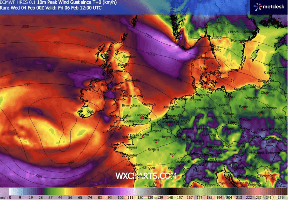
The deep cyclonic low nudging in on the jet stream will hit swathes of the UK
|WXCHARTS
Cold weather next week may be a taste of things to come, with mid-month threatening a more ‘significant’ freeze.
Mr Dale said: “There is the chance that next week we will start to see an easterly or a more northeasterly flow, and this will bring the risk of much colder conditions.
“Temperatures to the north could drop to minus 5C overnight, with snow over high ground and the risk of morning frosts.
“But it is from mid-month that we are looking at something more significant in terms of a return to winter.”
LATEST DEVELOPMENTS
The jet is being fuelled by a major winter freeze hitting the United States
|WXCHARTS
Britain’s topsy-turvy weather has, for the past month, been at the mercy of a powerful jet stream to the south of the country.
The jet is being fuelled by a major winter freeze hitting the United States, powering up high-altitude winds on its journey across the Atlantic.
Low-pressure storm systems off the UK coast use the jet as a conveyor belt and energy source, as was seen with Goretti, Ingrid and Chandra.
Southern Britain will stay in the firing line for stormy outbreaks through the week, with Britons heading out this weekend warned to expect more bad weather.
Met Office meteorologist Clare Nasir said: “The jet stream is to the south of the UK, so the low pressures are developing on the northern side of the jet towards southern and southwestern side of the country.
“That means that with the temperature contrast, spells of rain will swirl around the centre of that low with some strong winds from time to time into Friday and the weekend.
“There is a chance that we will see a little bit of rain moving across Pennine districts, and this could turn wintry in places.
“Towards the south, the rain will continue and the winds will pick up strength along the south coast.”
Met Office meteorologist Alex Deakin added: “We have a repeating weather pattern, with low-pressure systems continuing to try to get into the southwest.”
Our Standards: The GB News Editorial Charter