


A surge of warmth from the south will push temperatures in parts into double figures before the mercury nosedives.
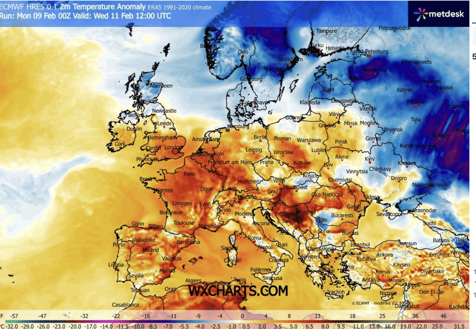
Southern Britain could see highs of 12C over the next 24 hours, well above average for the time of year.
But forecasters warn the mild blip will give way at the end of the week to a bitter thrust from the Arctic.
Bitter winds off the North Sea will plunge Scotland and northern England back into winter as the region braces for frost, ice and snow.
TRENDING
Stories
Videos
Your Say
Met Office meteorologist Tom Morgan said: “Tuesday will be a mild day in the south with winds coming in from a south-westerly direction, and we could even see temperatures of 12C or 13C in any brightness which is well above average for the time of year, but only 6C or 7C across northern Scotland.
“It will start to feel colder in the wind coming off the North Sea, and another batch of rain pushes across the southwest of England into Wales and central southern England.
“Low pressure will dominate through the week with mild air in it, but towards the weekend winds switch to a northerly direction, bringing colder air, and that will bring a return to frosts, some icy patches and potentially some snow showers in places.”
Rain will drench swathes of Britain through the rest of the week as flooding grips regions saturated from the January deluge.
Rain will drench parts of Britain
|WX CHARTS
A ‘blocking pattern’ of high pressure to the east will weaken to allow stormy lows to sweep the country with bands of heavy downpours.
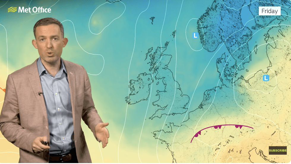
But a change in meteorological set up ahead of the weekend will open the gates to northerly winds.
Temperatures will nosedive, first in the north before the rest of the UK shivers by the weekend.
Jim Dale, meteorologist for British Weather Services and co-author of ‘Surviving Extreme Weather’, said: “At the moment we are being controlled by low pressure in the Atlantic, bringing persistent, showery bands of rain, but there is a change on the way from the end of the week.
LATEST DEVELOPMENTS
The cold snap will be driven in part by a ‘dislocation of the Polar Vortex
|MET OFFICE
“Northern regions will turn colder first, and here will be the greatest risk of frost, ice and snow over high ground.
“But with this cold snap, we are not ruling out the risk of snow further south, so this is something we are going to have to keep an eye on.”
The cold snap will be driven in part by a "dislocation" of the Polar Vortex, he explained, drawing cold winds down from the Arctic.
The churning body of cold air over the North Pole will slide southwards, plunging temperatures across Scandinavia, Europe and the UK, he warned.
He said: “Thursday will see the first intrusion of Arctic air, as we see the first signs of the Polar Vortex dislocation, first into Scandinavia and then into Europe.
“From Friday, the cold air will be dominant, with much of the country in a northerly flow.
“It is going to be cold enough everywhere for something in the way of frost or wintry showers.”