


An "energised jet stream" will smash Britain with a barrage of thunder, rain and hail as the nation is put back on storm alert.
After a motionless fortnight, the UK weather is about to turn violent with the arrival of a potentially named storm.
A cyclonic low-pressure system will barrel in mid-week, prompting warnings for possible widespread disruption.
Although no name has been issued by the Met Office, the second storm of the season would be "Bram".
TRENDING
Stories
Videos
Your Say
Jim Dale, meteorologist for British Weather Services, said: “We are now looking at a complete change from what we have seen at the start of the month, with potentially stormy conditions arriving from Wednesday.“
This is something that we are keeping an eye on as these things can turn very volatile quickly, and although there is no named storm, this can change.
“This system will bring strong winds, heavy rain, thunder and hail, and there is the possibility of some disruption.
“As always at this stage, this is now a watching brief, but this is going to signal a change to more volatile autumnal weather.”
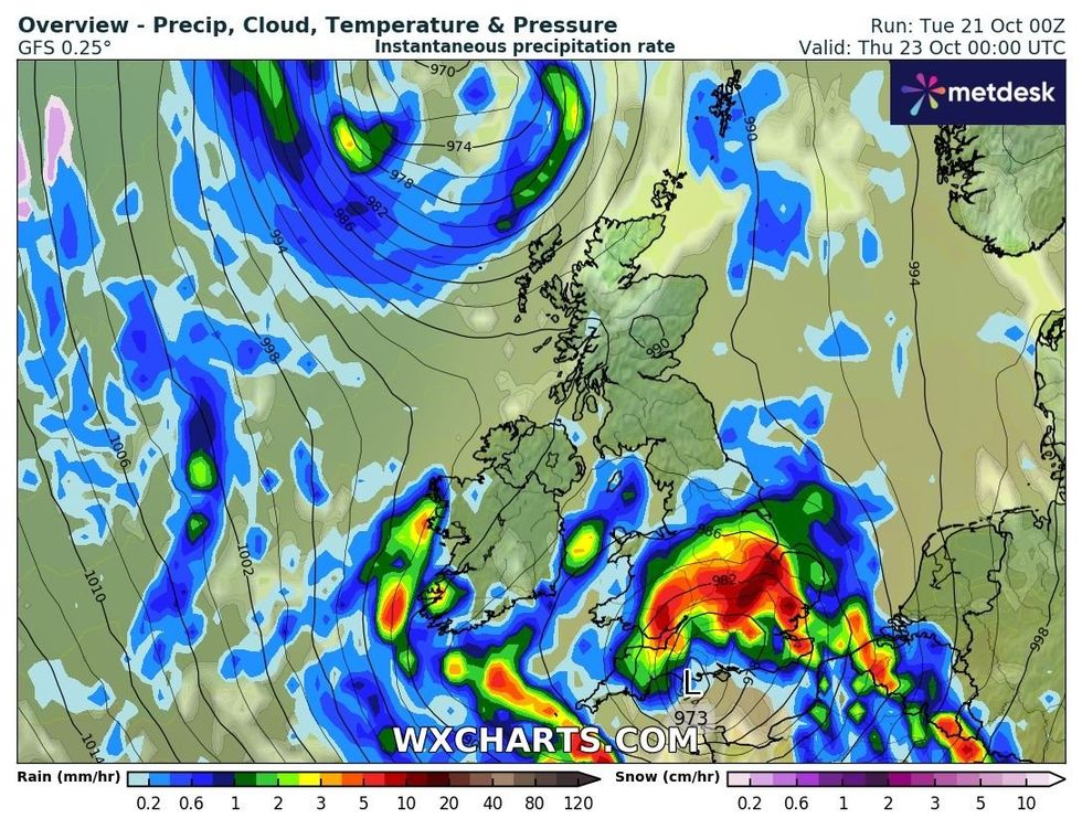
The Met Office is forecasting downpours on Thursday
|WXCHARTS
A dome of high pressure trapping gloomy mist and fog over the country will shift to make way for a westerly weather pattern.
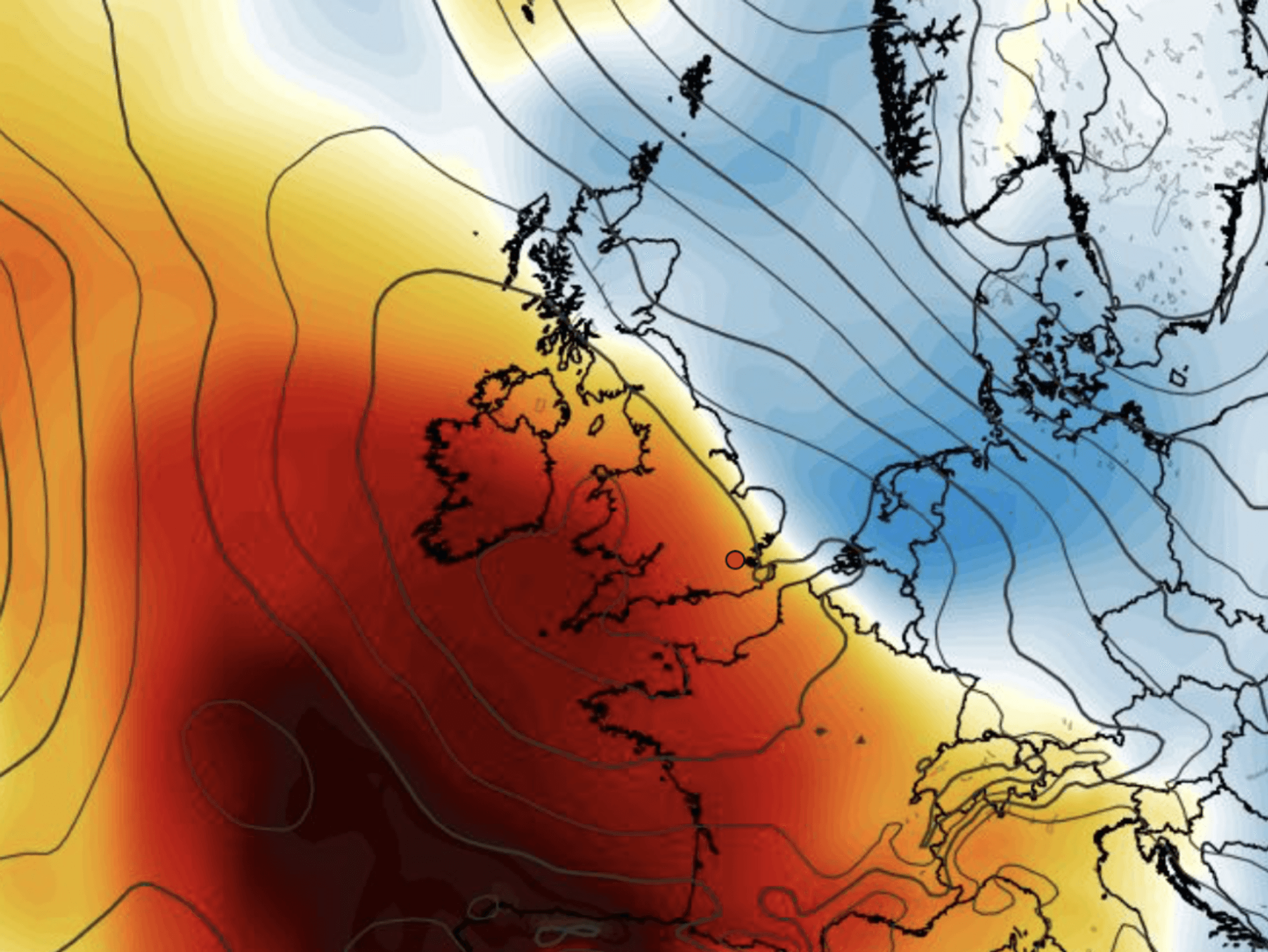
The jet stream, fired up by a powerful tropical typhoon, will charge across the Atlantic into Britain.
Typhoon Halong, which hit the Pacific and Alaska last week, has turned the jet into a frenzied storm conveyor belt.
Met Office meteorologist Alex Deakin said: “We have had a static weather pattern for the past few days, but we are now going to see things turn much more changeable and much more unsettled, and there will be bands of rain and some fairly gusty winds.
LATEST DEVELOPMENTS
The weather is changing due to an energised jet stream
|PA
“The jet stream is highly energised, and it is being shifted by a pulse from the far northwest, and that energy ripples through right across the Atlantic, and that is why the jet stream for us is also changing.
“It is strong enough to push low pressure in, and there are further low-pressure systems waiting in the wings.”
Temperatures through the coming days will hover around average – in the mid-teens for southern Britain and slightly lower further north.
However, the next whammy will be when northerly winds arrive at the end of the week, ushering in a cold snap.
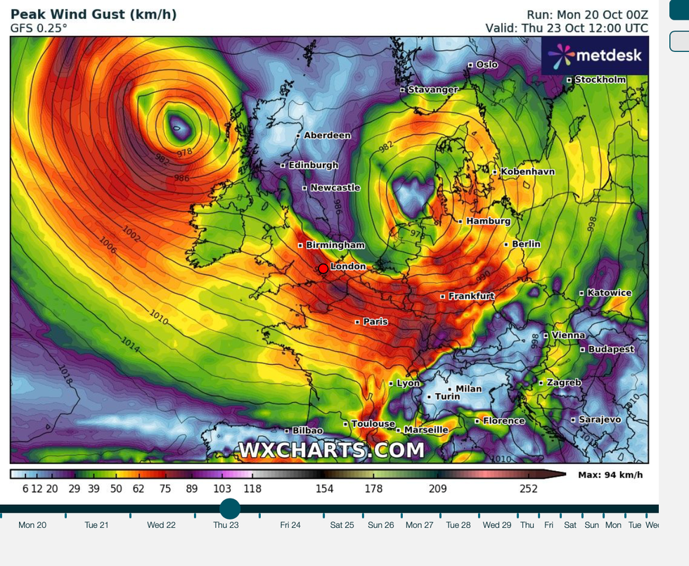
Maximum wind gusts will pick up over the coming days
|WXCHARTS
Scotland and the far north could dip to freezing or below as the south struggles to top single figures.
Met Office meteorologist Kathryn Chalk said: “Temperatures are still holding up but in clear spells, they will fall away, and it will feel a little bit chilly with some mist and fog.
“As we go through the week, it looks like there will be heavier spells of rain on Wednesday evening and into Thursday, and then something a little bit colder as we head into the weekend.
”As brutal winds batter western coasts, torrential rainfall threatens flooding in parts of the country.
Mr Dale, co-author of ‘Surviving Extreme Weather’, said: “Heavy downpours in parts will fall on dry ground after very little rain for the past few weeks, and that will bring the risk of flooding to parts of the country.”