


A double ‘cyclonic’ hit will smash Britain’s anticyclonic gloom with a torrent of rain as autumn blows in with a bang.
Almost a fortnight of grey, still skies is about to give way to a battering from a duo of Atlantic storms.
Downpours will hit widely at the start of next week before another drenching next weekend, experts warn.
A huge high-pressure dome wedged over the UK will finally shift allowing autumn in with an overdue deluge.
TRENDING
Stories
Videos
Your Say
Met Office meteorologist Aidan McGivern said: “On Saturday, the high pressure is starting to migrate slowly to the east, and weather fronts are starting to appear.
“On, Sunday a low in the Atlantic begins to break through from the west, and there is another low hot on the heels of that one.
“There will be outbreaks of rain on Monday and Tuesday with a respite before this next low turns up.
“We are seeing some deeper lows on some of the model runs, so this could be a larger and deeper feature, and it is more likely to push to the northwest of the UK.”
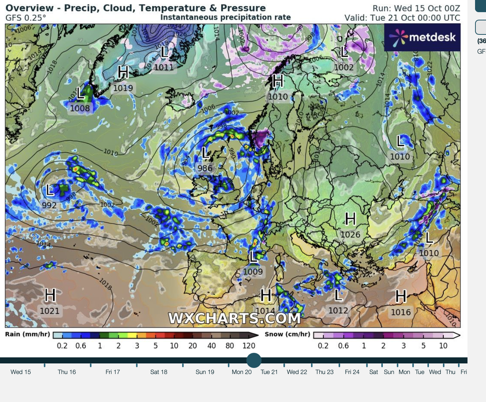
Two cyclonic lows en route to Britain
|WX CHARTS
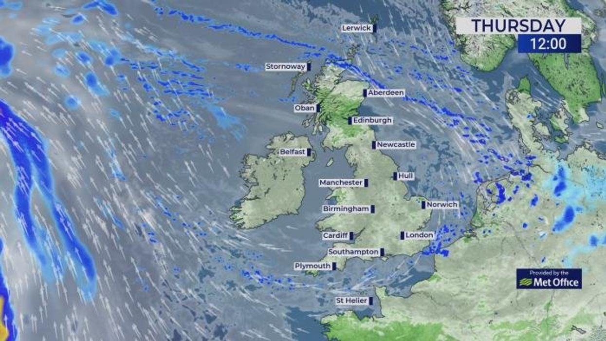
Rain will sweep in from the Atlantic as high pressure, which has dominated the weather, gives way to ‘cyclonic’ low pressure.
Two storm systems are lined up to give the UK a shake next week as weather patterns drastically shift.
Western and northern regions are braced for ‘a lot of wet weather’ with most areas likely to see showers.
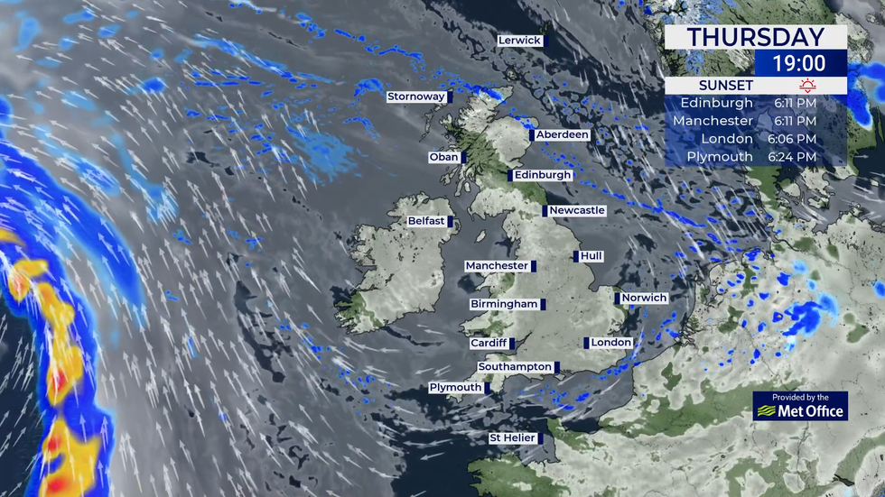
The break in the weather will start this weekend when the gloom lifts to give some sunny relief to parts.
LATEST DEVELOPMENTS
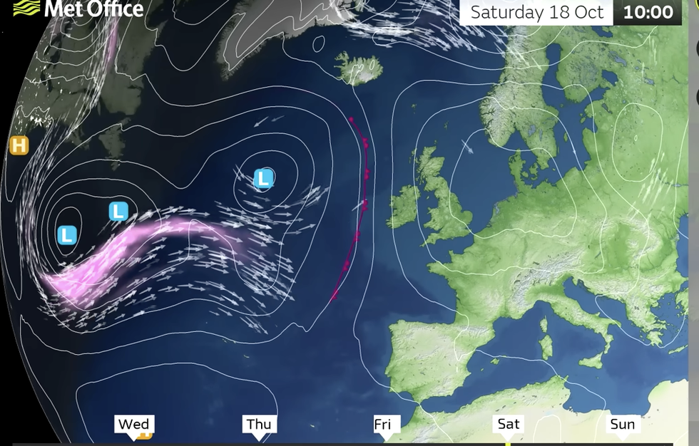
Low pressure storms in from the west
|MET OFFICE
Mr McGivern said: “There will be some more sunshine, and this will lift the anticyclonic gloom.
“Although there is a lot to play for, the theme for next week is low-pressure dominated, and there is a lot of uncertainty about what type of low.
“There could be a lot of wet weather with the low in a slightly different position, so the general theme is low-pressure dominated and spells of rain, which will move slowly across the UK, most likely affecting western areas, but all areas are likely to see spells of rain.”
Heavy and persistent rain on regions parched after the dry spell could bring the risk of flooding.
Two storm systems are lined up to give the UK a shake next week
|MET OFFICE
Rather than speeding across the country, regions of low pressure will move slowly as they dump their load.
Jim Dale, meteorologist for British Weather Services and co-author of ‘Surviving Extreme Weather’, said: “There is going to be a change around Sunday or Monday, with low pressure beginning to take charge and high pressure breaking down.
“The heaviest and most persistent rain will be to the southwest and the south, and the amount of rain will be something to watch as it will bring a risk of localised flooding.
“We could see a good amount of rain in some parts, which after this long dry period will bring a significant change to the outlook.”