


Britain’s weather is about to get a brutal jolt from a tropical typhoon smashing Pacific coasts with hurricane-force winds.
Typhoon Halong, currently 5,000 miles west of the UK, threatens Alaska with destructive gales and a devastating storm surge.
So powerful is the storm that it will shudder the jet stream, hurtling it across the Atlantic into Europe.
In its path is a region of stubborn high pressure that for the past week has wedged a gloomy calm over Britain.
This will shift, driving a ‘big switch in the weather’ and opening the Atlantic gates to torrential rain and gales.
Met Office meteorologist Alex Deakin said: “We are going to see a dramatic change which could have something to do with a typhoon.
“We are going to see a big switch in the weather from the largely dry weather to something much wetter and much windier.
A big area of high pressure has been with us for a number of days and it is staying with us for the rest of this week.
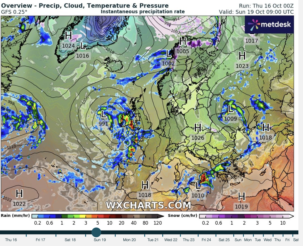
A big area of high pressure has been with us for a number of days
|WX CHARTS
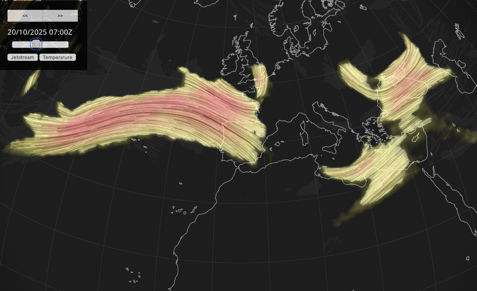
A jet stream is heading to the UK
|NETWEATHER
“We change high pressure with low pressure, and the jet is in a different position, and the high pressure is ousted into Europe.”
A wavy jet stream looping up and over the UK has for the past fortnight allowed high pressure to wedge fast.
This has brought dull, windless skies and an ‘anticyclonic gloom’ of trapped cloud and mist.
The grey pattern will hold into the start of the weekend before the knock-on ‘ripples’ of Halong’s remnants ‘ripples’ hit Britain.
LATEST DEVELOPMENTS
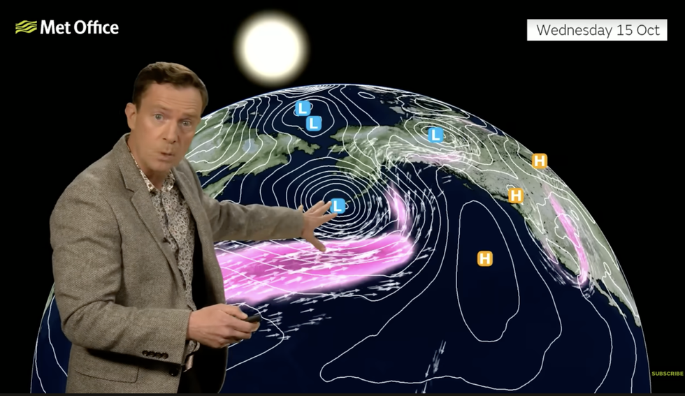
High pressure has been wedged over the UK
|MET OFFICE
Deakin said: “Halong has become an area of low pressure with a lot of energy pushing the jet stream into North America, and by Sunday, and the remnants of that typhoon will become quite a powerful area of low pressure in Alaska.
“It is energising the jet stream and will have downstream effects that eventually ripple across the Atlantic and changing the jet stream for us and waiting in the wings are further low-pressure systems to come in next week.
“So, we are going to see things much more unsettled next week, with plenty of showers and gusty winds.”
With low pressure will come trailing weather fronts, sweeping the UK with bouts of wind and rain.
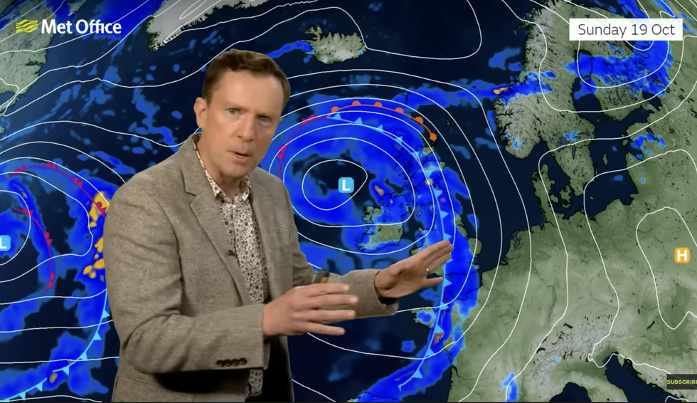
Britons can expect a torrent of downpours in some regions
|MET OFFICE
These fronts have been battered away by the stubborn high-pressure dome bringing an unusually dry start to autumn.
Western regions over the coming days are warned a sharp U-turn will dump a torrent of downpours.
Jim Dale, meteorologist for British weather Services and co-author of ‘Surviving Extreme Weather’, said: “The breakdown of the high will come this weekend, and this will allow fronts in from the Atlantic and a change in the weather.
“Between Sunday and Monday, these will come in from the west, and it is western and northern regions that will bear the brunt of the unsettled change.
“However, many places could see rain through the end of the month, and in places this could be heavy enough to bring the risk of localised flooding.”