


An early spring ‘heatwave’ could be about to kick-start an unusually warm run into summer.
Higher than average ground and sea temperatures after the mild winter will force up temperatures through until May.
A dominant late-winter theme of low pressure driving the wind and rain is expected to give way to high pressure–the vital ingredient for spring and summer heat.
A Sudden Stratospheric Warming (SSW) event feared to bring a cold plunge has instead swerved Britain to deliver late snow over the United States.
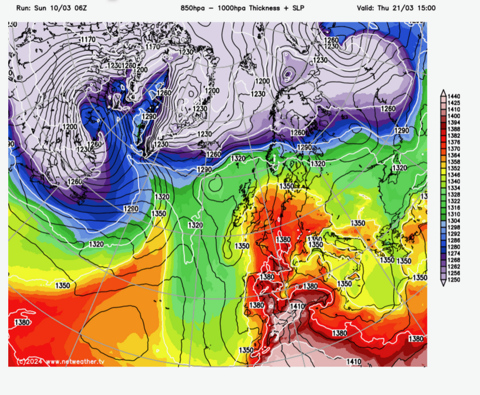
Models favour warmer conditions later this month
|Netweather
Weather forecasting models are pushing temperatures for late March and early April several degrees above average.
Jim Dale, meteorologist for British Weather Services, said: “The potential is now there for a very mild spring, and I would expect to see some decent temperatures, potentially 19C or 20C before the end of March.
“But it is really during April that the warmer weather is likely to set in, and for this time of year we could even be looking at ‘heatwave’ conditions.”
Britain’s weather throughout the year is driven by the position and strength of the jet stream and the influence of low and high pressure.
WEATHER LATEST:
Temperatures to soar into the high teens
|Netweather
A strong jet encourages low-pressure ‘cyclonic’ systems to barrel in from the Atlantic, resulting in wet and windy weather.
Conversely, high pressure fends off these lows, bringing clear skies and settled conditions.
In winter, this allows heat to radiate from the ground rapidly leading to very cold temperatures and harsh morning frosts.
But in the spring and summer, as the Earth tilts towards the sun, high pressure builds blue skies and warm weather.
After the prolonged unsettled end to winter, a ‘balancing effect’ could allow high pressure to dominate through the coming weeks.
Weather models indeed show such ‘anticyclonic’ atmospheric conditions building later this month.
Mr Dale said: “We have seen hardly any high pressure over winter, and this is now long overdue.
“I am a believer of a balancing effect in the weather, so I would now be expecting to see high-pressure build as we go through spring.
“This would mean milder temperatures into summer.”
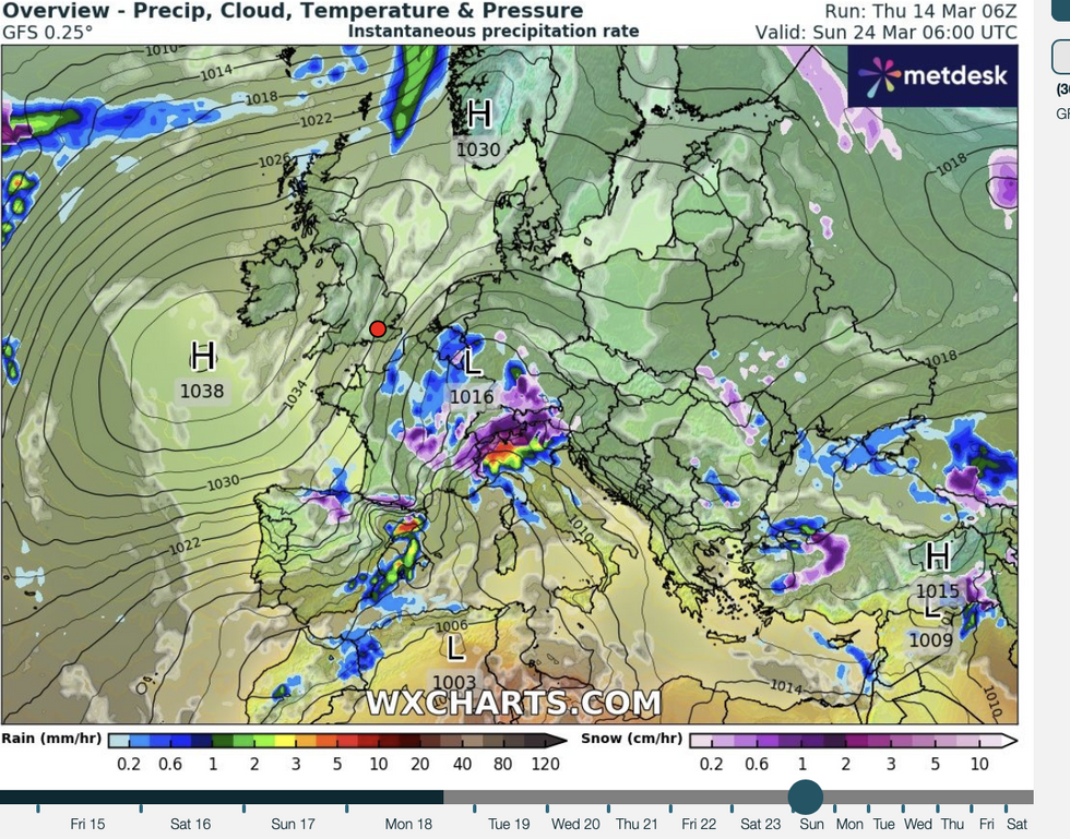
High pressure forecast to loom over UK
|WX charts
Higher than normal sea and ground temperatures will also contribute to the warm weather, he added.
Figures show temperatures around the UK coast to be slightly higher compared to the previous five years.
The Brighton coast is around 9.2C, compared to 8.1C in March last year, and 8.8C the year before.
Plymouth is at 10.2C compared to 9.5C last year, while Southend-on-Sea is at 7.8C up around a degree on last March.
The warmer predictions thwart some forecasts of a cold snap driven by an SSW warming of the atmosphere.
SSW results from a change in direction of winds in the stratosphere which causes air to fall, and warm, pushing Polar air out in the Northern Hemisphere as with the 2018 Beast from the East.
However, SSW is not guaranteed to bring cold weather, and forecasters agree Britain has dodged a late cold plunge.
The Met Office’s three-month outlook predicts slightly higher-than-normal chance of above-average temperatures into May with a lower risk of cooler conditions.
The exception would be Scotland and the north which is more likely to see snow later in the year.
High pressure will predominate across northern regions through the next month as the south catches the tail end of the unsettled winter, according to the Met Office.
A spokesman said: “During the end of March and into the start of April, higher-than-average pressure is likely to the north of the UK.
“This will push the focus of the unsettled weather further south than usual, and the highest rainfall is most likely to be in the south if the country.
“Temperatures are likely to be near average or slightly above overall, with any cooler interludes most likely in the north.”