
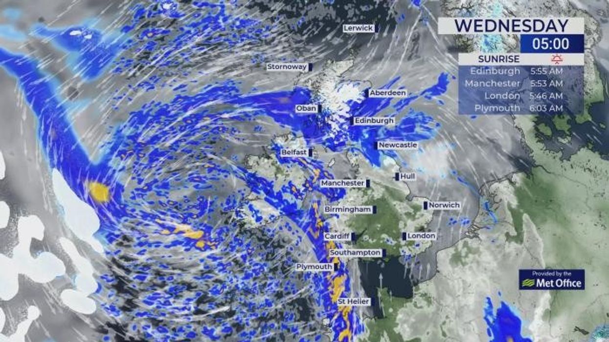


The Met Office has warned that the UK is set to see some snow tonight and tomorrow as temperatures are set to plummet into minus figures.
Hill snow is also likely to continue for parts of Scotland into the early hours of Wednesday morning as the Met Office is warning of unsettled weather going into Easter weekend.
Winds will increase for many from Wednesday and into Thursday, with low pressure to the west also bringing some blustery showers for many.
On Wednesday, most areas will see rain or showers during the day, with the heaviest rain likely in the southwest, and the far north of the UK.
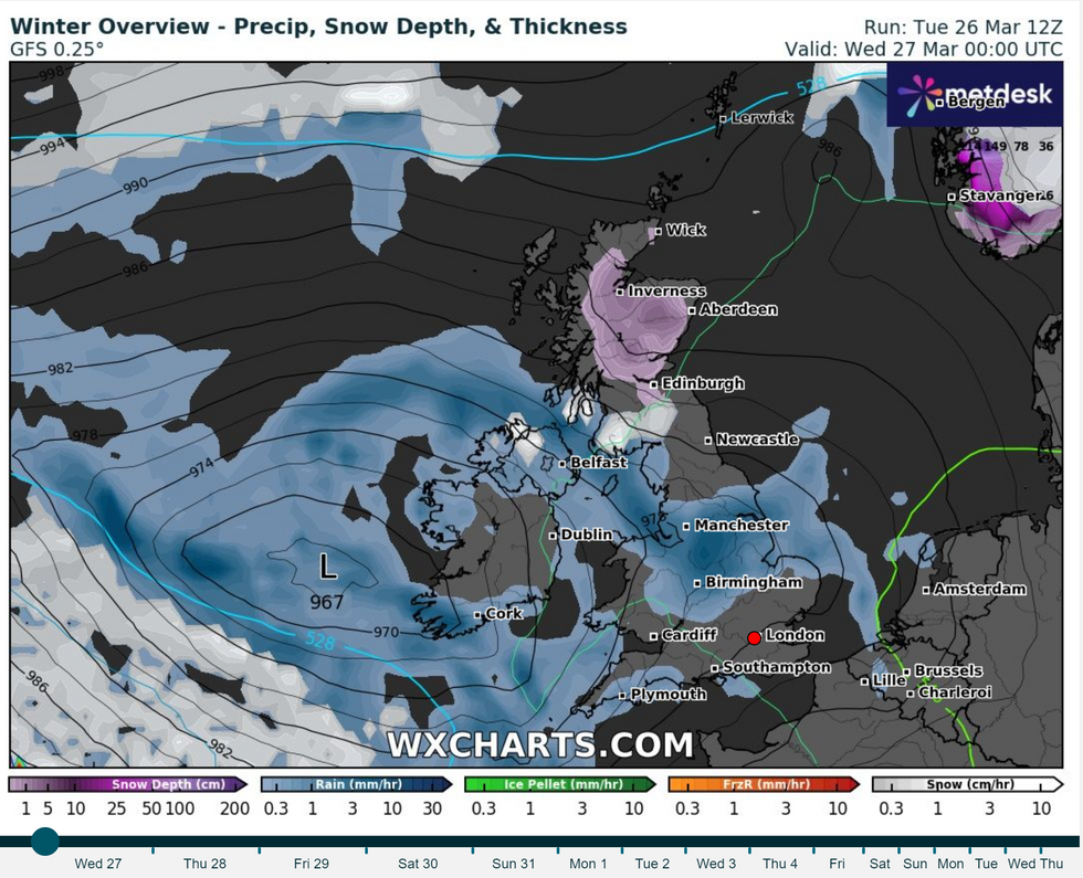
Met Office warns rain could turn to SNOW tonight and tomorrow
|Met Office
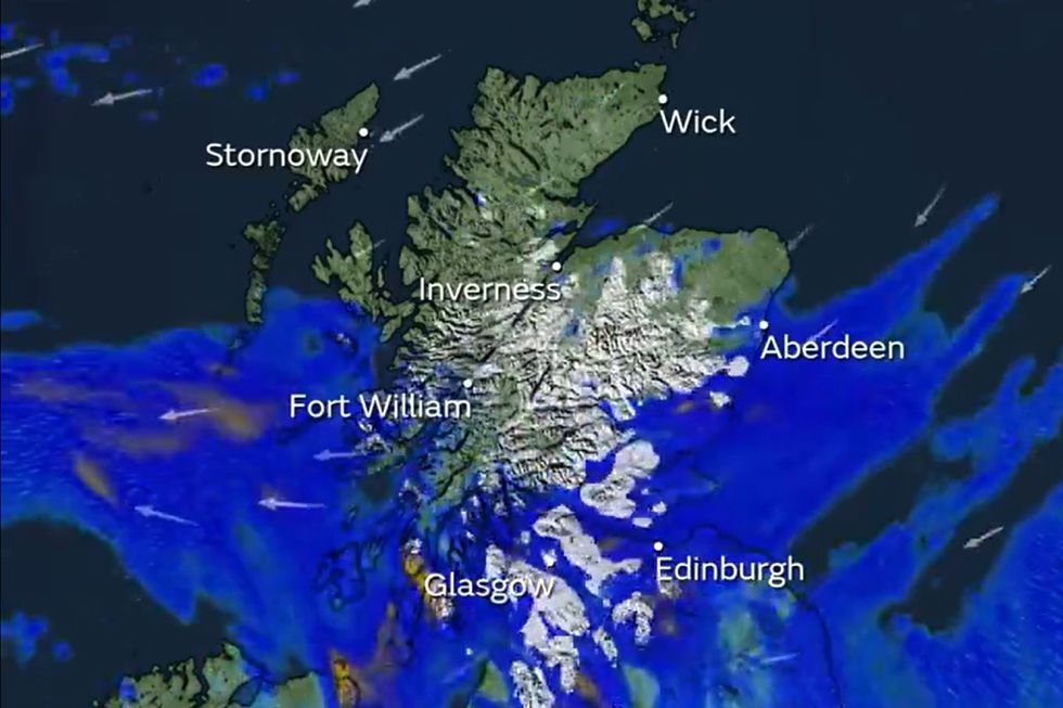
Some snow is expected around the UK in the Scottish hills
|WXCharts.com
According to a social media update from Britain's national weather service: "Rain will turn to snow at times across the hills of Scotland tonight and into tomorrow.
"This may lead to some tricky travelling conditions across the highest routes, so allow some extra time for your journeys."
However, a spokesperson for the Met Office has said that snow is not unusual for this time of year.
Met Office deputy chief meteorologist Helen Caughey said: "It’s another very unsettled week for much of the UK, with heavy, blustery showers, longer spells of rain and also some strong winds."
"In terms of hazards in the current forecast, we’re continuing to keep an eye on some of the expected rainfall totals as they build up through the week, with some places, including Northern Ireland, still quite sensitive to rainfall amounts due to the wet winter many have experienced.
"We will also need to monitor the winds with the potential for gales to develop around some coastal areas of the north at first, then later for some south and southwestern areas, especially as these may coincide with some high tides."
LATEST DEVELOPMENTS:
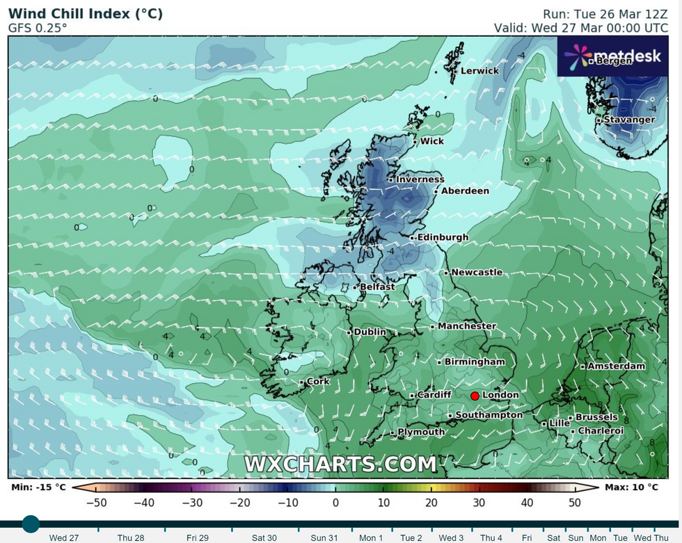
The wind chill for tonight across the UK
|WXCharts.com
Looking ahead to Easter weekend, Good Friday is likely to see another day of blustery showers, with these being more frequent in the south and west.
Easter Saturday sees a continuation of this showery theme in southern and western areas, though there is an increasing chance of brighter spells further north and east.
Caughey continued: "Showers will continue into the weekend, especially for southern and western areas. However, it is likely that we will see something of an improvement for most areas, with showers tending to become less frequent, and a better chance of longer spells of sunshine for eastern and northern areas in particular.
"It will also become less windy, and temperatures should start to trend upwards, feeling quite warm in any sunshine. However, more widely unsettled conditions look likely to return into Easter Monday, but there is still some uncertainty in the timing of this deterioration."
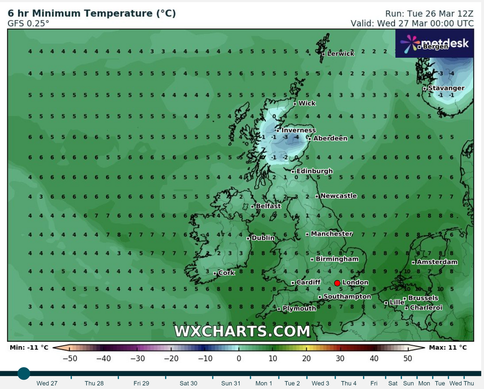
The minimum temperature for the UK
|WXCharts.com
For anyone looking to do Easter egg hunts on Easter Sunda looks to be the best day of the week but, conditions will return to more unsettled from the south later on Sunday night and into Monday.
This will bring a widely unsettled day, at least across southern areas, for Easter Monday, with the best of the conditions, at least to begin, further north.