


A late sub-tropical storm driving up the Gulf of Mexico threatens an unseasonable deluge across the US.
A cyclonic ‘disturbance’ boasting an ominous ‘eye’ is whipping up to unleash a stormy assault across southern states.
Swaths of the region already hit by heavy rain face flooding from the latest downpour ahead of the weekend.
Warm ocean waters and calm winds aloft have delivered ‘favourable’ conditions for the storm, simply called ‘1’, to gather.
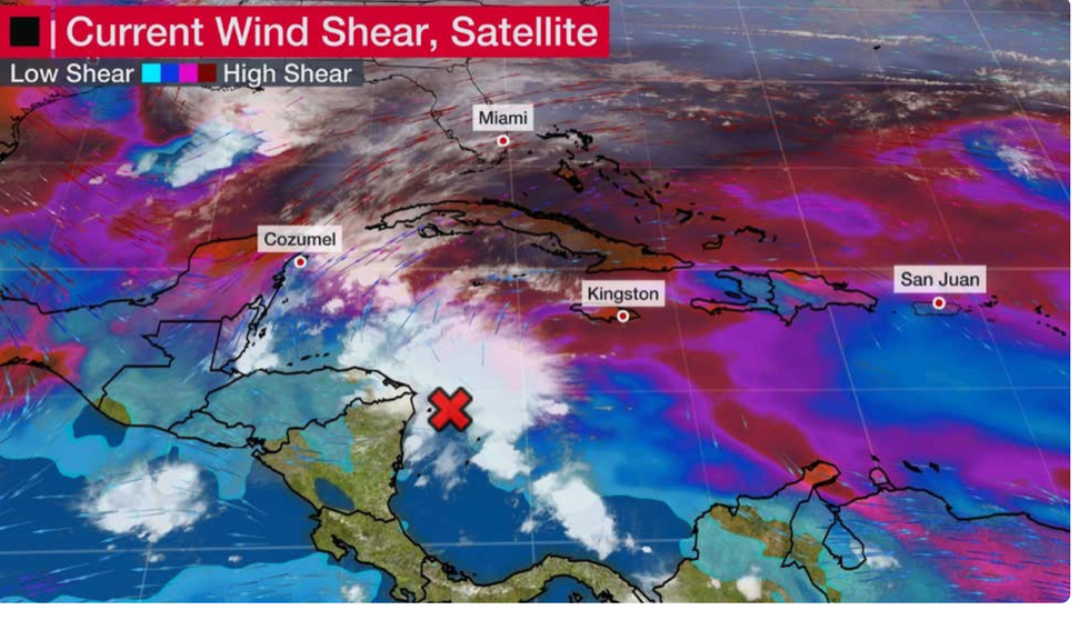
Tropical disturbance forms in the Caribbean sea
The Weather Channel
Jim Dale, social commentator and US weather correspondent with British Weather Services, said: “We are going to have to watch the south coast this week.
“There is a storm coming out of the Gulf of Mexico and it looks like a sub-tropical storm that could affect eastern Texas, Missouri, Florida and Louisiana, later this week.
“It drives along the southern coast, and it looks like it has an eye to it.”
The main risk will be heavy rain heading for Florida, already besieged by downpours this autumn.
The storm is unusual in forming this late in the season with abnormally high sea temperatures being blamed.
Searing temperatures through the summer have left ocean waters still warmer than average for the time of year.
Waters around the Gulf of Maine are currently 50.5F, around 0.5F higher than normal, while Virginia Key, Florida, is 80.1F, compared to the average of 78.2F, according to the National Oceanic and Atmospheric Administration (NOAA).
The tropical disturbance in the western Caribbean Sea is expected to strengthen through the coming days.
It is also unusual in forming during an El Nino event, as was confirmed to have set in earlier in the year.
El Nino drives opposing wind currents–wind shear–and sinking air over the Caribbean which usually spell the death knell for hurricane formation.
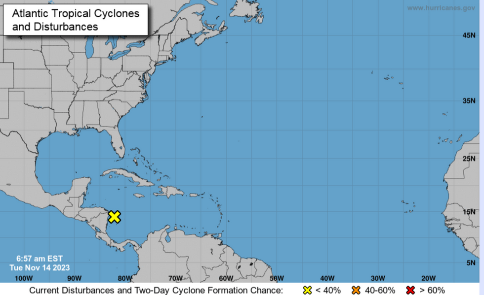
NOAA map of tropical disturbance
NOAA
The Weather Channel’s meteorologist Jonathan Erdman said: “We are watching a cluster of showers and thunderstorms percolating near the eastern coasts of Honduras and Nicaragua.
“Computer forecast models over the past several days have consistently hinted that an area of low pressure could form later this week in that general location east of central America and south of Jamaica.
“In records dating to 1950, only three systems have previously become depressions or storms in November during a strong El Niño in the Atlantic Basin.
“So, this could be a first for the tropical Atlantic in at least 73 years.”
However, he said that the storm is likely to head north-eastwards swerving the United States and presenting no threat.
It comes as swaths of the country enjoy a burst of ‘spring-like’ warmth thanks to a surge of heat from the south.
This will be driven by a huge high-pressure ‘anticyclone’ building over central America, according to experts.
Weather channel meteorologist Ari Sarsalari said: “Over the next couple of days a lot of the country is going to be experiencing some unseasonable warmth.
“There's a big ridge of high pressure and it's kind of broad from west to east so that means that a lot of people are going to get in on some of the above average temperatures.”
