
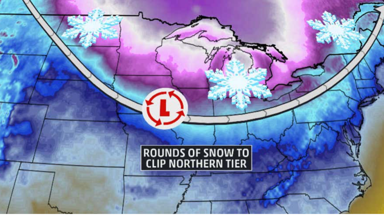


An ‘Alberta Clipper’ winter storm will bring snow to parts of the US this week while rising temperatures elsewhere herald the start of spring.
Winter will hang on in the northeast, the Upper Midwest and the Great Lakes as the clipper rolls in, while central states warm up.
An ‘Alberta Clipper’ system is a fast-moving low-pressure system particular to winter originating from the Alberta region of Canada.
The storms usually bring snow and strong winds while driving down temperatures across the Plains, the Midwest and the Great Lakes.
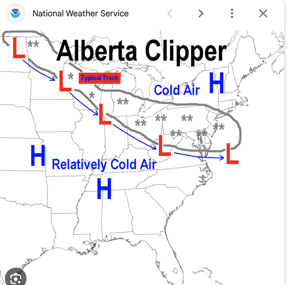
The route the Alberta Clipper is expected to take
|National Weather Service
Snow is forecast to hit the region through the start of the week, according to the National Weather Service (NOAA), which also warns of heavier downpours further west.
A spokesperson said: “A clipper system moving out of southern Canada will produce light snow across portions of the northeast and Upper Midwest and the Great Lakes through Monday.
“Meanwhile, heavy snow will develop over the Sierra and Shasta Siskiyous, and this snowfall is expected to continue into Tuesday.
“Between two to four feet of snow are forecast for the Sierra and Shasta by Tuesday morning with locally higher amounts possible.”
A clipper-type system hit New York last week following a separate winter storm that dumped the most snow to the region for around two years.
A snow warning was issued on Friday across Oswego, Jefferson and Lewis near the east end of Lake Ontario.
LATEST DEVELOPMENTS:
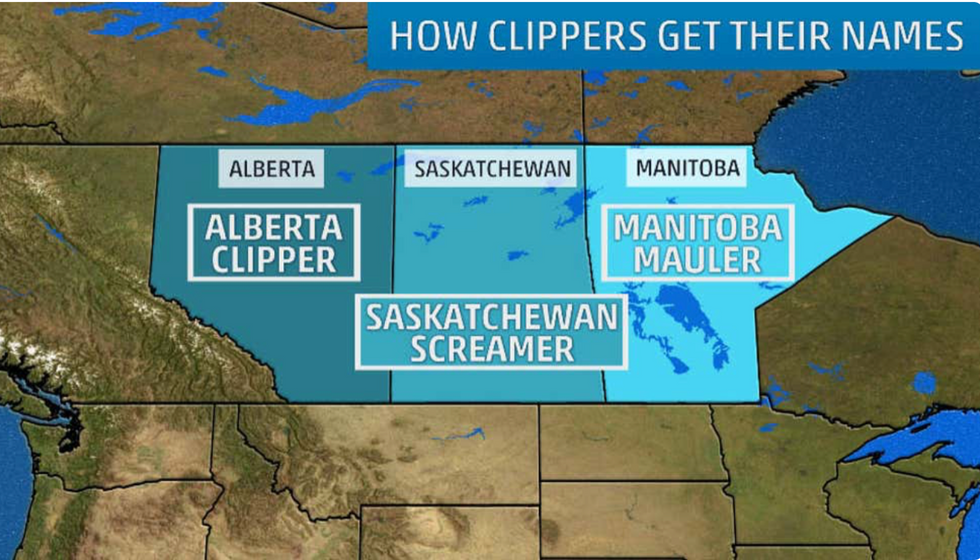
How clippers get their names
|The Weather Channel
Alberta Clippers spawn from warm, moist air from the Pacific Ocean hitting the Canadian mountains spanning Alberta and British Columbia.
They are steered by the jet stream as it dips southwards east of the Rockies, pulling low pressure, wind and snow across the Midwest.
Depending on where they originate, the storms may also be referred to as Saskatchewan Screamers or Manitoba Maulers.
They are a significant driver of lake-effect snow, seen when cold dry air passes over the moist surface of the Great Lakes–as expected this week.
However, because these low-pressure systems move quickly through the region, snowfall is usually short-lived.
Speaking during a previous clipper event, Weather Channel spokesman Brian Donegan said: “While Alberta clippers don't typically evolve into powerful winter storms, they can produce localized bands of heavier snow and strong winds that often result in low visibility and hazardous travel conditions.”
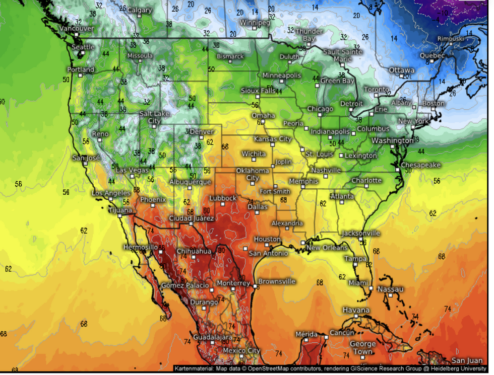
Parts of the US are set to see milder temperatures too
|Weather.us
Meanwhile, central states are expecting the mercury to rise this week as the winter chill gives way to a spring buzz.
Temperatures are forecast to hit 68F in Kansas and Oklahoma this week, while further south, highs of 80F are possible.
Eastern states, though, are likely to see more unsettled weather until the end of the week, according to The Weather Channel.
A Weather Channel meteorologist said: “We have an area of low pressure that is going to develop, and it is not going to stay anchored to the ground, but it is going to set sail to move into the northeast.
“This storm is going to strengthen as it meets the coast of the mid-Atlantic, and we have moisture coming in from the Gulf as well.
“The low will move just off the Jersey shore by Friday night, and the American weather model has a bit more moisture associated with it.”