


Storm Ciaran is looming its head with the “bomb cyclone” expected to batter the UK tonight, with 100mph winds heading towards Britain in an "explosive cyclogenesis".
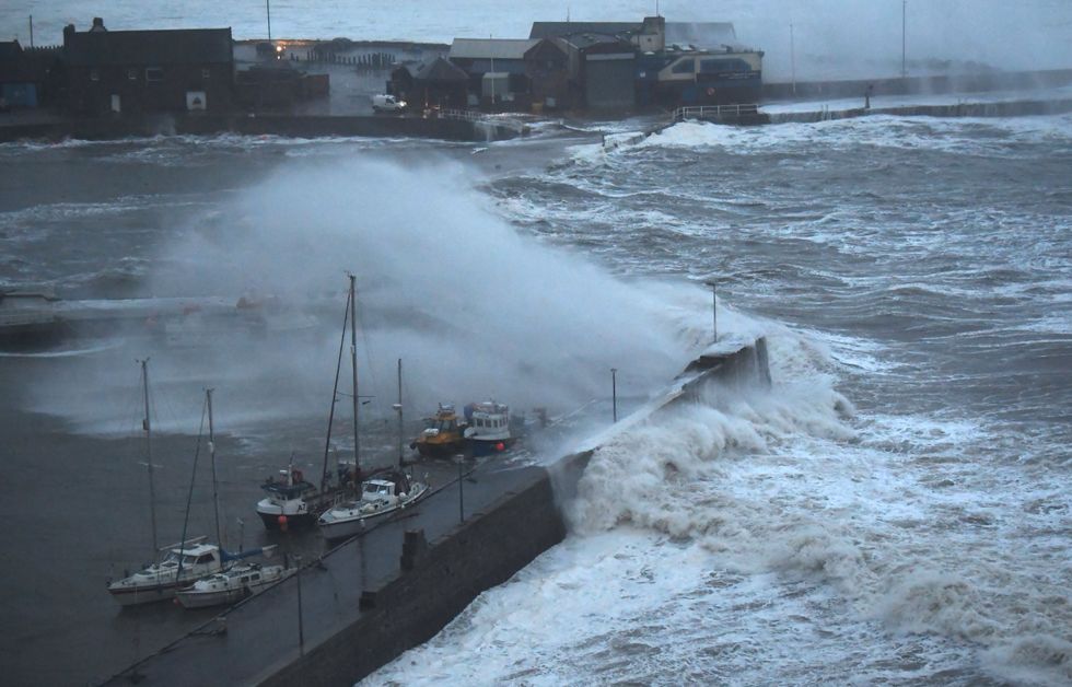
Last night, a violent windstorm began to brew in the open waters of the Atlantic, with massive 50ft waves developing.
The Met office has put amber warnings in place and dozens of flood alerts have been issued.
The storm will reach its peak intensity once arriving on European shores.
WATCH NOW: Flood defences bolstered as Storm Ciaran looms
100mph winds are expected in France before the violent storm crosses the channel.
It is expected to hit southern Britain on Wednesday night and continue into the Thursday.
The Met Office said: "Wind and rain warnings associated with Storm Ciarán are in force from Wednesday night onwards into Friday, with further updates possible on Wednesday.
"These include amber warning for winds for southwestern parts of England and Wales Thursday early hours and morning and the far south and southeast of England Thursday daytime and early evening.
WEATHER LATEST:
- UK snow forecast: Britain set for early winter freeze as strengthening polar vortex to bring November snow
- Northern Ireland floods: Residents told not to go out as Newry canal bursts banks
- UK weather warning: 'Menacing bomb-cyclone' surges towards Britain in 200mph jet stream - 'Conditions never seen before'
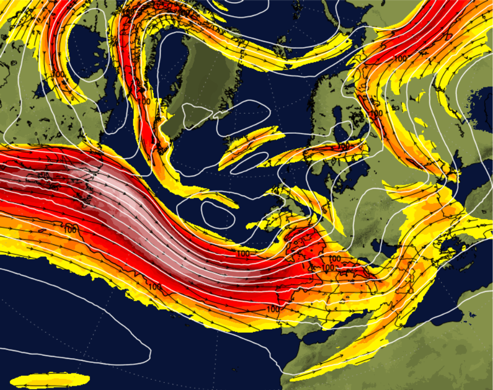
The powerful jet stream on Wednesday night
|Netweather
"Storm Ciarán is expected to bring very strong along southern coastal areas of England in particular where gusts of 70 to 80mph are possible, gusts perhaps exceeding 85 mph in the most exposed locations. Further inland, gusts could reach up to 50 or 60mph."
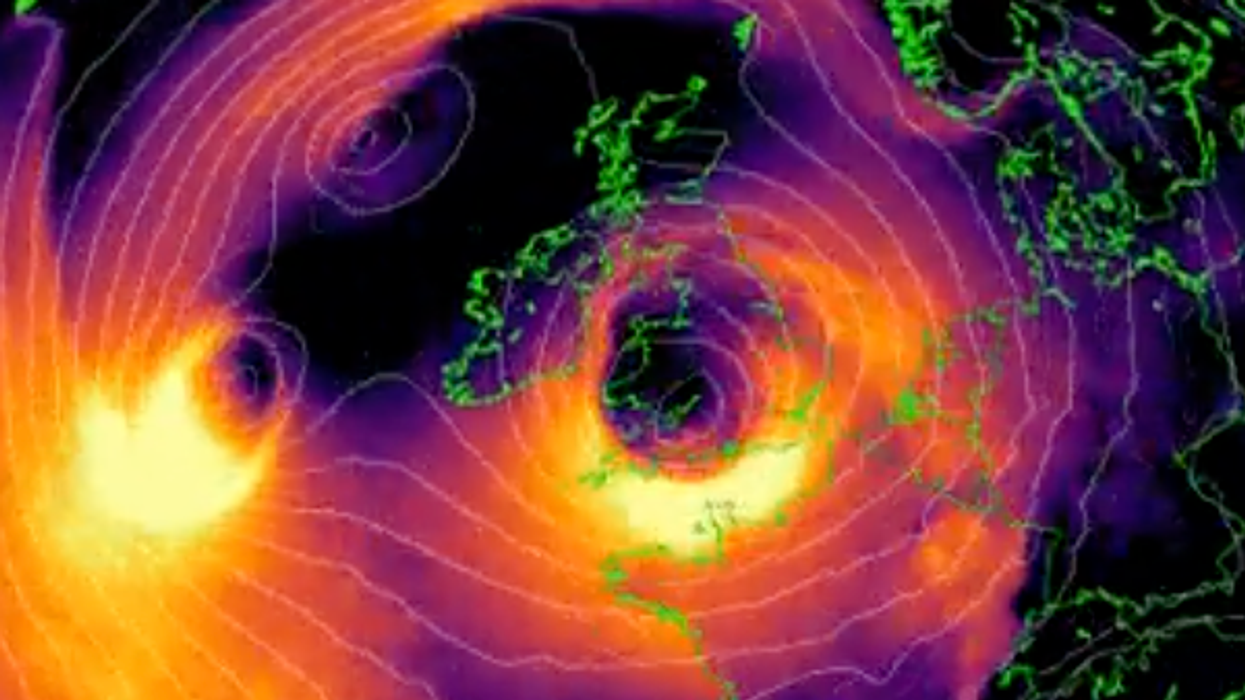
Meteorologist Scott Duncan said of the approaching storm: "A violent wind storm is brewing in the open waters of the Atlantic right now. Ciarán unfortunately reaches peak intensity upon arrival on European shores with severe weather warnings issued.
"The explosive deepening of the surface low should be among the deepest low pressure systems on record for this part of the world. Low centre potentially dropping sub 955 hPa."
He described the storm as "Intensifying rapidly under the left-exit jet region just west of Europe. A true bomb cyclone".
An independent weather forecaster for south-east England, known as MetJam, said that the storm is "expected to begin to undergo explosive cyclogenesis from around 06 UTC tomorrow".
Two amber wind warnings have been issued by the Met Office, which come into effect from 6.00am tomorrow.
The weather office said: 'Very strong winds associated with Storm Ciarán may disrupt travel, utilities, and cause some structural damage'
|Getty
The affected regions are: East of England, London, South West England and Wales.
Impacted areas include Bournemouth, Cornwall, Devon, Essex, Hampshire, Isle of Wight, Kent, Pembrokeshire, Portsmouth and Southampton.
The weather office said: "Very strong winds associated with Storm Ciarán may disrupt travel, utilities, and cause some structural damage".
They issued a danger to life warning, due to the likelihood of falling debris.
The Met Office cautioned: "Damage to buildings and homes is possible, with roofs blown off and power lines and trees brought down.
"Roads, bridges and railway lines may close, with delays and cancellations to bus, train, ferry services and flights.
"Power cuts could occur and affect other services, such as mobile phone coverage
"There is potential for large waves and beach material being thrown onto sea fronts, coastal roads and properties."