


A menacing “bomb-cyclone” is surging towards Britain as the Met Office issues weather warnings amid a 200 miles per hour jet stream.
The UK’s national weather service has imposed three weather warnings across Northern Ireland today, including an amber rain alert which could shower parts of Ulster with up to 100 millimetres.
Yellow weather warnings are expected to hit much of the UK, including parts of England and Wales, later this week.
Rain and wind alerts have been issued in southern England and Wales on Wednesday and Thursday.
WATCH NOW: The Met Office's weather forecast
Britons in the North East will face a similar yellow rain warning on Thursday and Friday.
The adverse conditions come as Storm Ciaran continues to wreak havoc across much of Europe, including France and Spain.
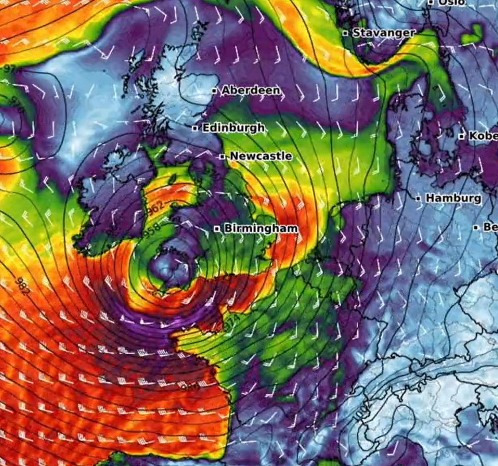
Meteorologist Jeff Beradelli said: "A monster 950mb storm Ciaran is heading for Europe with 'landfall' near the English Channel Wed-Thu. 950mb would be a near record low pressure for region (equiv cat 3 hurr pres). 80mph coast gusts /35 ft+ waves. The storm is powered by a buckling, wicked 200 mb jet stream aloft.”
Weather expert Nahel Belgherze added: “From an innocuous looking low over the Northeast U.S. to a powerful ‘bomb-cyclone’ menacing Northwest Europe in less than 48 hours. Thanks to a powerhouse 200+ mph jet stream, Storm Ciarán’s 3,000-mile journey across the Atlantic will be quick and explosive.”
Peter Dynes also warned: "Storm Ciaran looks to be another climate monster in the making. Southern England and Northern France may see conditions never witnessed before. We are entering a new era of storms. Increasing the energy in the system is only going to make things much worse in the future."
LATEST DEVELOPMENTS:- Met Office weather warnings UPGRADED: Homes to be 'cut off for DAYS' as floods strike
- Storm Ciaran warning: 90mph HURRICANE-FORCE winds to smash Britain as heavy rain squalls spark hundreds of flood alerts
- UK weather warning: Storm Ciaran threatens to batter Britain with rain just days after flood hell
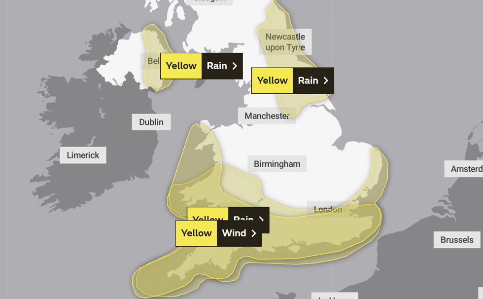
An image of the Met Office's weather warnings on Thursday
|MET OFFICE
The wind and rain warning which will likely batter much of England and Wales from tomorrow could damage buildings and homes.
The Met Office’s warning said: “Storm Ciarán is likely to bring a spell of very strong winds to southern parts of the UK.
“Winds are expected to gust 50-60 mph along coasts, and may reach 70-80 mph at times along the English Channel coast of England as well as north Cornwall.
“There is a very low likelihood that of gusts up to 90mph could affect the far west of Cornwall and the Isles of Scilly.
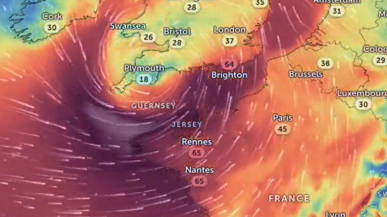
An image of WXCHARTS' forecast
|WXCHARTS
“Inland, gusts are likely to reach 40-50 mph at times, with a possibility of 60-70 mph gusts over high ground such as Dartmoor.
“Very large waves could bring additional impacts to coastal areas, especially parts of west and south Wales, and southern England.”
The UK’s national weather service added: “Periods of heavy rain, associated with Storm Ciarán, are expected to affect much of southern Britain from Wednesday evening and during Thursday.
“A further 20 to 30 mm is likely quite widely, but 40-60 mm may accumulate in places, especially, but not exclusively, over higher ground.
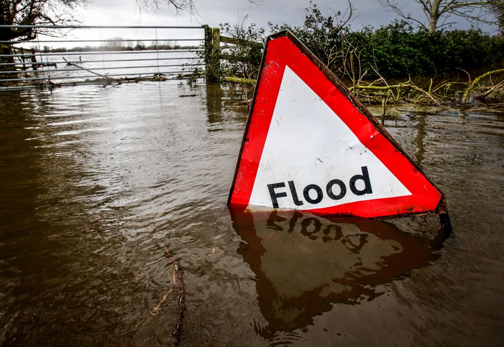 A flood sign | GETTY
“Given this amount of rainfall, the current saturated conditions, and the potential for fallen leaves to block drains etc - further impacts are likely.”
A number of flood alerts have been issued as rain threatens to wreak further havoc.
England’s Environment Agency imposed 26 flood warnings and 124 flood alerts.
An additional 13 warnings and alerts have been issued in Wales.