


Britain’s hours-long respite from the rain will collapse into another deluge as families brace for a half-term washout.
The sunniest day of the year, which saw clouds part briefly on Saturday, is about to become a distant memory as the Atlantic barrage resumes.
A ‘deep’ storm heading towards the UK mid-week threatens torrential rain, gales and the snow over high ground.
Met Office meteorologist Alex Burkill said: “While temperatures may lift a little bit, colder air will come in again as we go into Monday, and there will be wet weather around with this cyclonic pattern.
“One weather model has a particularly deep area of low pressure on Wednesday, and that could bring some wet and windy weather, and perhaps some wintry weather across many parts.
“As we go into Monday, generally it looks like low pressure will be around, so we will be in a cyclonic pattern.”
A slight shift in meteorological patterns, however, will ease the water pressure slightly, he said.
The past weeks have seen a region of ‘blocking’ high pressure to the east stall stormy lows from the Atlantic over Britain.
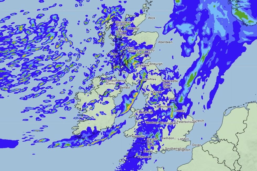
Rain is set to batter Britain for much of the week, the Met Office has said
|MET OFFICE
Rather than sweeping across the country, they have hovered largely to the west, dumping huge rainfall totals over a limited area.
This Scandinavian high-pressure dome is about to shift, clearing the path for some drier interludes, Mr Burkill explained.
He said: “The high pressure that has been over Scandinavia is drifting away.
“We are switching it up a little bit, and instead of low pressure hovering to the west bringing rain to the west, we are going back to what we are more used to at the time of year.”
LATEST DEVELOPMENTS
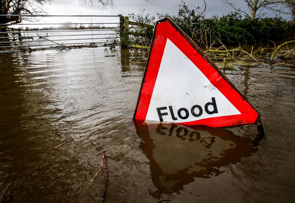
Heavy rainfall could lead to flooding, the Met Office has warned
| GETTYHowever, the outlook in general for the week is for more rain, as Britain squelches through one of the wettest winters on record.
Britons heading out and about for half term will have to ‘pick their days’ to dodge the deluge.
Jim Dale, meteorologist for the British Weather Services and co-author of ‘Surviving Extreme Weather’, said: “This week, for the most part, will bring more of the same in terms of a very unsettled and changeable picture.
“There will be some breaks in the rain, so people will have to pick their days carefully, otherwise they will be in trouble.
“There is a slight shift in the weather patterns, so there will be some dry moments, but nothing dry and sunny.”
Cold air over Britain will collide with Atlantic moisture to trigger snow over Scotland and high ground of northern England, he warned.
He said: “We still have cold air over the country, so when the rain comes in, there will be a risk of snow, particularly over the Highlands of Scotland and northern England.
“It will feel cold with temperatures in parts dropping to minus double figures, and there will be the risk of ice and frosts, especially when the winds are light under clear skies.”
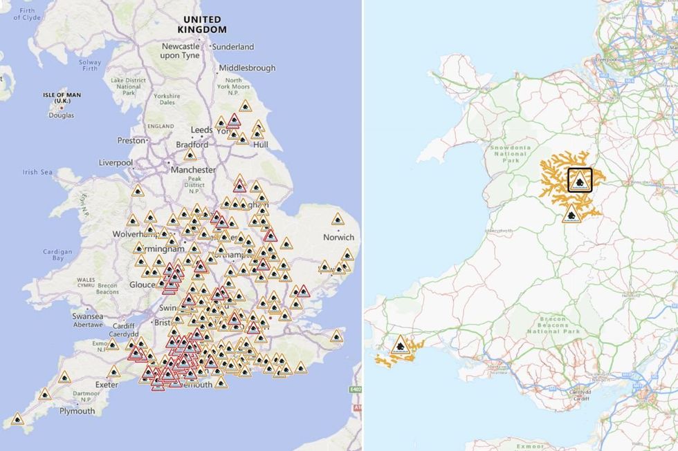
Flood warnings have been issued across the UK
|ENVIRONMENT AGENCY/NATURAL RESOURCES WALES
England's Environment Agency has issued 200 flood warnings and 76 flood warnings today.
The warnings stretch from Cornwall to Yorkshire, including a high concentration in Dorset and Hampshire.
Meanwhile, an additional three flood alerts have been issued in Wales.
"Local surface water and river flooding impacts are possible in parts of England and Wales today and Wednesday, with impacts possible but not expected later on Wednesday and Thursday," the Environment Agency said.
"Land, roads and properties could flood and there could be travel disruption."