


The Met Office has issued yellow weather warnings as parts of the UK look set to face travel chaos amid fresh snowfall.
Following a wet, windy and sometimes freezing start to 2026, the Met Office's latest update shows no sign of warming up, with another cold snap set to freeze parts of the nation.
Storm Goretti and Storm Chandra have already battered UK shores, particularly in the South West and blanketed many regions with snowfall.
Areas of Scotland and Northern Ireland are now expected to face heavy rain, sleet and snow between 3pm on Monday to 10am on Tuesday.
TRENDING
Stories
Videos
Your Say
"Periods of sleet and snow on Monday afternoon, evening and night may cause some disruption from both accumulating snow and icy surfaces," the Met Office said.
The weather agency said that roads and railways are likely to be affected, cautioning road users, cyclists and pedestrians over icy conditions.
The snowy showers are expected to spread southeastwards across Scotland, with snow accumulating on hills in particular.
Further wintry showers are expected to arrive from the northwest later in the evening, carrying on into Tuesday morning.
 The Met Office have issued yellow weather warnings with parts of the UK se to be blanketed with snow and traffic chaos warned | MET OFFICE
"The greatest accumulations of snow will be during Monday evening and night, where 1-2 cm will be possible in places at low levels (away from north-facing coasts), 2-5 cm above about 150 m elevation and 5-8 cm above 300 m," the Met Office added.
"With temperatures falling below freezing, ice is likely on untreated surfaces, even where precipitation may have fallen as rain or sleet. A few isolated lightning strikes will be additional hazards.
"Strong north to northwesterly winds are also likely during Monday evening and night across the Northern Isles and northeastern parts of the mainland, where gusts in more exposed areas could reach 50-60 mph."
LATEST DEVELOPMENTS
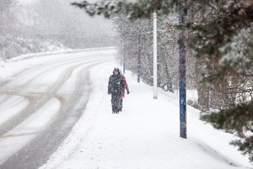
Snow has already blanketed much os Scotland since the new year
|PA
The areas affected by the warning include: Angus, Perth and Kinross, Stirling in Central, Tayside & Fife; Aberdeen, Aberdeenshire, Moray in Grampian; Na h-Eileanan Siar, Highland in Highlands & Eilean Siar; Orkney Islands, Shetland Islands in Orkney & Shetland and Argyll and Bute in Strathclyde.
The weather agency warned road users to plan their journeys and to check for road closures.
A "winter essentials pack" was also recommended.
This can include ice scrapers, de-icer, a large torch with spare batteries, a charger, warm clothes and blankets, high-visibility clothing, jump leads, an empty fuel can, food and drink, a shovel, warning triangles and sunglasses.
Weather warnings are likely to change, the weather agency added, so it has been advised to keep up to date with the latest warnings being issued.
A yellow warning is issued depending on how likely or how severe forecast conditions are expected to be.
The Met Office confirmed that this particular warning was for medium likelihood and a low impact.
Our Standards: The GB News Editorial Charter