


A ‘race between the Atlantic and the tropics’ will keep spring hanging in the balance as the UK braces for a week of wind and rain.
Low pressure from France will tussle high pressure from the tropical south which drove the glorious weekend weather.
A battle between the two will bring a mixed and often rainy picture for the next week and possibly the rest of May.
Jim Dale, meteorologist for British Weather Services and social commentator, said: “We are now looking at a race between the Atlantic and high pressure from the tropical Azores with the Atlantic pushing another low-pressure system through this week nudging out the high.
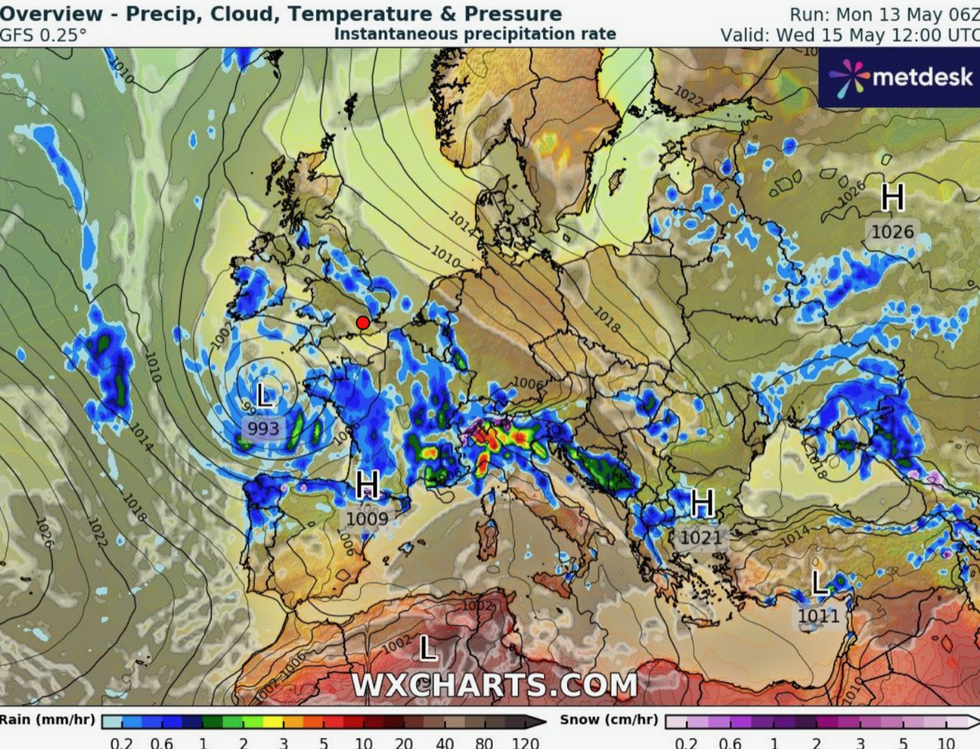
Low pressure is close by
|WXCharts
“It is going to be a different picture from the very warm and dry weather we had at the weekend with more in the way of rain and high winds.
“Through the middle of the week, a low comes through first bringing wind and then the rain.”
Temperatures will drop from the weekend high of 25.9C recorded in East Sussex.
However, in the sunshine, the mercury is likely to reach the high teens or low 20Cs–still above average for May.
Mr Dale said: “In the south it will be a bit of a stop-start week, with rain and periods of sunshine, but temperatures could still reach 20C in parts.
“So, we are not looking at anything cold, but there will be some heavy showers making temperatures will feel lower.”
LATEST DEVELOPMENTS:
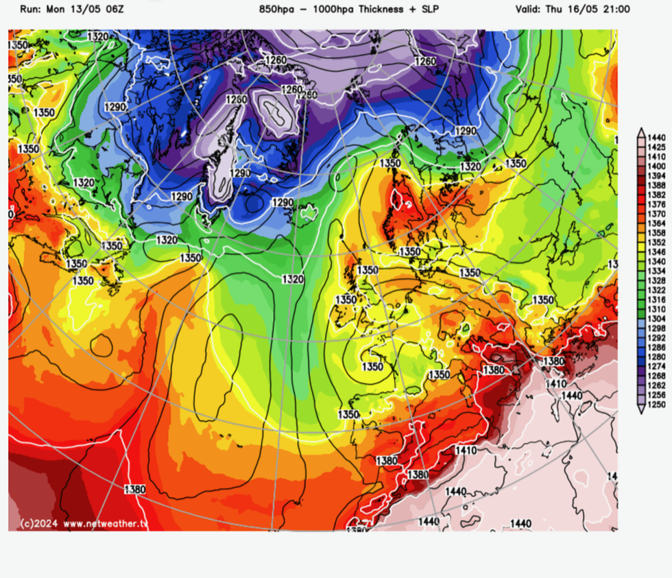
Temperatures hold up in parts of the country
|Netweather
It is the latest twist in Britain’s topsy-turvy weather which brought the dullest April for more than 20 years.
In the run-up to spring, the UK has battled 11 named storms, more than normal for the season which starts in September.
With a 0.4C above average overall temperature, April was the warmest for four years although a particularly chilly end to the month made it feel anything but.
Despite the mixed outlook this week, Britons who manage to dodge the showers will catch some warm sunshine.
Met Office meteorologist Alex Deakin said: “This week’s weather won’t be as sunny and warm as it was at the weekend, but there will still be some warm sunshine.
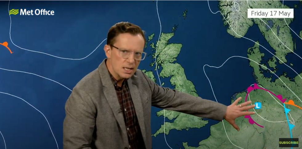
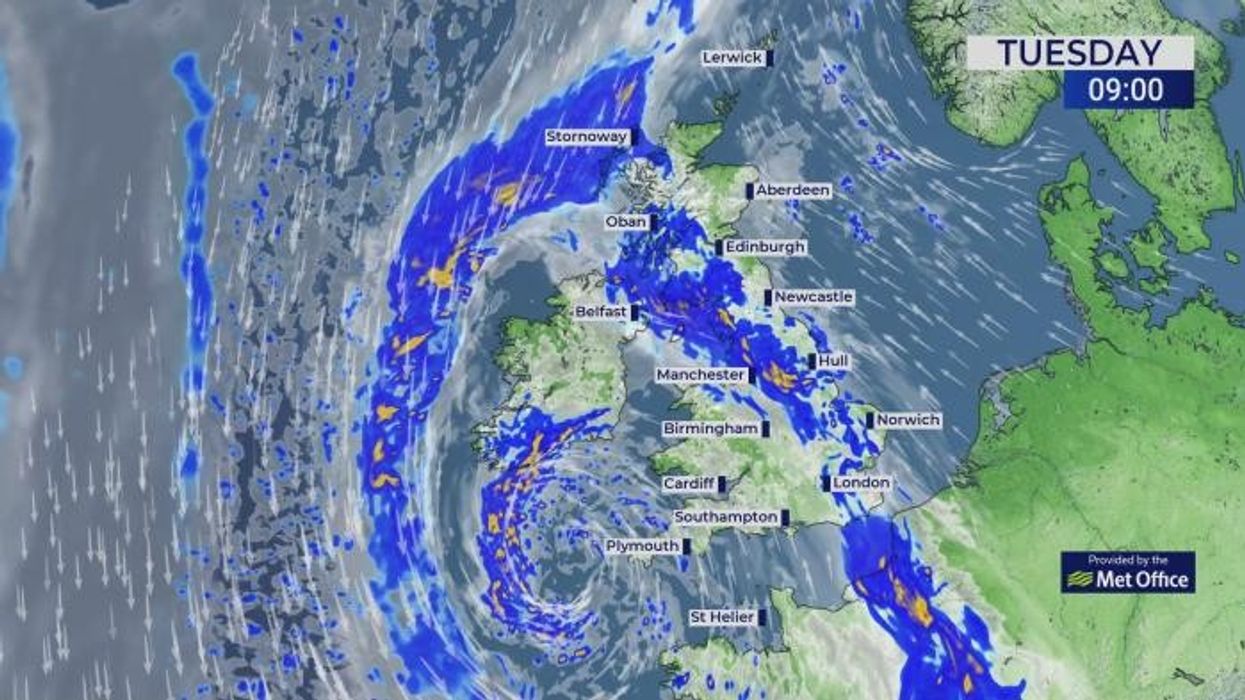
Met Office’s Alex Deakin warns of the risk of unsettled weather this weekend
|Met Office
“There will also be quite a few heavy showers around, and the reason for that is an area of low pressure that will dominate the weather through the working week.
“It meanders around, and sits to the southwest and eventually weakens, and it drifts down towards the bay of Biscay, and it will be the main player in our weather for the next four or five days.”
Western Scotland could see the best temperatures by the end of the week, he added, before another band of rain drifts up from France.
He said: “Temperatures on Friday are close to average across eastern and central parts and above average where we see some sunshine, particularly western Scotland.
“At the weekend, there is more uncertainty around an area of low pressure drifting up from France, and it’s likely to provide more showers.”