


The UK is set to be battered by "cyclonic patterns" for the next fortnight, as the Met Office forecasts more cold and snowy conditions.
It has been a wet, windy and sometimes treacherous start to 2026, which has seen rainfall every day in the UK so far.
Storm Goretti and Storm Chandra have already battered UK shores, particularly in the South West and blanketed many regions with snowfall.
But the weather shows no sign of slowing down, as another cold snap is set to freeze the nation.
The Met Office have now issued a fresh long range weather forecast, detailing more rain expected across the UK.
However, icy conditions, expected to extend throughout February, mean it could turn to snow in many areas.
The forecast lasts between February 12 and February 21.
The Met Office said: "Predominantly cyclonic patterns are expected to dominate the UK.
The UK is set to be battered by 'cyclonic patterns' for the next fortnight, as the Met Office forecasts more cold and snowy conditions
|WXCHARTS
"The early part of this period could see colder conditions becoming established more widely for a time, bringing with it the likelihood of some snow, primarily to the north and northeast.
"However this should offer a few days' respite from the wet weather across the south.
"By the end of this period, the track of Atlantic depressions may shift a little further north than during the last few weeks.
"This will maintain broadly unsettled weather, with further spells of rain and perhaps strong winds at times.
LATEST DEVELOPMENTS
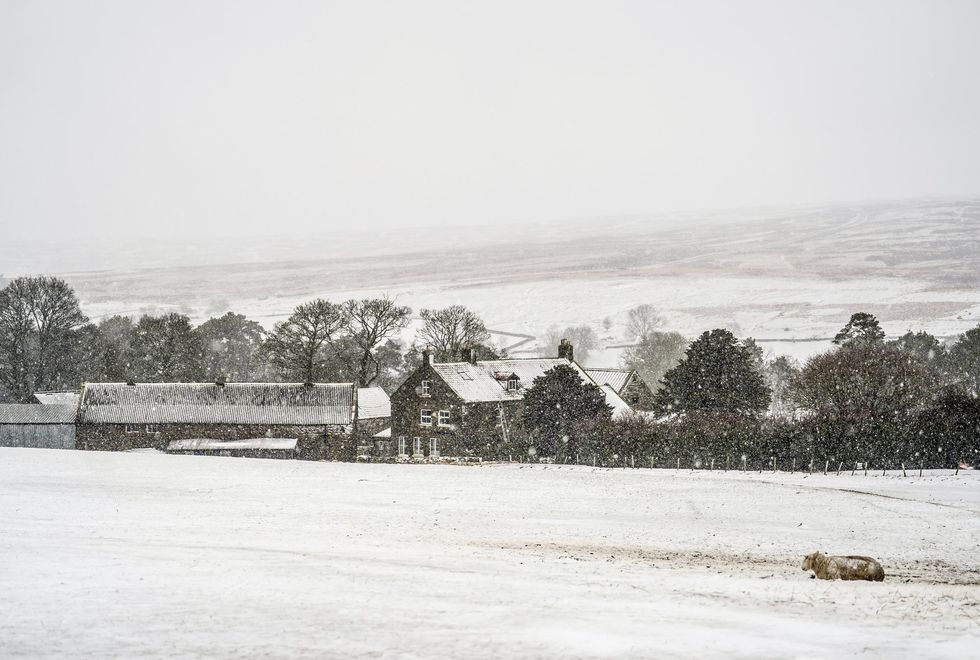
Storm Goretti and Storm Chandra have already battered UK shores and blanketed many regions with snowfall
|PA
"Many parts may become somewhat milder, given more of a westerly influence, though there remains the chance that colder conditions could linger towards the northeast."
The snow is expected to fall from Friday, February 13, until Tuesday, February 17.
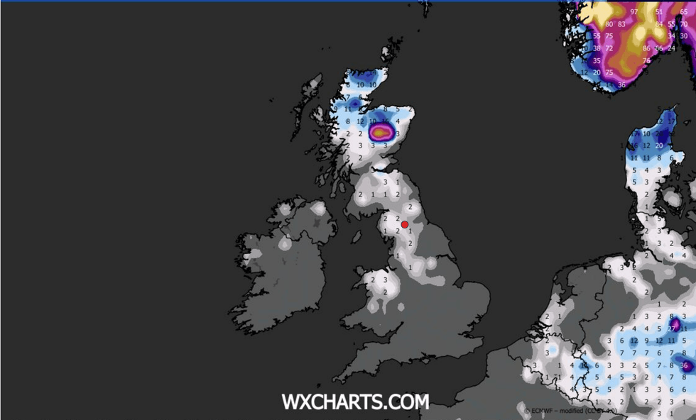
By 6am on Friday, snowfall could reach up to 20mm per hour, affecting Wales, the Midlands, and the East of England.
Temperatures are expected to remain around 0C and -3C across the country, with only the most southern regions of Cornwall experiencing slightly warmer conditions, at around 8C.
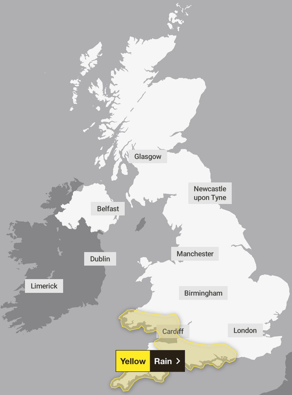
The South West have been issued with a yellow weather warning for rain at the beginning of next week
|THE MET OFFICE
Weather maps from WXCHARTS project Scotland could see up to 51 inches.
And while the South West may escape the freezing conditions, the region has received a yellow weather warning on Monday, February 9, for heavy rain.
"Bands of rain and heavy showers will move east across southern parts of England and Wales during Monday afternoon and evening. 10-15 mm of rain is likely fairly widely with 20-30 mm in some places exposed to the strong south to southeasterly winds," the Met Office said.
Our Standards: The GB News Editorial Charter