


A ‘breakthrough cyclone’ poised to sweep Britain threatens to fling open the gates to a shivering puff from the Arctic.
In a departure from January’s ‘blocked’ rainy patterns, an Atlantic storm will barge past the West Country, across the south, and into Europe.
Instead of stalling and wringing its load over Somerset, Wales, Devon and the northwest, it will push through, switching winds from southerly to northerly.
The change in weather pattern will be driven by a ‘tilt’ of the jet stream, jolting from a southerly position to edge closer to Britain.
Met Office meteorologist Alex Deakin said: “Low pressure will bump up against high pressure on Monday, bringing another spell of rain to western areas.
“Then the jet stream starts to tilt, and there is another low moving into the UK and doing something which most lows haven’t done, crossing the UK and getting into Europe.
“This will allow the winds to draw in some colder air, and we could introduce some colder conditions across the UK.”
Weather forecasting models, however, once again disagree with some outlooks predicting more mild, wet weather.
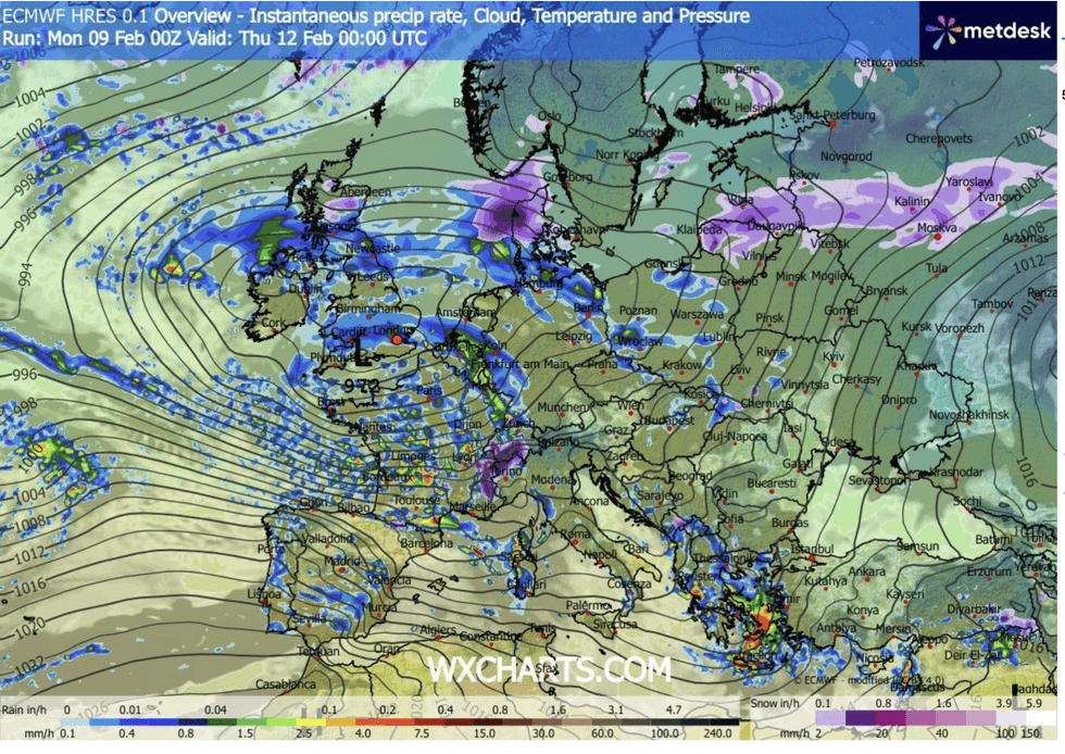
Low pressure cyclone sweeps Britain
|WX CHARTS
Some predict low pressure storms from the west breaking through the blocking easterly high to trigger colder conditions.
But others keep the theme of milder, wet and rainy weather as the ‘battle’ between high and low pressure rages.
Deakin said: “Not all weather models are agreeing, and it all depends on which one wins out with the Met Office model there are some examples of where the colder air wins, but there are more that keep the milder air to the south and keep that battle going into next week.
“There is a suggestion that we could see something of a northerly towards the back end of the week.
LATEST DEVELOPMENTS:
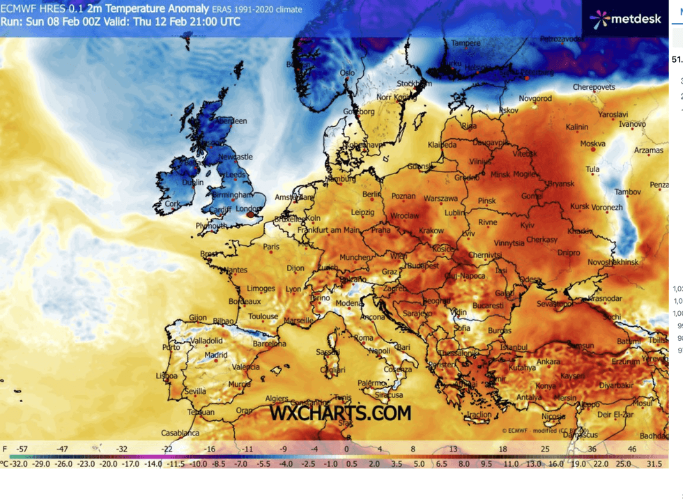
Weather maps show cold air descending from the north
|WX CHARTS
“But the more likely outlook is that we will continue to see more of the battleground with low pressure trying to bring milder air to the south, although there is a hint of a change which brings the chance of seeing something colder.”
Independent forecasters are more certain that showery milder weather will give way to the cold.
Scotland, northern England and even parts of the south are on alert for snow later this week.
Jim Dale, meteorologist for British Weather Services and co-author of ‘Surviving Extreme Weather’, said: “At the moment we are being controlled by low pressure from the Atlantic, but on Thursday it is most likely we see an intrusion from the Arctic bringing something much colder.
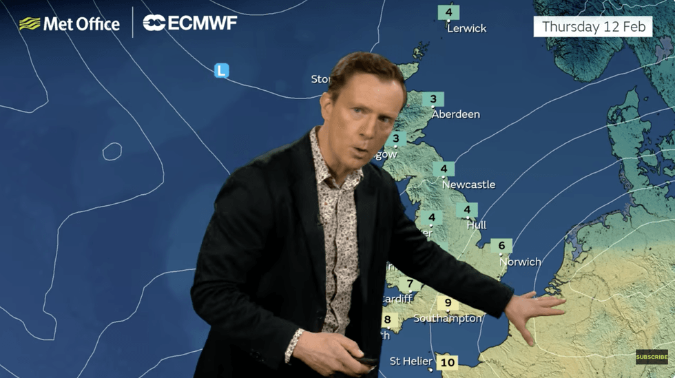
Alex Deakin warns of the risk of a cold snap
|MET OFFICE
“This is something we have been talking about for more than a week, and it looks likely it will come off, with the risk of snow greatest to the north, but not out of the question further south.
“In the meantime, there is more rain in the forecast through the start of the week as low pressure continues to come in off the Atlantic.”
Met Office meteorologist Aidan McGivern added: “There are no changes in sight imminently, with another spell of rain coming in from the southwest on Monday.
“On Tuesday, further fronts come through on the powerful jet stream across the Atlantic, and into Wednesday, but by this stage the jet stream is not quite as strong and that hints at a subtle change for the second half of the week.
“On Thursday, low pressure is still close to the UK, and there is a hint that we will see northerly winds start to arrive, meaning colder weather and the potential for some snow in places.”