


The UK may be in for another ‘Beast from the East’ thanks to an “unprecedented” weather event which could drive down temperatures across the country, the Met Office has said.
The ‘Sudden Stratospheric Warming’ (SSW) event – a disruption of the normal westerly air flow 10-50km above the Earth’s surface – has been observed three times during winter for the first time since records began.
Three SSW events happening in a single winter is a one in 250-year phenomenon, according to Met Office research – though an ‘El Niño winter’ like this one drives up the chance of this going on.
An SSW event can divert the jet stream – the flow of warmer, wetter air from across the Atlantic which ensures Europe enjoys milder weather than other parts of the Northern Hemisphere.
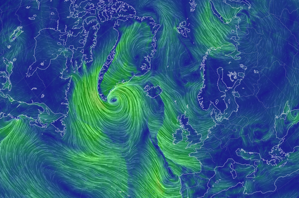
Images from Earth Nullschool showed the polar vortex over the North Atlantic drawing in cold easterly winds over the UK
|Earth Nullschool
During winter, a disruption to the jet stream can lead to a large area of high pressure over northern Europe – drawing in cold polar air and driving up the risk of heavy snow like 2018’s ‘Beast from the East’.
But the Royal Meteorological Society said the conditions brought on by SSWs can vary a great deal, highlighting the fact that the polar vortex was “just one piece of the puzzle”.
The Met Office’s head of long-range forecasting, Professor Adam Scaife, said: “Although we have not seen it before, we recently documented the chances of an unprecedented three SSW events happening in one winter.
“Our research work, using multiple computer simulations, showed that this could occur about once in every 250 winters.
LATEST DEVELOPMENTS:
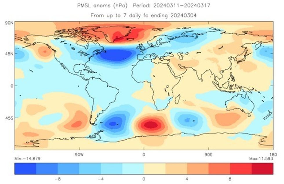
Graphics from the Met Office show the area of high pressure over Iceland and Greenland
|Met Office
“Although this is very rare, we also found that the chance of multiple SSW events is increased during El Niño and so the chance of multiple events this winter is raised.”
SSW events have been recorded since the 1950s, when meteorologists developed radiosonde balloons to take high-altitude measurements in Earth’s stratosphere.
The Met Office said one SSW every two winters is typical – though some years have seen two and some none – but three in one winter period is unprecedented.
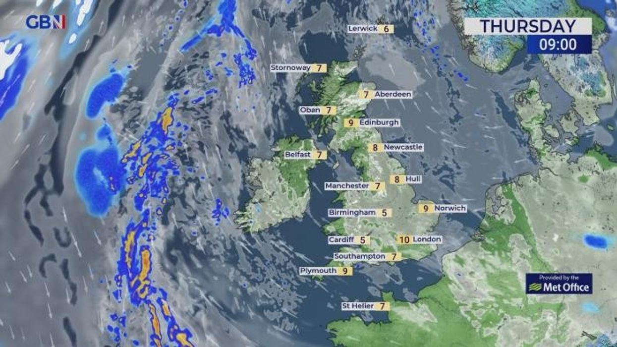
It said the current SSW event is consistent with its long-range outlook for March, which predicts a “continued increased chance of blocked, high-pressure conditions to the north of the UK and a southward shift in the Atlantic jet stream”.
Its long-range forecast said winds from the north and east “can still bring wintry hazards, such as snow and ice, but the risk of these is likely to decrease as the month progresses”.
The Met Office continued: “The wettest conditions are most likely to be in the south, with northern areas drier overall.
“Overall temperatures are more likely to be near or below average, though some warmer days are still possible at times.”
Parts of the UK have already seen some light snow – a cold snap this week meant Britons in the West Country woke up to a dusting of the white stuff on Saturday morning.