


A 400-mile icy wall is expected to hit the UK next week with eight days of snow to fall across the country.
New weather maps show the snow bomb striking Scotland and Northern England the hardest, whilst the mercury is also set to plummet to as low as -5C.
The snow will start to fall on February 20 and continue until the end of the month.
At its largest extent the clouds of snow will stretch from the north of Scotland down to around Cheshire, Staffordshire, Derbyshire, Leicestershire and Nottinghamshire by 6am on February 26.
FREE NEWS ALERTS STRAIGHT TO YOUR PHONE: FOLLOW GB NEWS ON WHATSAPP HERE
In the Scottish Highlands, up to 32cm of snow is expected to fall on February 28, maps from WX Charts show.
Meanwhile, parts of southern England are likely to be spared from intense snow settling, with 1cm being expected across South West England, East Anglia, and the Midlands.
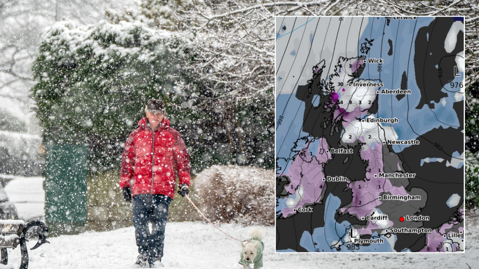
Over a foot of snow is expected to smother parts of the UK next week
|PA/Wx Charts
Using data generated by the MetDesk, the forecaster has predicted the temperatures will drop to as low as -8C in parts of Scotland a few days earlier.
Britons in other parts of the UK will still need to wrap up warm, as an icy chill will be felt across the country.
In Wales, the mercury is expected to plummet to -4C on February 26.
In the south, freezing temperatures are also expected to hit, with a chilly -1C being expected in London.
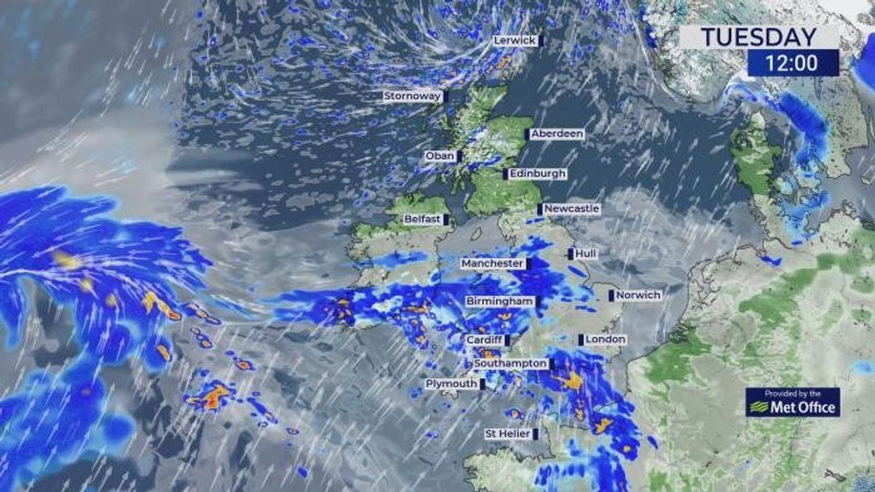
WEATHER LATEST:
The Met Office has warned that next week will see “unsettled conditions” across the UK.
A spokesperson for the forecaster said snow this week will largely hit high ground in the north.
They told the Daily Express: “It’ll gradually get milder from the south this week, with periods of heavy rain for some. There’s a chance of a northerly airflow bringing cooler conditions at times later in February, but it’s too early to determine details.”
It’s still too soon for official warnings, but the Met Office has acknowledged the potential for snowfall as winter comes to a close.
The Met Office's long-range forecast for February 27 to March 12 predicts potential snow. It says: "During late February and early March, there is a slightly higher than normal likelihood of northerly or easterly winds occurring, which would increase the chance of colder and drier than average conditions.
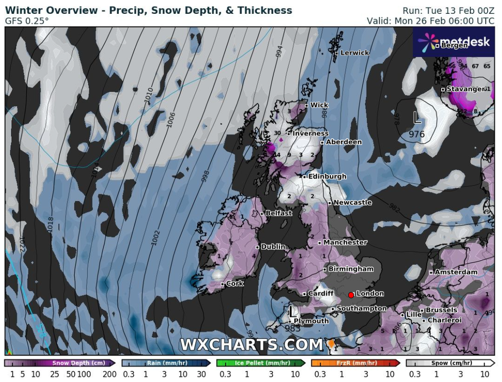
New maps show the wintery conditions continuing towards the end of February
|WX Charts
“Spells of milder and wetter weather are still likely to occur at times, especially in the south and southwest, with the potential for snow on the boundary between milder and colder air.”
The predictions come amid widespread snow disruption across Scotland, with amber alerts and school closures impacting Wales and the Midlands over the last few days.
Parents in Flintshire in Wales were furious after the county decided to shut all 88 of its schools, while travel warnings were issued throughout the region.
Last week, National Highways’ Amy Shaw said: “Freezing conditions bring hazards such as snow and ice, so take every possible step to understand your journey in advance and allow lots of extra time when travelling to prepare for the unexpected.”