


A powerful 200mph jet stream is heading towards the UK in time for Christmas, bringing with it strong winds and a drop in temperatures.
The powerful winds will hit the north over the weekend, before travelling down towards the south next week.
The jet stream has a “unsettled, windy and disturbed” weather pattern, which will bring with it violent winds and cold air.
Nick Finnis, a senior forecaster at NetWeather, said: “As we approach the weekend, the jet stream which has been close to the south of Britain will begin to move further north, taking the rain-bearing systems with it and allowing high pressure to build from the south.
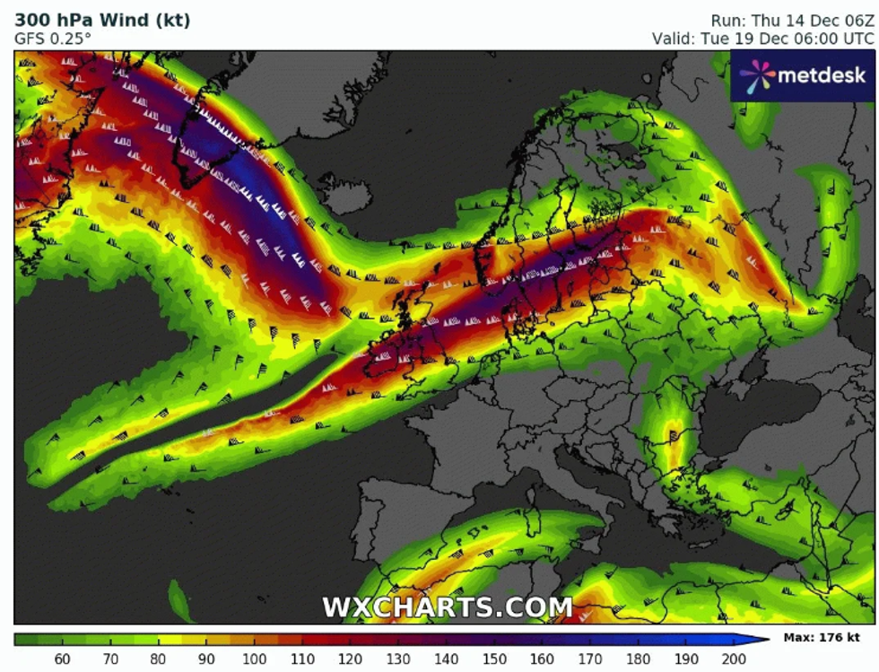
The jet stream has a 'unsettled, windy and disturbed' weather pattern, which will bring with it violent winds and cold air
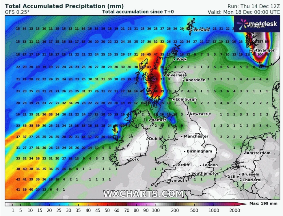
|WXCharts
“This shift north in the jet stream will herald a drier and more settled spell for England and Wales from tomorrow through to the beginning of next week. However, it will turn much wetter across western Scotland – which has been the driest part of the UK so far this month.”
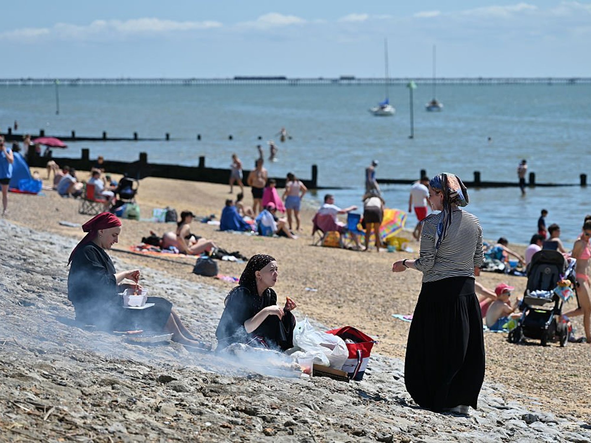
Finnis forecasts that the temperature will become unusually mild, with some parts of eastern Scotland seeing mercury in the teens.
However, despite the warmer temperature, the moisture from the jet stream which originates from the tropical North Atlantic will turn into rainfall over much of western Scotland.
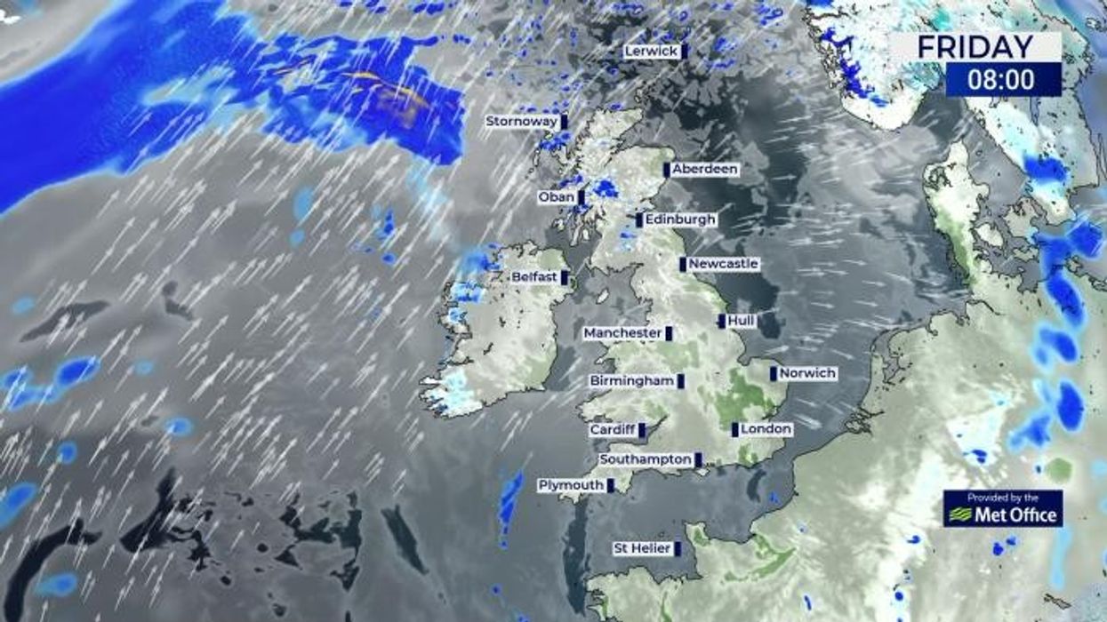
The Met Office has issued a yellow rain warning for western Scotland, beginning on Saturday at 6.00pm and finishing at 11.59pm on Sunday.
WEATHER LATEST:
They said: “A prolonged period of heavy rain this weekend is expected to lead to some flooding and travel disruption.”
The weather office have cautioned that “there is a slight chance of power cuts and loss of other services to some homes and businesses”.
They said: “There is a small chance that some communities will become cut off by flooded roads.
"Where flooding occurs, there is a chance of delays or cancellations to train and bus services,” they continued.
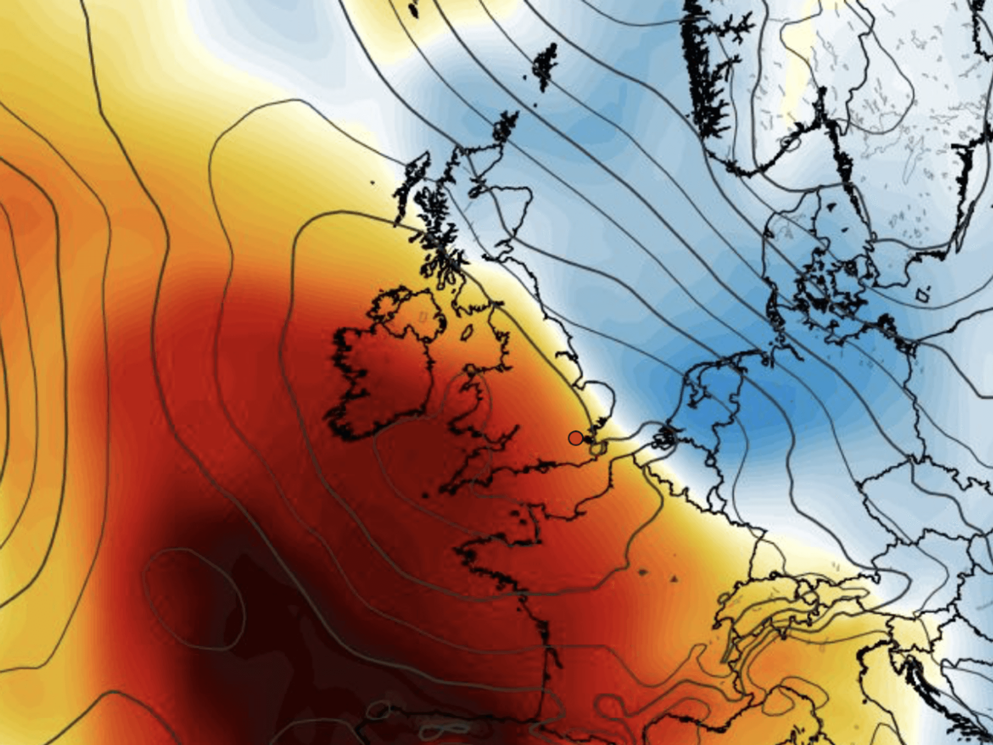
Rain hitting western Scotland
|WX Charts
Describing the movement of the jet stream into next week, Finnis said: “It then looks to shift back south again towards the middle of next week, this will bring rain-bearing frontal boundary affecting Scotland over the weekend southwards early next week, so probably one last dry day in the south on Monday, before a cold front arrives from the northwest Tuesday, bringing a band of rain through.
“Following this cold front an increasingly unsettled, windy and disturbed weather pattern looks to unfold for the rest of the week and weekend in the final run up to Christmas.
“This is thanks to a very strong 200mph+ jet stream forecast by models, which forecast to arc over the far North Atlantic, including the tip of southern Greenland, before plunging southeast to the British Isles and the rest of northern Europe.”
The timing of when the cold air will hit is not yet certain, however Finnis predicts that the jet stream will bring with it at least one deep low pressure system. This means unsettled weather is likely and the temperatures are likely to drop.