
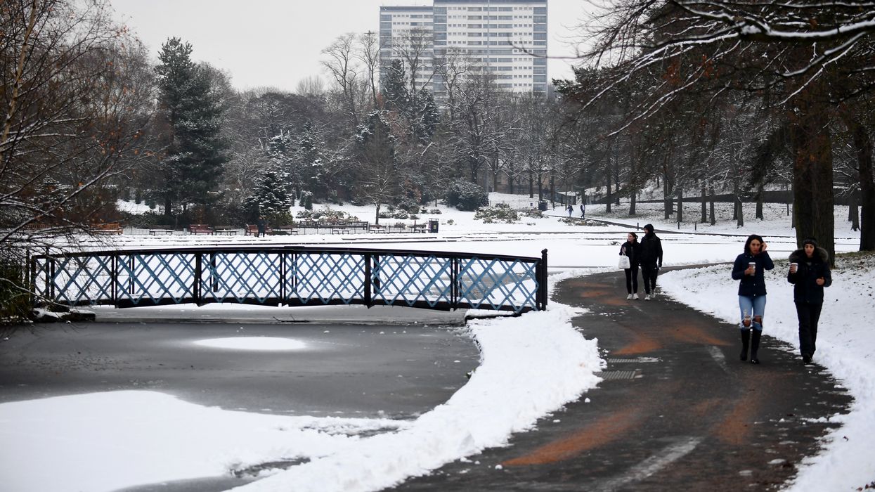


Brits should brace themselves for a blanket of snow as high as 20cm as a -9C ice blast hits the UK.
Next week, parts of Britain will be hit with a frosty spell that will result in heavy snowfall, turning weather maps blue and white.
In the north, temperatures will plummet to a chilling -9C, whilst a snow depth as high as 20cm is expected in Scotland.
The snowfall and ice blast will impact Scotland and parts of northern England, with the frostiest day coming on December 21.
WATCH NOW: Today's weather forecast
The Met Office forecast for 17-26 December says: “It now looks probable that there will be at least one short-lived colder interlude next week, with a period of north or northwesterly winds that could bring some snow and ice, especially in the north.”
The rest of the UK will see more settled weather, with the south seeing above-average temperatures for this time of year.
Describing the long-range forecast, the weather office said: “For most locations, more settled weather continues into Sunday with high pressure close to the southwest of the UK.
“Though northern and western Scotland likely remaining in a more wet and windy, but exceptionally mild regime. Settled conditions in the south with well above average temperatures here too, but cloudy at times with some patchy light rain, mainly near western coasts and over hills.
WEATHER LATEST:
- UK weather forecast: Storm deluge strikes as creepy ‘radiation fog’ descends on Britain
- UK snow forecast: 'Icelandic low' set to be 'displaced' with parts of Britain in line for White Christmas
- Two Cold Weather Payments worth total of £50 now due in certain postcodes as DWP shares full list of triggers
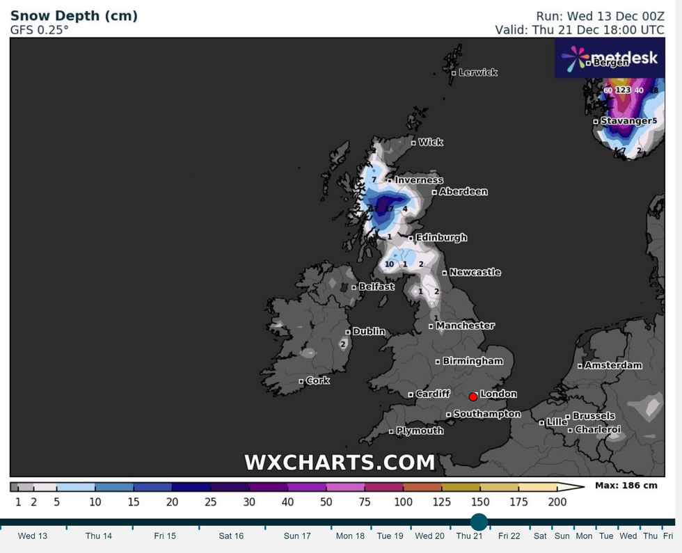
The snowfall and ice blast will impact Scotland and parts of northern England, with the frostiest day coming on December 21
|WXCharts
“From next week high pressure will likely move further west into the central Atlantic, allowing a return to unsettled conditions and typically nearer average temperatures nationwide.”
Its forecasters are predicting an “unsettled” festive period, with the weather varying throughout the week.
A spokesperson from NetWeather said: “The weather is expected to turn more unsettled during this period with a mainly westerly flow, and the Icelandic low displaced to the east of its normal position with lowest pressure generally between Iceland and Scandinavia.
“It will be generally mild in the south, but some colder north-westerlies are likely in the north.
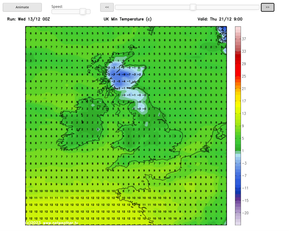
In the north, temperatures will plummet to a chilling -9C
|Netweather
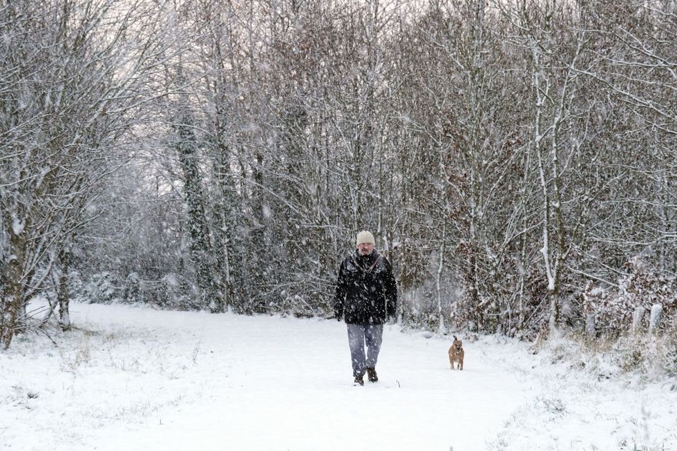 An image of snow falling | PA
“While a widespread white Christmas is currently looking unlikely, there is potential for northern parts to have some snow on Christmas Day if Christmas Day coincides with one of the colder north-westerly outbreaks.
“It is expected to be warmer than average in the south, probably by 1 to 2C in southern England, but temperatures are likely to be close to normal in most parts of Scotland and Northern Ireland, and possibly into northern England.”
The Met Office considers it a White Christmas if a single snowflake falls in the UK in the 24 hours of December 25.
In 2022, nine per cent of weather stations recorded snow falling but none saw snow settling.