


Britain is trapped under the dome of a huge, rainless ‘anticyclonic’ pressure lid as the threat looms of a winter drought.
The UK is locked tight under a giant high-pressure system stretching from the mid-Atlantic to eastern Europe.
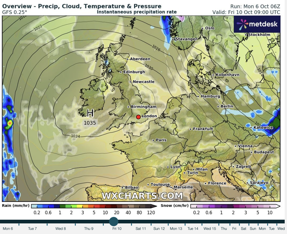
Britain could be contending with a winter drought
|WX CHARTS
While this spells good news for storm-haters, it means water reserves desiccated after the hot summer will struggle to recover.
Apart from northern Scotland, most of the UK can expect no rainfall through and beyond the middle of October.
TRENDING
Stories
Videos
Your Say
Jim Dale, meteorologist for British Weather Services, said: “There is a real threat now of a drought into winter, with little rain in the forecast through the next week to two weeks.
“This will have implications for reservoirs and water tables, which need steady rainfall at this time of year to restore supplies.
“This could also have a knock-on effect into next year, when the warm weather returns, as water reserves will be low.”
Dry weather is being driven by a huge high-pressure ‘anticyclone’ wedged over Britain and reaching across the Continent.
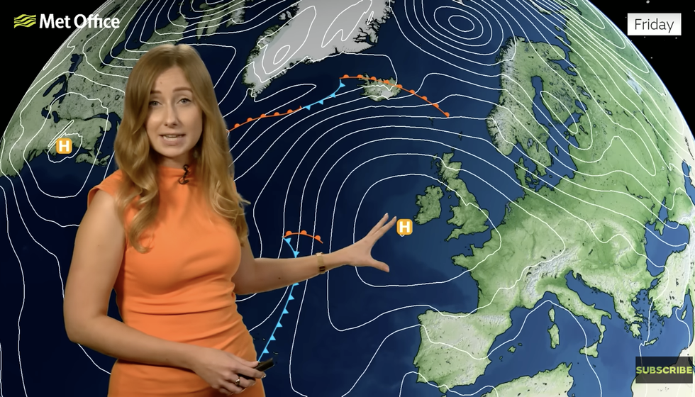
A high pressure front is set to hit the UK
|MET OFFICE
High pressure causes air to compress, stopping moisture lifting into clouds and rainfall.
During the summer months, it drives hot dry weather, while during the winter, clear skies can cause overnight temperatures to plunge.
Chilly nights will bring the risk of frost to Scotland, this week, while temperatures in the south nudge the high-teens.
Met Office meteorologist Honor Criswick said: “Temperatures will slip away to the north, and it will feel much chillier and there is a chance that we could see some isolated spots of frosts away from western Scotland.
Latest Developments
 |
| MET OFFICE
“High pressure this week means mostly dry and settled conditions with sunny spells at times.
“There is a split in temperatures, with a much milder start to Wednesday across the south.
“For the rest of the week, high pressure remains dominant and building to the west, so it will be dry and settle for much of the country, and high pressure should stick around for the weekend.”
While most of the country parches, northernmost Scotland will get the odd burst of rain, she added.
She said: “It will be quite murky across southern counties, but to the north it will be dry with plenty of sunshine away from the far north and west of Scotland where there will be cloud and showers and longer spells of rain which could turn blustery.
“In the sunshine, highs could reach 17C or 18C where we see sunshine.”
Storm Amy last weekend became the first named storm of the season, although it could be a long while before the next.
Autumn storms sweep into Britian on the jet stream as strengthening areas of low pressure.
High pressure acts as a block, shunting any spicy lows to the north, shielding the country from any impact.
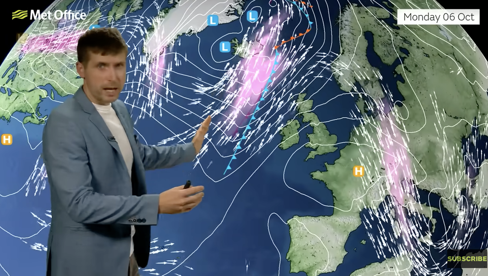
Met Office meteorologist Alex Burkill said: “The weather this week is going to be pretty different to last week when Storm Amy was hitting.
“It was the strong jet that led to Storm Amy intensifying so much, but the jet stream is now weaker and meandering to the north of us which is why things are more settled.”