


Britain will bask in a 70F Indian summer as the death throes of Superstorm Amy drag in a ‘Bermuda ridge’.
Temperatures this week will rocket as the remains of Amy bolster a heat dome of high pressure, smothering the country.
Its edge will creep in on a ridge of the Azores High – also known as the Bermuda High – the hero ingredient of blistering summer heatwaves.
Although most of northern England will be cooler, southern Britain and the edge of Scotland is poised for the mercury to hit 21C.
TRENDING
Stories
Videos
Your Say
Jim Dale, meteorologist for British Weather Services, said: “We are going to see 18C quite easily, but in the south, we are looking at 20C or even 21C.
“High pressure is going to build in the wake of Storm Amy, and this late in the season, we are looking at a true Indian Summer.
“Storm Amy, which whipped up winds of 100mph in the far north of the country, will drag in high pressure and a southerly airflow this week, and that is going to make it feel very mild in parts.”
Apart from Storm Amy’s weekend battering, autumn so far has been eerily free of seasonal wind and rain.
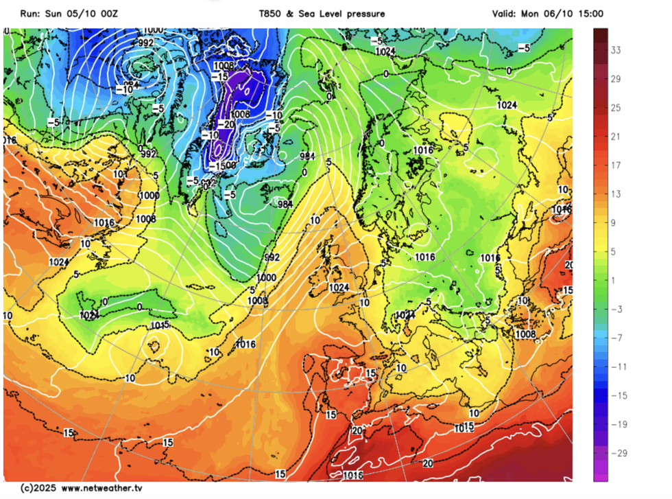
Mild air will sweep over Britain this week
|NETWEATHER
As high pressure builds this week, the autumn calm will continue under clear skies and balmy winds.
Nudging in from the southwest will be a ‘ridge’ of the Azores High, more commonly seen during high summer.
Dale said: “The Azores High will push in from the southwest and then split with the UK, developing our own separate high.
“This is going to dominate through the rest of the week and possibly beyond, with a very calm, settled and mild start to October on the cards.”
Westerly winds laden with rain through the start of the week will continue to drench western Scotland.
LATEST DEVELOPMENTS: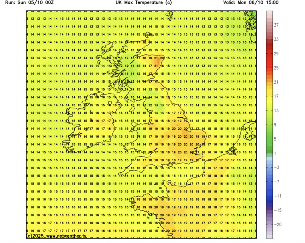
Temperatures could reach as high as 21C
|NETWEATHER
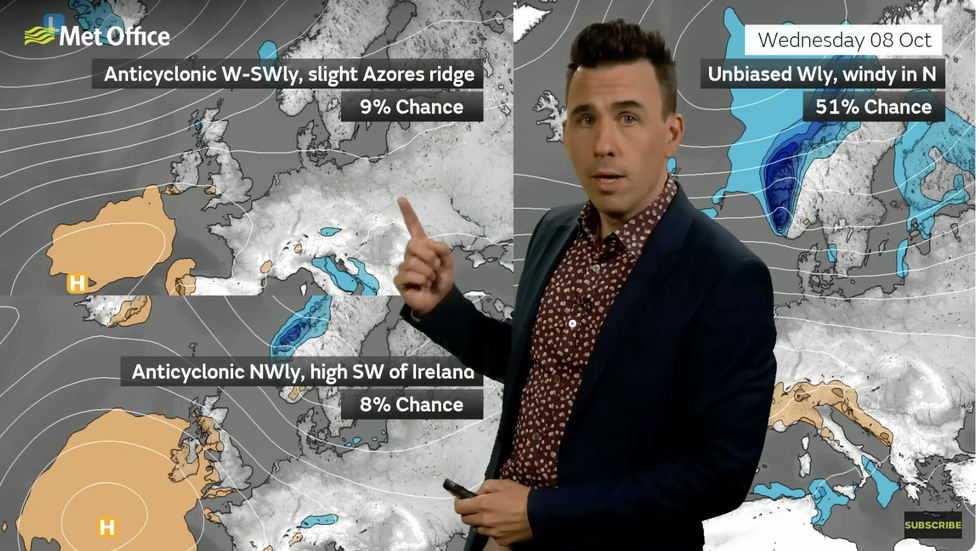
Met Office’s Aidan McGivern describes the ridging Azores High
|MET OFFICE
Up to three inches in total could hit the most exposed areas, triggering the risk of localised flooding.
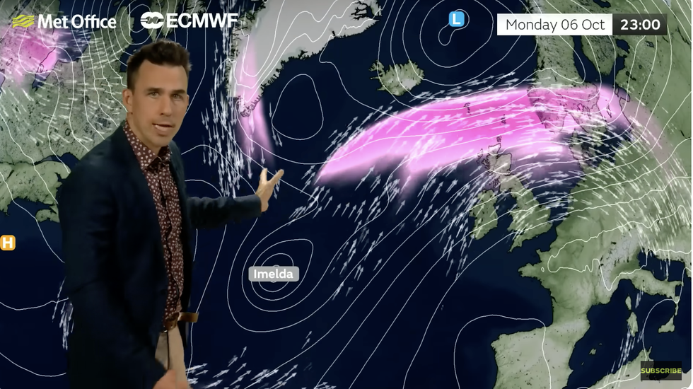
A tropical Hurricane, Imelda, swirling to the south of the UK, and a northerly shunted jet stream today and tomorrow will keep the doors to the Atlantic open.
Met Office meteorologist Aidan McGivern said: “We keep a westerly breeze, with high pressure to the south, low pressure to the north and we have the jet stream to the north of the UK with Hurricane Imelda milling about as an ex-hurricane.
“We keep a westerly dominated airflow, and into Tuesday and Wednesday, there will be spells of rain for the west and the northwest, and this may cause some issues for the northwest of Scotland.
“Then there is a better chance of higher pressure building back in, and that becomes increasingly dominant later in the week, and there will be below-average rainfall for the time of year.”
Met Office’s Aidan McGivern said 'there will be below-average rainfall for the time of year'
|MET OFFICE
Hopes of an Indian Summer have prompted bookmakers to slash the odds on October smashing records.
Coral’s John Hill said: “Storm Amy has hit the UK with strong winds and rain, however, temperatures remain mild for this time of the year.
“With a pleasant outlook for the next couple of weeks, we have slashed the odds on this month ending as a record-hot October.”
Our Standards: The GB News Editorial Charter